


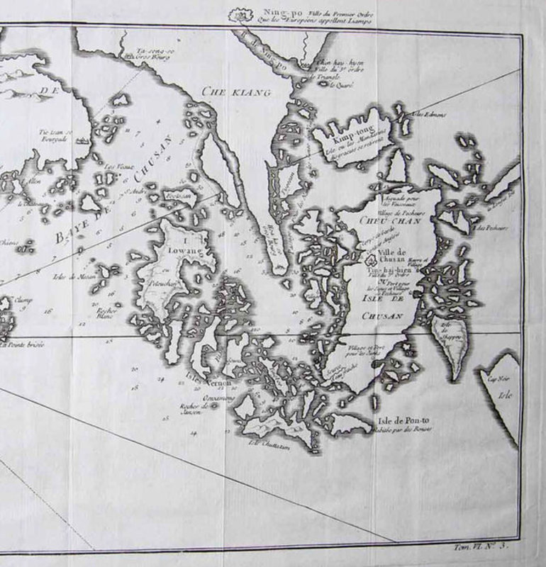


Carte de l' Isle de Cheu-Chan ou Isle de Chusan de la Province de Che-Kiang Avec les Costeset Isles voisines…
Paris: 1749. Copper engraving of the Chinese city Ningbo with surrounding islands. Dimensions: approx. 22 x 32 cm. Map of the city Ningbo (depicted just above the map) and the region east of Ningbo with Zhoushan in the province Zhejiang. The west on top. In the cartouche bottom left the French title and the scale. Very good. Several horizontal and vertical folds. Margin bottom left narrow (map image complete), remainder sufficient. Verso: blank. 220 x 320 mm (8¾ x 12½ inches). Gravure sur cuivre de la ville chinoise de Ningbo avec les îles environnantes. Dimensions : env. 22x32cm. Carte de la ville de Ningbo (représentée juste au-dessus de la carte) et de la région à l'est de Ningbo avec Zhoushan dans la province du Zhejiang. L'ouest en haut. Dans le cartouche en bas à gauche le titre français et l'échelle. Très bien. Plusieurs plis horizontaux et verticaux. Marge en bas à gauche étroite (image de carte complète), reste suffisant. Verso : vierge. 220 x 320 mm.