- Category = British Topography,European Travel & Exploration,Maps & Atlases,Polar,Rest of the World,Travel Guides
-
 Asia
From Keith Johnston's General Atlas
Asia
From Keith Johnston's General Atlas
London: W & A.K. Johnston. A map of Asia, extracted from the General Atlas. This conforms best to the 1879 edition, except the lack of page title to the top edge, and the different page number. Engraved area is 13" x 17" (sheet is 141/2" x 181/2"). Lightly tipped onto mounting board, and now protected by archival protection. A lovely copy of this map from the height of colonial era.
Condition: A clean and tidy copy of this map. No significant damage at all. Clean and tidy, with the lightest of darkening.
Book ID: 1727More details Price: £15.00 -
 Atlas Géographique - Dressé sous la Direction du Conseil Royal de l'Instruction publique. Pour l'usage des Colléges.
1ère partie Géographiqe ancienne.
Book ID: 4054More details Price: £250.00
Atlas Géographique - Dressé sous la Direction du Conseil Royal de l'Instruction publique. Pour l'usage des Colléges.
1ère partie Géographiqe ancienne.
Book ID: 4054More details Price: £250.00 -
 Atlas Historique, Genealogique, Chronologique et Geographique.
Avec des augmentations par J. Marchal, de Bruxelles et de nombreuses ameliorations par une societe de savans et de gens de lettres.
Atlas Historique, Genealogique, Chronologique et Geographique.
Avec des augmentations par J. Marchal, de Bruxelles et de nombreuses ameliorations par une societe de savans et de gens de lettres.
Edition: First Thus
Book ID: 1918More details Price: £395.00 -
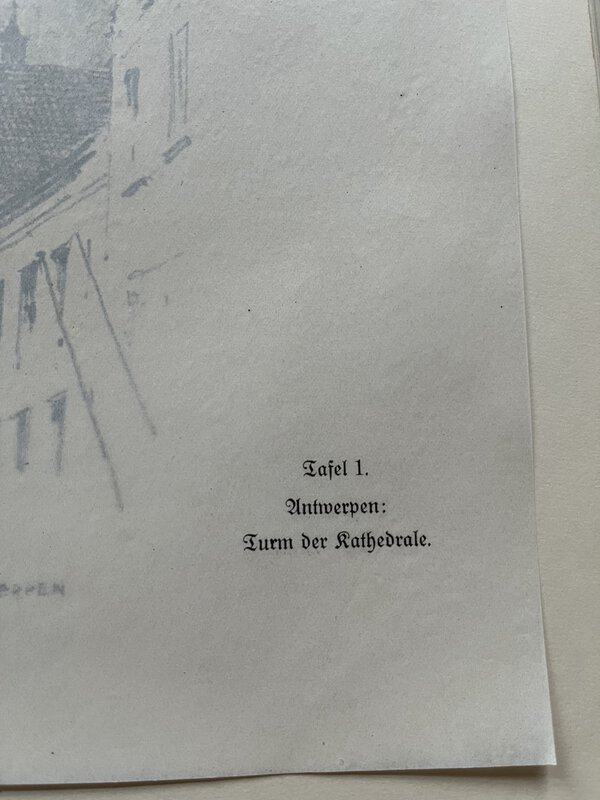
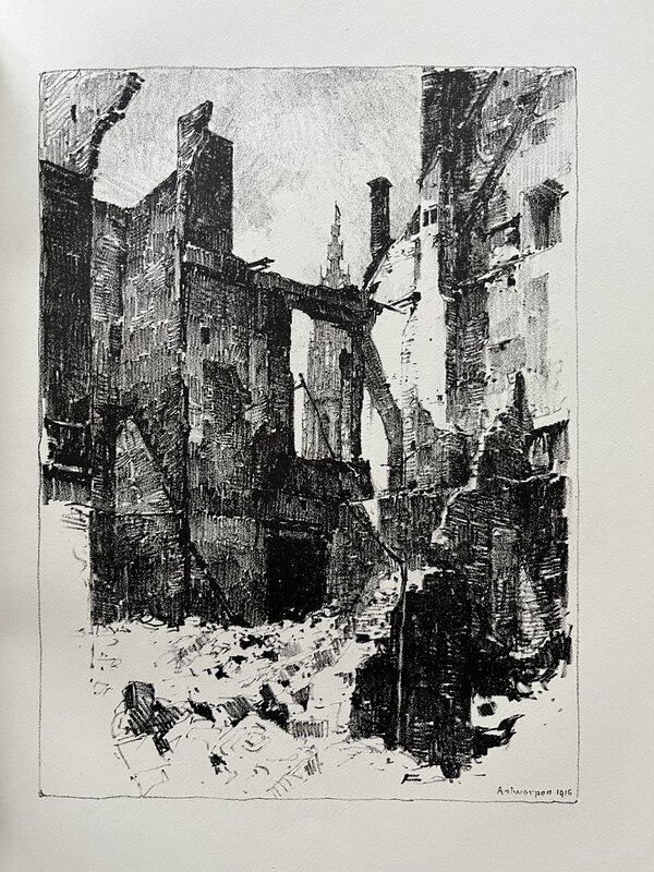
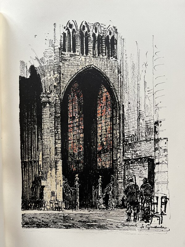
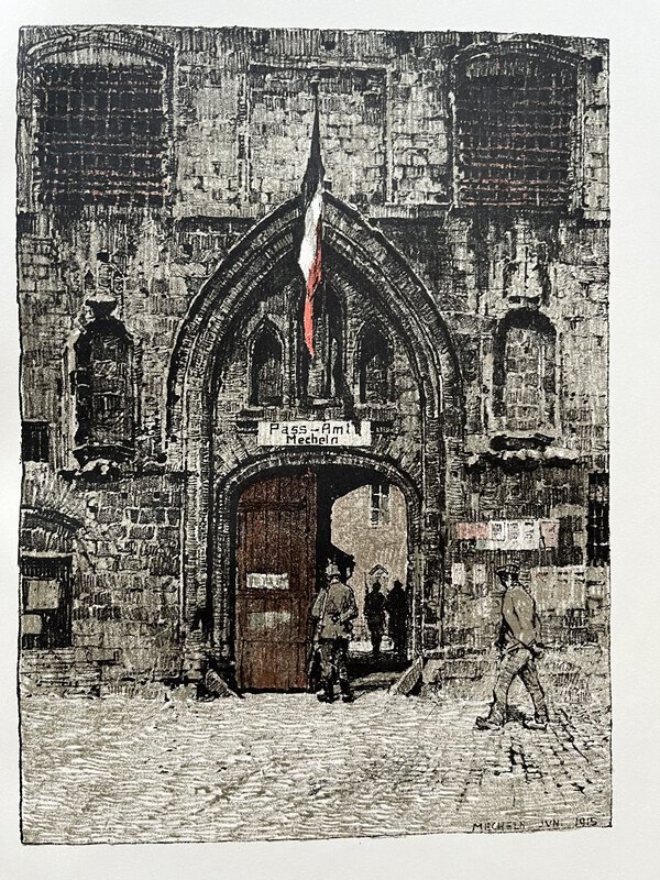
 Belgien 1915. Ein Skizzenbuch von Luigi Kasimir.
Text von Fedor von Zobeltitz.
Belgien 1915. Ein Skizzenbuch von Luigi Kasimir.
Text von Fedor von Zobeltitz.
München: Franz Hanfstaengl, 1915. First edition in publisher's original hardback. Fascinating images of Belgium's early 20th century architecture - from sketches by Luigi Kasimir; often referred to as The Master European Printmaker. Illustrated with frontispiece, 29 full-page plates, and some in-text illustrations. German text by Fedor von Zobeltitz. All full-page plates have captioned tissue guards. Cities: Brussels, Antwerp, Bruges, Ghent, Louvain and Mechelen. Pictorial boards are somewhat age toned and bumped at the edges. The ribbon ties are still attached, but front ones are broken. Lacks slipcase. Inside excellent. 39, [1] + 29 plates. 340 x 260 mm (13½ x 10¼ inches).
Book ID: 3639More details Price: £75.00 -
 Brighton Official Handbook 1936-37
Book ID: 4339More details Price: £28.00
Brighton Official Handbook 1936-37
Book ID: 4339More details Price: £28.00 -
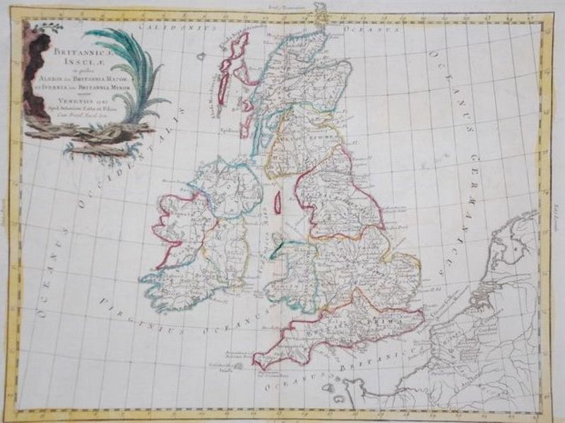
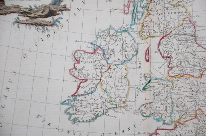
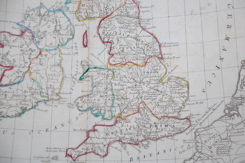
 Britannicae Insulae in quibus Albion Seu Britannia Major
Venitiis / Venice: Antonium Zatta, 1785. Hand-coloured map of Great Britain in good condition. Good. Wide margins. Fold as published. Slightly foxed in the margins. Imprint later hand colouring on verso. Verso: blank. 31 x 40 cm. From Zatta's Altante Novissimo, one of the last great decorative atlases of the 18th Century. Carte coloriée à la main de la Grande-Bretagne en bon état. Bon. De larges marges. Plier tel que publié. Légèrement rousseur dans les marges. Imprimez plus tard la coloration à la main au verso. Verso : vierge. 31x40cm. De l'Altante Novissimo de Zatta, l'un des derniers grands atlas décoratifs du XVIIIe siècle.
Book ID: 1783More details Price: £90.00 -
![Bubbles from the Brunnens of Nassau by An Old Man [HEAD, Francis Bond].](https://images.vialibri.net/production/20/2009-1---200.jpeg?v=1531510928) Bubbles from the Brunnens of Nassau
Bubbles from the Brunnens of Nassau
Edition: First Edition
London: John Murray: 1834. First edition. Bound in recent half morocco with gilt titles to the spine and marbled boards. Half title. Engraved frontis. Title, preface, 10 plates (including frontis). A guide to the author's travels through the "bathing resorts and fountains in the Duchy of Nassau" and his trip to Mainz. 376 pages. The binding is recent, and is in good, clean condition without flaws. There is darkening to the title page and a little staining to the verso of the frontis. Otherwise in good, if slightly darkened condition. 190 x 120 mm (7½ x 4¾ inches). 376 pp
Book ID: 2009More details Price: £95.00 -
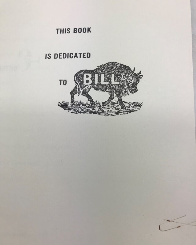
 Buffalo Bill and the Wild West
SIGNED
Book ID: 2761More details Price: £30.00
Buffalo Bill and the Wild West
SIGNED
Book ID: 2761More details Price: £30.00 -
 Campbell's New Revised Complete Guide and Descriptive Book of Mexico.
Campbell, 1907. First published in 1899, this is the revised edition. Hardback book in maroon coloured cloth. Gilt titles to front board and spine. Page edges red. Boards are slightly handled and a little bumped at corners. Lots of interesting photos - including frontis portrait and large colour fold-out map attached at rear. 351 pages plus map. Overall good + 190 x 145 mm (7½ x 5¾ inches).
Book ID: 3990More details Price: £30.00 -
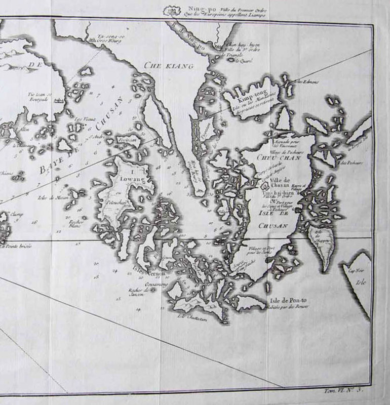
 Carte de l' Isle de Cheu-Chan ou Isle de Chusan de la Province de Che-Kiang
Avec les Costeset Isles voisines…
Book ID: 1788More details Price: £50.00
Carte de l' Isle de Cheu-Chan ou Isle de Chusan de la Province de Che-Kiang
Avec les Costeset Isles voisines…
Book ID: 1788More details Price: £50.00 -
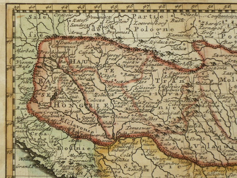
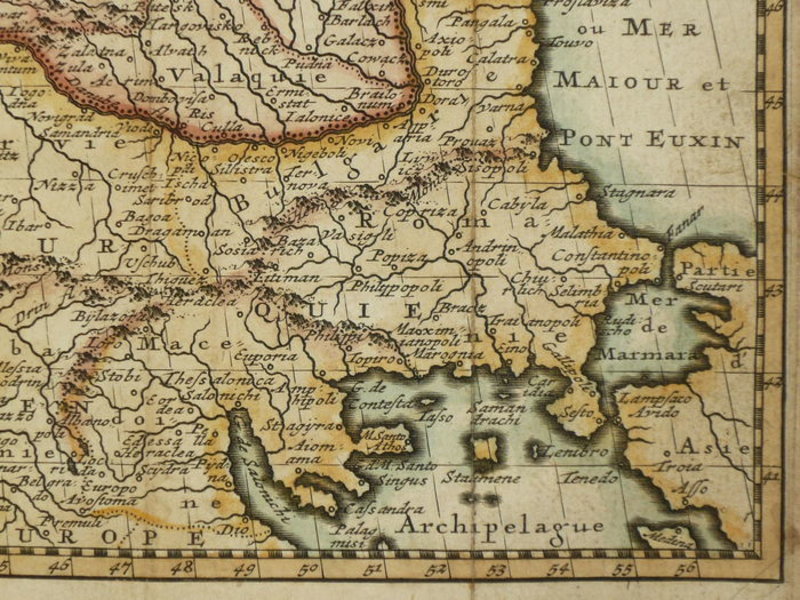
 Carte de la Hongrie
Paris: 1786. Hand coloured map of Hungary, published in Geographie Universelle. A touch darkened, with light staining to the verso. Folds where issued. A decent copy. 130 x 170 mm (5 x 6¾ inches). Carte coloriée à la main de la Hongrie, publiée dans Géographie Universelle. Une touche assombrie, avec légères taches au verso. Plis où émis. Une copie correcte. 130 x 170 mm.
Book ID: 1853More details Price: £55.00 -
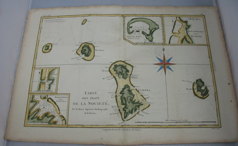
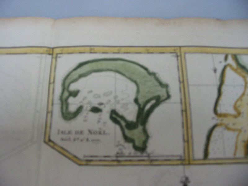
 Carte des isles de la Societé
Isle de Noël, Maurua, Tubai, Bolabola, Ulieta, Huaheine, Havre d'Oopoa, Havre d'Owharre.
Carte des isles de la Societé
Isle de Noël, Maurua, Tubai, Bolabola, Ulieta, Huaheine, Havre d'Oopoa, Havre d'Owharre.
Paris: Bonne: 1780. Copper engraving with hand colouring. Dimensions: 23 x 34 cm. Engraved by Andrei. States in the corner that this chart was part of Cooks 1st Voyage. A note engraved states (in French) that the islands are claimed by both the French and the English. Condition: very good, with a fold mark (as issued). 230 x 340 mm (9 x 13½ inches). Gravure sur cuivre avec coloration à la main. Dimensions : 23x34cm. Gravé par Andrei. Indique dans le coin que cette carte faisait partie du 1er voyage de Cooks. Une note gravée indique (en français) que les îles sont revendiquées à la fois par les Français et les Anglais. Condition : très bonne, avec une marque de pli (comme émis). 230 x 340 mm.
Book ID: 1806More details Price: £150.00 -
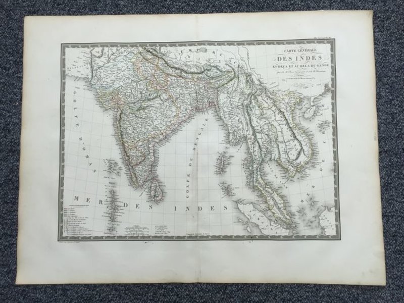
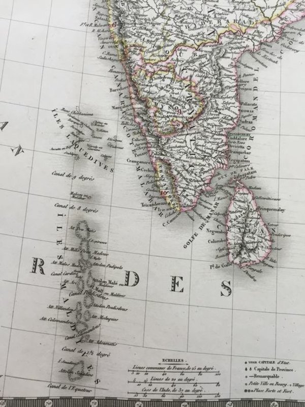
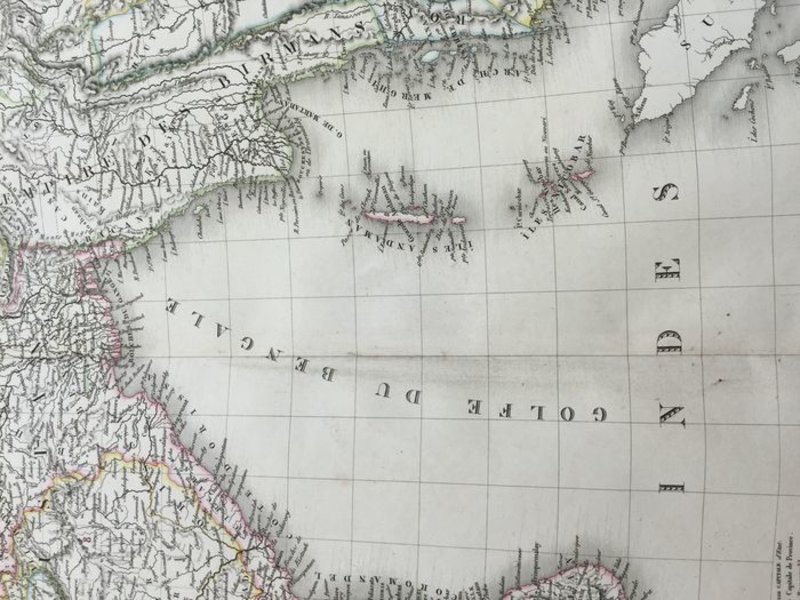
 Carte Générale Des Indes en-deca et au-dela du gange
Book ID: 1793More details Price: £60.00
Carte Générale Des Indes en-deca et au-dela du gange
Book ID: 1793More details Price: £60.00 -
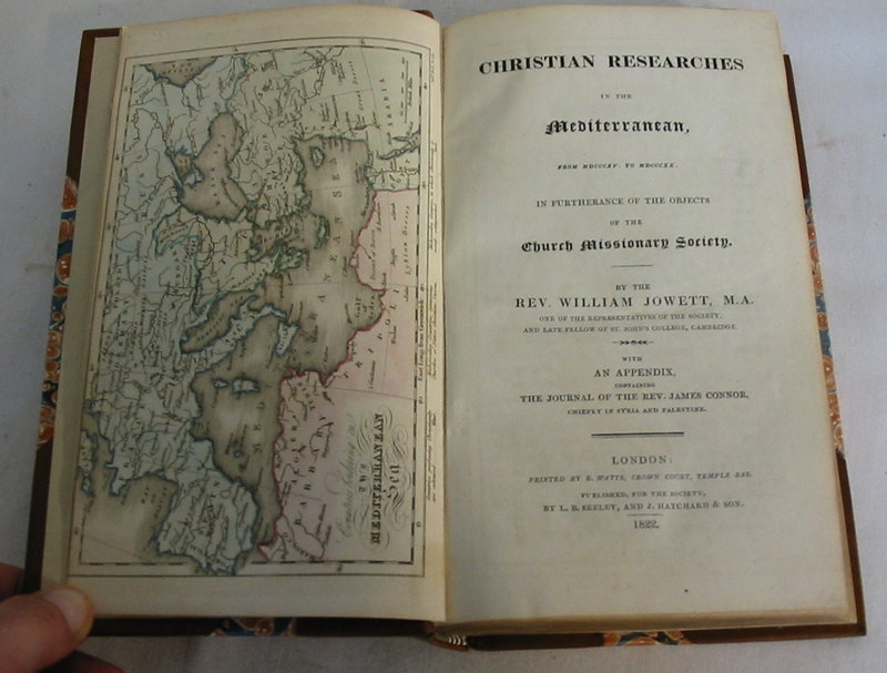
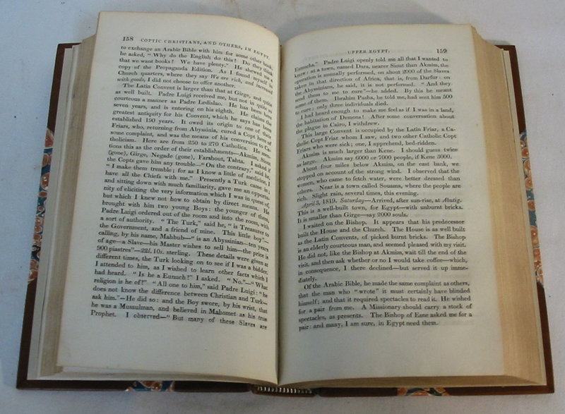
 Christian Researches in the Mediterranean.
From MDCCCVXV to MDCCCXX. In furtherance of the objects of the Church Missionary Society.
Christian Researches in the Mediterranean.
From MDCCCVXV to MDCCCXX. In furtherance of the objects of the Church Missionary Society.
Edition: First Edition
London: R. Watts, L.B. Seeley, and J. Hatchard, 1822. First edition. New half leather binding with marbled boards. Burgundy labels and gilt titles. Stamp for the library of the "Society for the Propagation of the Gospel in Foreign Lands." Hand coloured map of the Mediterranean as a frontis. A lovely copy of this work. The new binding is in an immaculate state. Clean and tidy without flaws. The frontis map is also in beautiful condition. The text itself is clean and tidy, without marks. Fractional darkening to the closed page edges. viii, [viii], 1-454 pp
Book ID: 1506More details Price: £250.00 -
 Colour-printed aquatint with hand-finishing on wove paper: Brighton
Condition: The aquatint has been mounted on a board (presumably it was once framed), the bottom right corner has been damaged (perhaps whilst being removed from the frame). Actual scope of image remains clean and bright,
Book ID: 2314More details Price: £45.00 -
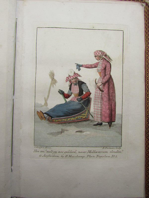
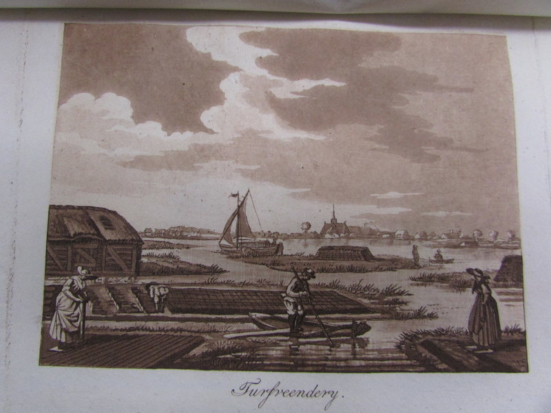
 Compte Rendu.
A collection of 18 aquatint views and 11 hand-coloured costumes.
Compte Rendu.
A collection of 18 aquatint views and 11 hand-coloured costumes.
Amsterdam: E. Maaskamp, 1812. First edition. A beautiful bound volume, with 29 plates produced by Maaskamp between 1807 and 1812. These are comprised of 18 Aquatint engravings and 11 hand coloured pictures of traditional Dutch peasant costumes. The binding is in period red leather, with gilt title and decoration. The binding is in very nice, if slightly rubbed condition. The plates are in excellent condition, many with tissue guards, and in a clean and tidy state. 210 by 140 mm (8¼ by 5½ inches).
Book ID: 2237More details Price: £300.00 -
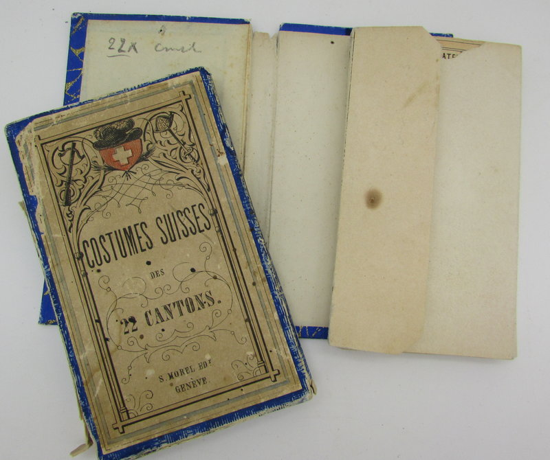
 Costumes Suisses.
Edition: First Edition
Book ID: 1938More details Price: £400.00 -
 De Beurs - Hendrick de Keyser
Book ID: 4318More details Price: £200.00
De Beurs - Hendrick de Keyser
Book ID: 4318More details Price: £200.00 -
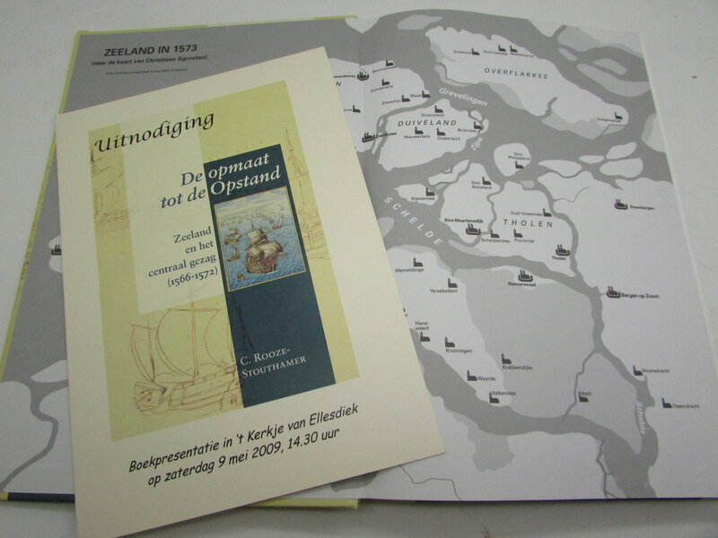
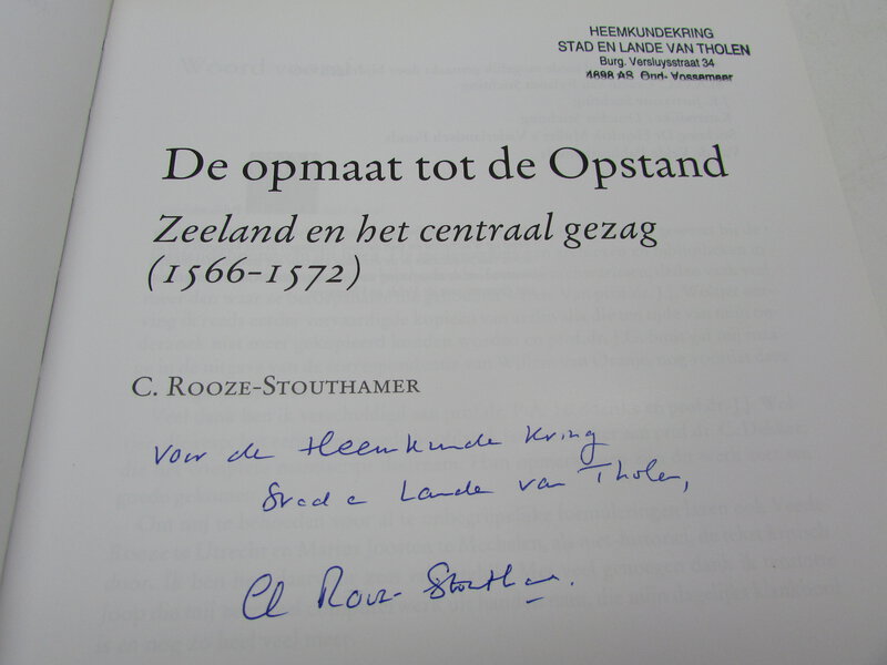
 De opmaat tot de Opstand: Zeeland en het centraal gezag (1566-1572)
Hilversum: Verloren BV, 2009. Hardcover eerste druk. Auteur gesigneerde opdracht aan het lokaal historisch genootschap te Tholen, op de titelpagina. In prima staat. Er is een kleine inktstempel van de plaatselijke geschiedenisvereniging bij de opdracht van de auteur op de titelpagina. Verder smetteloos exemplaar. 266 pagina's. 245 x 165 mm (9¾ x 6½ inch).
Book ID: 2666More details Price: £35.00 -
 De twee groote Synagogen der Hoogduitsche Jooden
en het Oude-Zyds-Huiszitten-Aalmoesseniers-Huis van agteren, in 't verschie
De twee groote Synagogen der Hoogduitsche Jooden
en het Oude-Zyds-Huiszitten-Aalmoesseniers-Huis van agteren, in 't verschie
1765. An attractive view of the synagogues in Amsterdam, by Isaak Tirion after Jan de Beijer. Published by Isaak Tirion as part of Jan de Wanenaar's "Amsterdam in its rise, growth, histories,..," ("Amsterdam in zyne opkomst, aanwas, geschiedenissen,.etc.,"). engraved area is 21cm x 38cm. Page is 43cm x 51cm. First edition. Also elsewhere attributed to the publisher Fouquet as part of his Atlas Van Fouquet. However, the dimensions of the plate and page make the Tirion edition correct.
Book ID: 4306More details Price: £200.00


![Bubbles from the Brunnens of Nassau by An Old Man [HEAD, Francis Bond].](https://images.vialibri.net/production/20/2009-1---800.jpeg?v=1531510928)