- Category = cartography
-
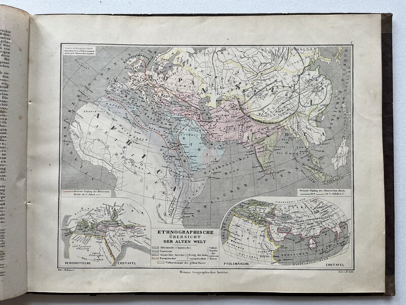
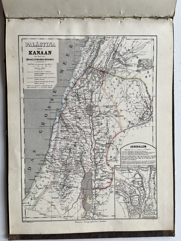
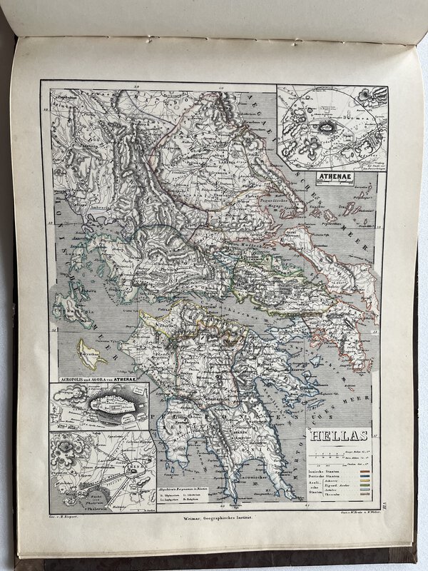
 Historisch - geographischer Atlas der alten Welt.
Zum Schulgbrauch bearbeitet und mit erläuternden Bemerkungen begleitet.
Historisch - geographischer Atlas der alten Welt.
Zum Schulgbrauch bearbeitet und mit erläuternden Bemerkungen begleitet.
Weimar: Geographisches Institut, 1858. The 12th revised edition. Hardback. Contemporary dark brown half leather binding. Complete with 32 pages of text in German (arranged in three columns), and 16 coloured steel engraved maps. Binding is rubbed at edges, but sound. Gilt stamped title to spine, and spine is rubbed. Text pages are somewhat foxed, but maps apear unaffected. Overall good. 255 x 335 mm (10 x 13¼ inches). 12. verbesserte Auflage. Gebunden. Dunkelbrauner Halbledereinband der Zeit. Komplett mit 32 Textseiten in deutscher Sprache (in drei Spalten geordnet) und 16 farbigen Stahlstich Karten. Einband an den Kanten berieben, aber intakt. Rückentitel goldgeprägt, Rücken berieben. Textseiten sind etwas stockfleckig, aber Karten erscheinen unbeeinflusst. Insgesamt gut. 255 x 335 mm
Book ID: 3553More details Price: £45.00 -
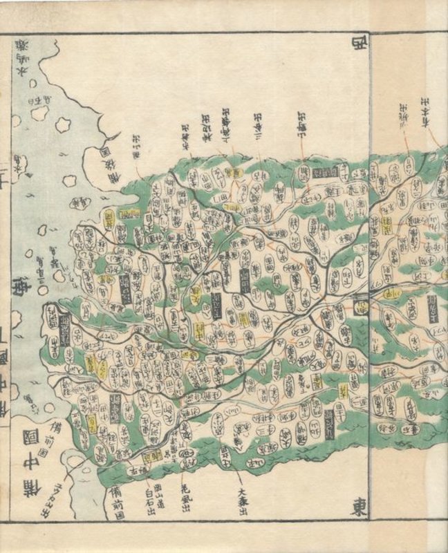
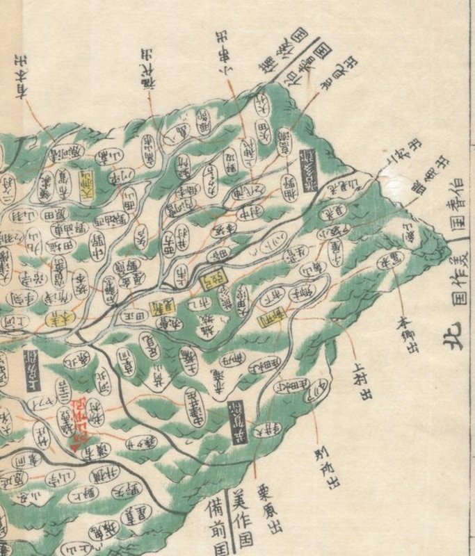
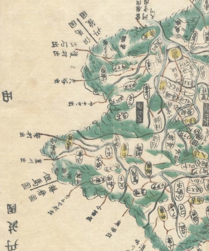
 Map of Bitchū (備中国, Bitchū no kuni), taken from Kokugun Zenzu / Atlas of Japan (De luxe version)
Book ID: 1767More details Price: £80.00
Map of Bitchū (備中国, Bitchū no kuni), taken from Kokugun Zenzu / Atlas of Japan (De luxe version)
Book ID: 1767More details Price: £80.00 -
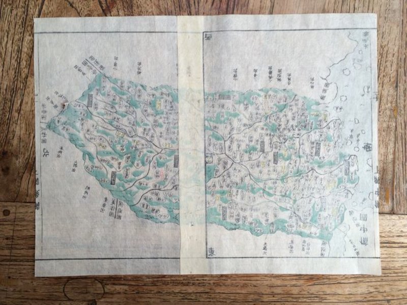
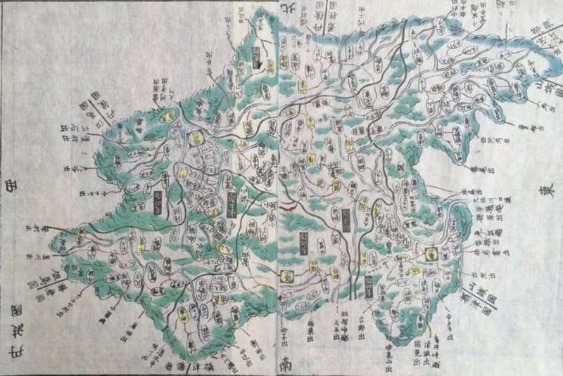
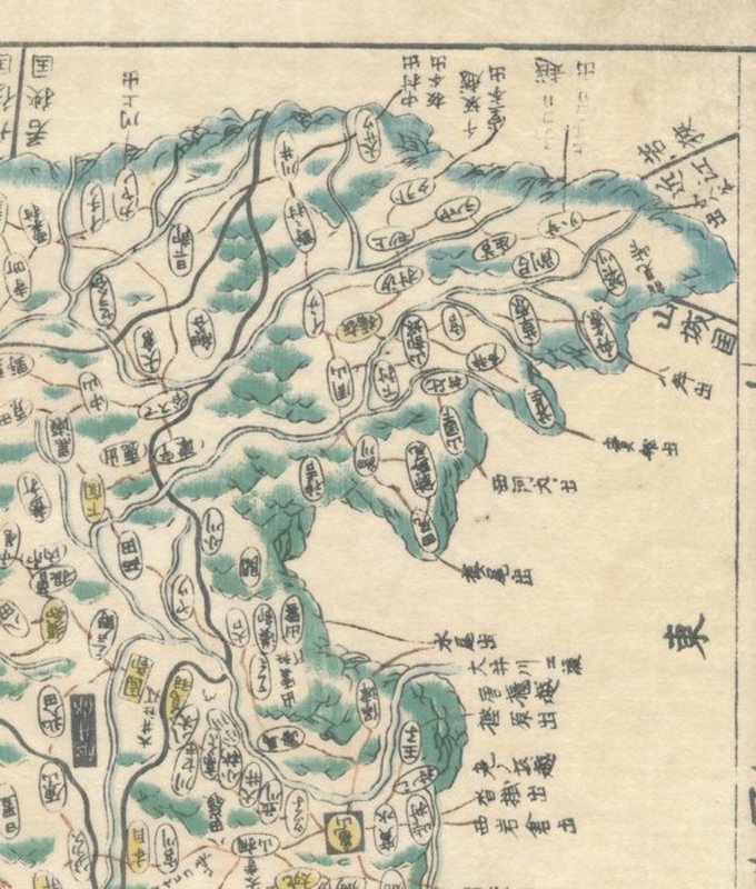
 Map of East Echigo (越後国, Echigo no kuni) , taken from Kokugun Zenzu / Atlas of Japan (De luxe version)
Book ID: 1742More details Price: £85.00
Map of East Echigo (越後国, Echigo no kuni) , taken from Kokugun Zenzu / Atlas of Japan (De luxe version)
Book ID: 1742More details Price: £85.00 -
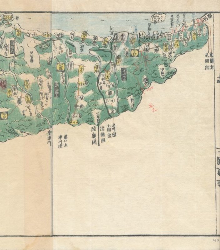
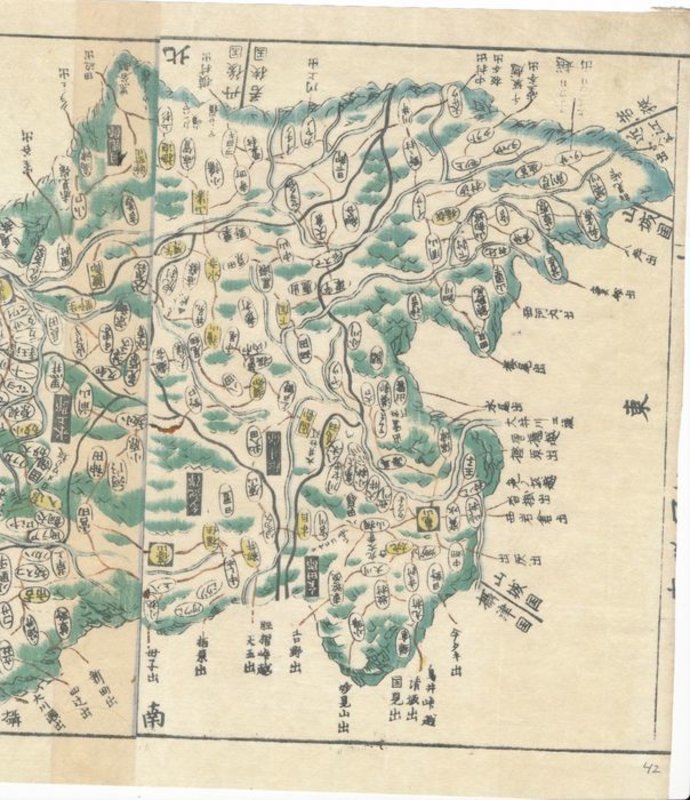
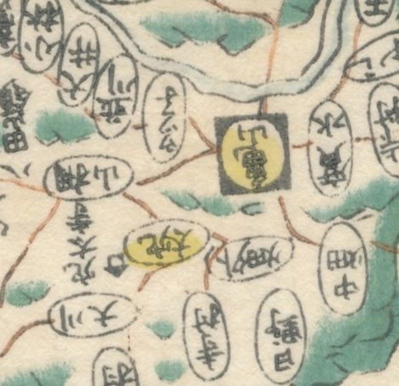
 Map of Settsu Province (摂津国, Settsu no kuni), taken from Kokugun Zenzu / Atlas of Japan (De luxe version)
Book ID: 1740More details Price: £85.00
Map of Settsu Province (摂津国, Settsu no kuni), taken from Kokugun Zenzu / Atlas of Japan (De luxe version)
Book ID: 1740More details Price: £85.00 -
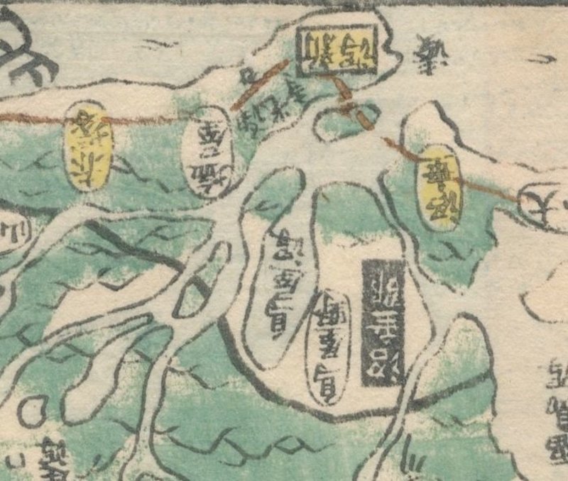
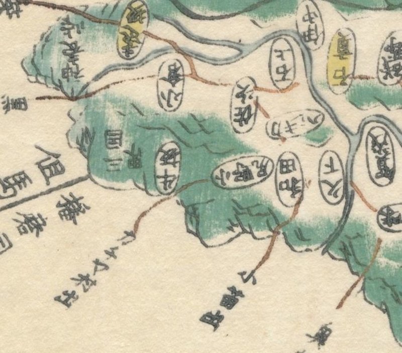
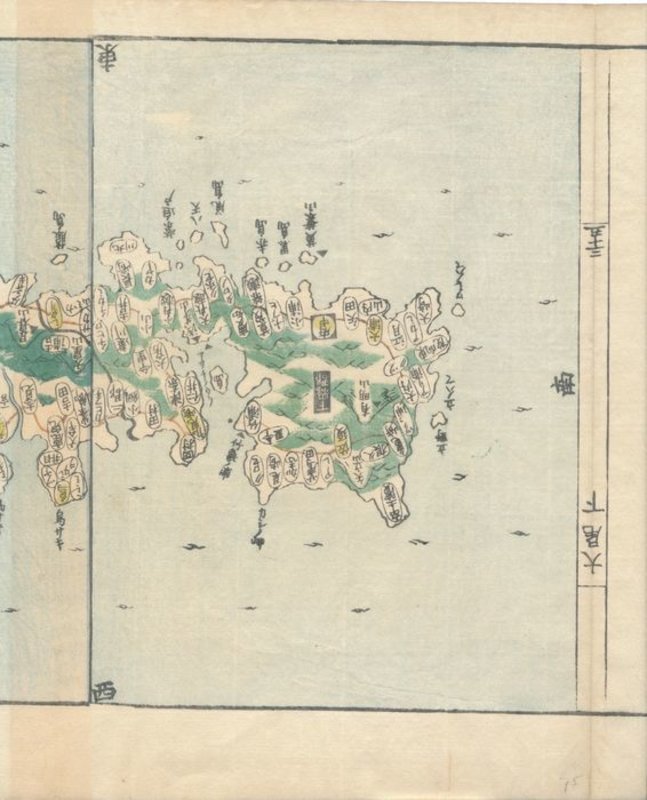
 Map of Tsushima (対馬国, Tsushima-no kuni), taken from Kokugun Zenzu / Atlas of Japan (De luxe version)
Book ID: 1761More details Price: £90.00
Map of Tsushima (対馬国, Tsushima-no kuni), taken from Kokugun Zenzu / Atlas of Japan (De luxe version)
Book ID: 1761More details Price: £90.00 -
 New General Atlas
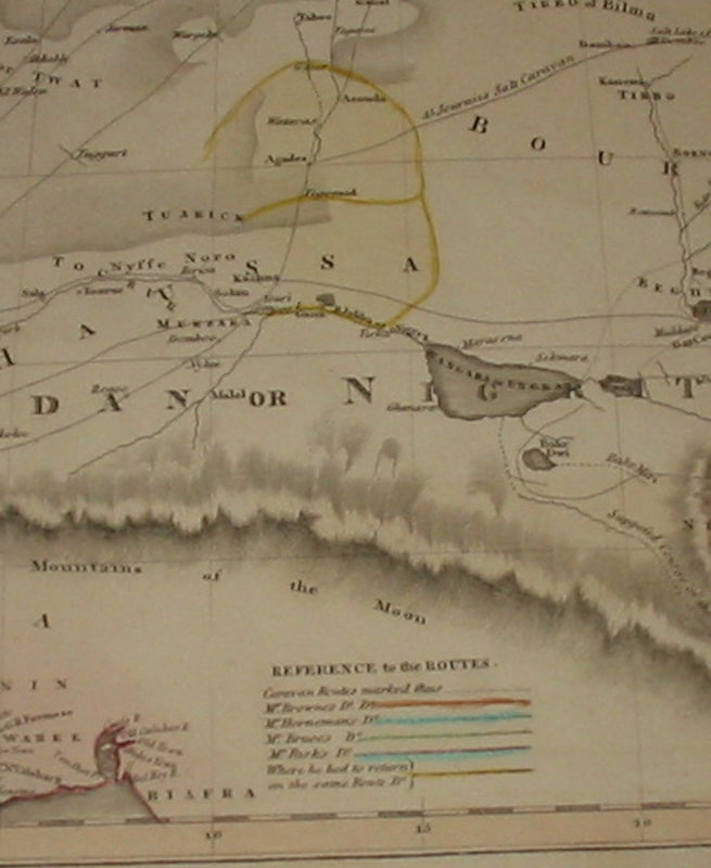
Map of North Africa showing the Routes of Explorers
New General Atlas
Map of North Africa showing the Routes of Explorers
Edinburgh: 1821. A hand coloured map, taken from Thomson's "New General Atlas". This shows North Africa (including the whole of the Sahara and West Africa). As well as the hand coloured detail, the map shows the routes of Mr Browne, Mr Horneman, Mr Bruce and Mr Parks. Originally this map was paired in a double page, folio atlas with a similar map for South Africa (not present). 280 x 515 mm (11 x 20¼ inches).
Condition: This map is in lovely condition. Clean and tidy with a little edgewear / nicking to the edges only (not affecting detail). The colour is clean and bright.
Book ID: 1533More details Price: £30.00 -
 Old-World Questions and New-World Answers.
London: Kegan Paul, Trench & Co, 1884. First edition, hardback. Bound in three quarter leather, with marbled boards, and gilt stamped title to spine. 369 pages + colour folding map to rear. Leather on boards is heavily rubbed, but the contents are quite clean, without markings or damage. Colour map is slightly foxed (see photos). 195 x 135 mm (7¾ x 5¼ inches).
This late nineteenth century work gives a fascinating glimpse in to the European view of the "American" as a social alchemist, and a glance at "evolution of the American people".Book ID: 3597More details Price: £35.00 -
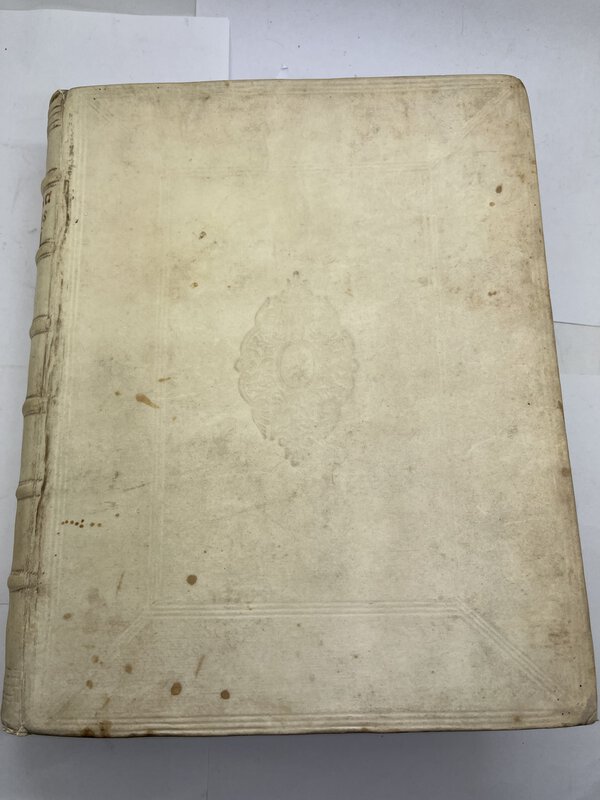
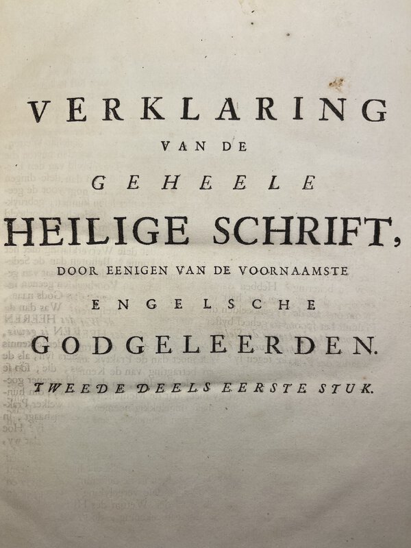
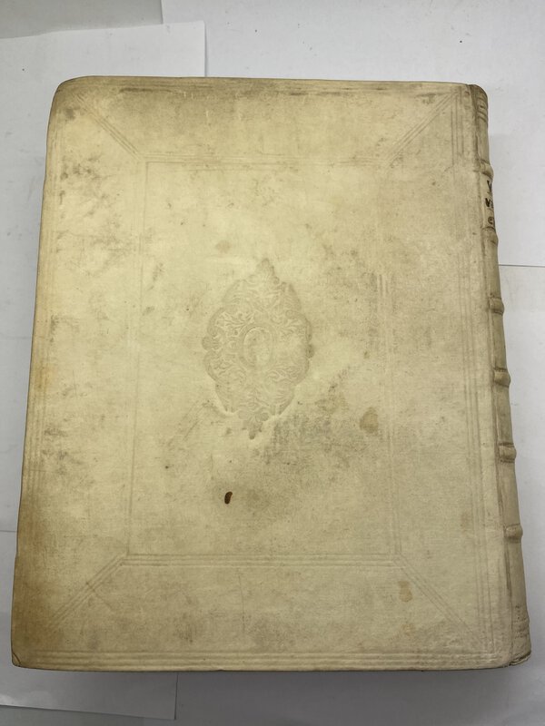
 Verklaring van Mozes Derde Boek, Genoemd Levitikus
uit de Engelsche verklaringen van de heeren Patrik Polus, Wels.
Book ID: 3661More details Price: £300.00
Verklaring van Mozes Derde Boek, Genoemd Levitikus
uit de Engelsche verklaringen van de heeren Patrik Polus, Wels.
Book ID: 3661More details Price: £300.00