


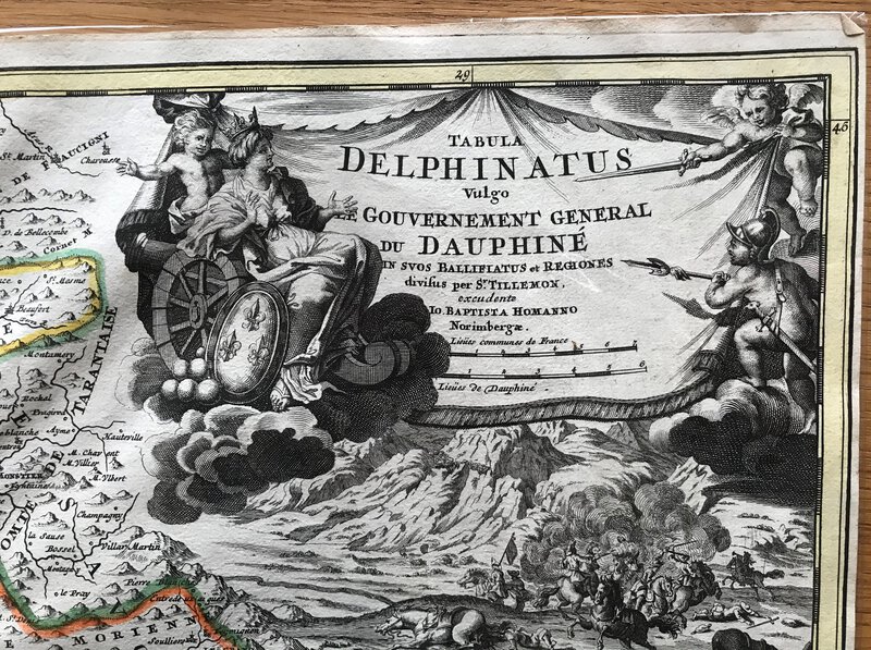


Tabula Delphinatus Vulgo le Gouvernement General du Dauphiné in suos Ballifiatus et Regiones divisus.
Norimbergæ [Nürnberg]: Jo. Baptist Homann, 1716. Copper engraving by Johann Baptist Homann, with contemporary hand colouring. The cartouche has a scene of Gods watching the fighting on a battlefield. The map covers the Dauphiné in southeastern France. In the west is the Rhône, and in the east Piemont in Italy. 505 x 580 mm (20 x 22¾ inches). One central fold. The colours are strong and edges are a little delicate. Blank verso. Gravure sur cuivre de Johann Baptist Homann, avec coloration à la main contemporaine. Le cartouche a une scène de dieux regardant les combats sur un champ de bataille. La carte couvre le Dauphiné dans le sud-est de la France. A l'ouest se trouve le Rhône, et à l'est le Piémont en Italie. 505 x 580 mm (20 x 22¾ pouces). Un pli central. Les couleurs sont fortes et les bords sont un peu délicats. Verso vierge.