- Category = British Topography
-
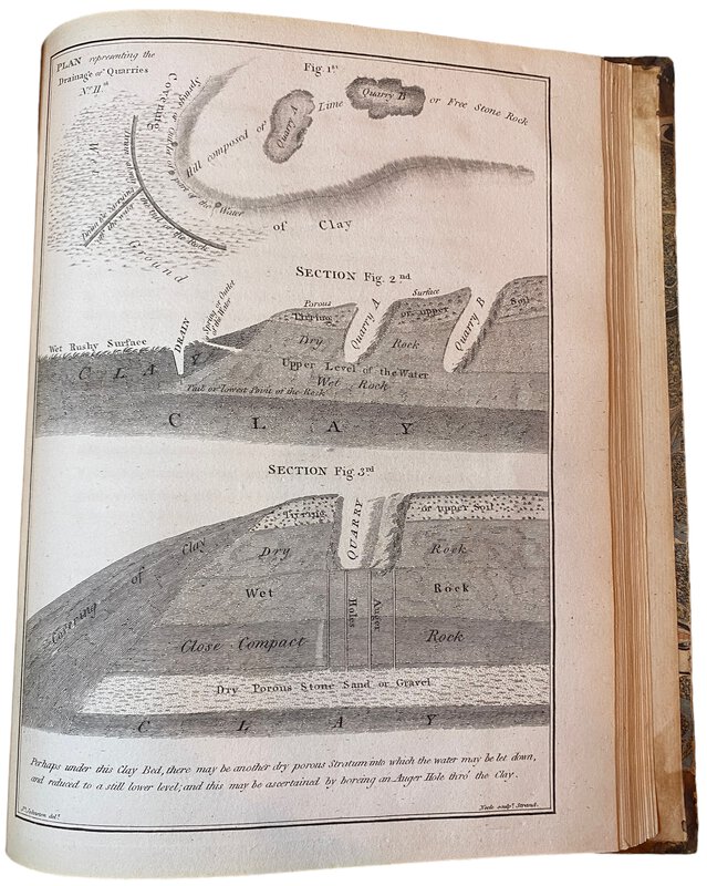
 An Account of the Most Approved Mode of Draining Land; according to the System practised by Mr Joseph Elkington.
With an appendix containing hints for the further improvements of Bogs and other Marshy Ground after draining;
Book ID: 3812More details Price: £480.00
An Account of the Most Approved Mode of Draining Land; according to the System practised by Mr Joseph Elkington.
With an appendix containing hints for the further improvements of Bogs and other Marshy Ground after draining;
Book ID: 3812More details Price: £480.00 -
 Brighton Official Handbook 1936-37
Book ID: 4339More details Price: £28.00
Brighton Official Handbook 1936-37
Book ID: 4339More details Price: £28.00 -
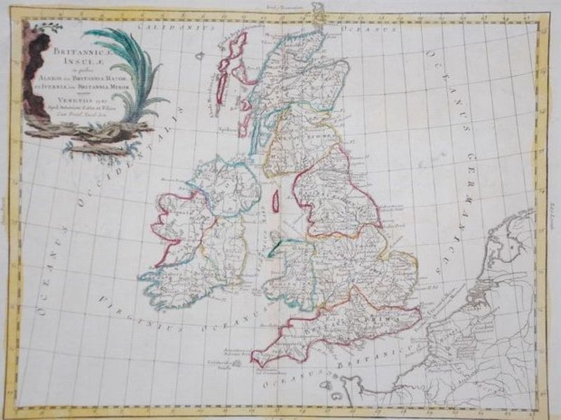
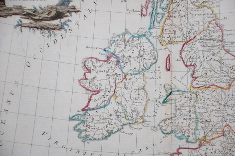
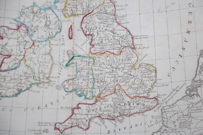
 Britannicae Insulae in quibus Albion Seu Britannia Major
Venitiis / Venice: Antonium Zatta, 1785. Hand-coloured map of Great Britain in good condition. Good. Wide margins. Fold as published. Slightly foxed in the margins. Imprint later hand colouring on verso. Verso: blank. 31 x 40 cm. From Zatta's Altante Novissimo, one of the last great decorative atlases of the 18th Century. Carte coloriée à la main de la Grande-Bretagne en bon état. Bon. De larges marges. Plier tel que publié. Légèrement rousseur dans les marges. Imprimez plus tard la coloration à la main au verso. Verso : vierge. 31x40cm. De l'Altante Novissimo de Zatta, l'un des derniers grands atlas décoratifs du XVIIIe siècle.
Book ID: 1783More details Price: £90.00 -
 Colour-printed aquatint with hand-finishing on wove paper: Brighton
Condition: The aquatint has been mounted on a board (presumably it was once framed), the bottom right corner has been damaged (perhaps whilst being removed from the frame). Actual scope of image remains clean and bright,
Book ID: 2314More details Price: £45.00 -
![[GREAT BRITAIN] – HEDENDAAGSCHE HISTORIE, Of Tegenwoordige Staat Van Groot Brittannie. [Vol. I-II] by [SALMON, Thomas.] & TIRION, Isaak](https://images.vialibri.net/production/20/3701-01---200.jpg?v=1671543216) [GREAT BRITAIN] – HEDENDAAGSCHE HISTORIE, Of Tegenwoordige Staat Van Groot Brittannie. [Vol. I-II]
Vervattende Eene Beschryving van 's Lands Gelegenheid.
Book ID: 3701More details Price: £600.00
[GREAT BRITAIN] – HEDENDAAGSCHE HISTORIE, Of Tegenwoordige Staat Van Groot Brittannie. [Vol. I-II]
Vervattende Eene Beschryving van 's Lands Gelegenheid.
Book ID: 3701More details Price: £600.00 -
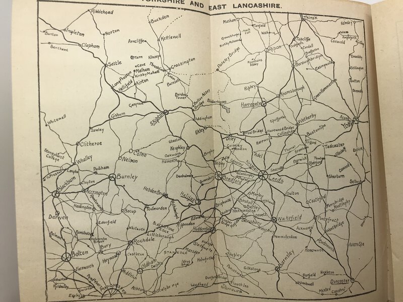
 Guide to Fountains Abbey
Plans and Illustrations from photographs by W. Wainwright.
Guide to Fountains Abbey
Plans and Illustrations from photographs by W. Wainwright.
Edition: Reprint
Ripon: W. Harrison & Son (C. Harker), 1922. Pale green paper covers with black titles. Advert for a similar book to the rear panel. This is the Third Edition, with the price One Shilling boldly printed to the front panel. Adverts to the inside covers. Stapled. A nice clean copy. Small stamp with "west lodge, Fountains Abbey" to the front cover - perhaps the then bookshop for the Abbey? Light rusting to the staples, otherwise clean and tidy inside and out. Not a first, but a very early edition of this guide to the Cistercian ruins. Black and white photographs throughout. [x], 48, [x], pp.
Book ID: 1252More details Price: £8.00 -
 Hove 1936-7
With illustrations by A.K. Macdonald and Helen McKie
Book ID: 4338More details Price: £75.00
Hove 1936-7
With illustrations by A.K. Macdonald and Helen McKie
Book ID: 4338More details Price: £75.00 -
 Les Isles Britanniques.
Paris: Robert de Vaugondy, 1754. Large-folio map of England, Ireland and Scotland. Contemporary border coloured. Copper engraving appeared in "Atlas Universel" Very good. Centrefold as published. Small tears in the margins. Light stains. Printers fold top centre. Verso: blank with the indication Isles Britannique. 480 x 590 mm (19 x 23¼ inches). Carte à grand folio de l'Angleterre, de l'Irlande et de l'Écosse. Bordure contemporaine colorée. Gravure sur cuivre parue dans "Atlas Universel" Très bonne. Pli central tel que publié. Petites déchirures dans les marges. Taches légères. Les imprimantes se replient en haut au centre. Verso : vierge avec l'indication Isles Britanniques. 480 x 590 mm.
Book ID: 1787More details Price: £130.00 -
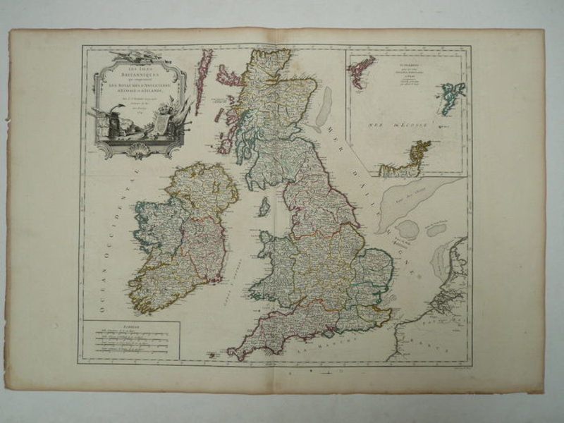
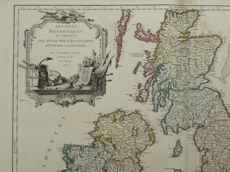
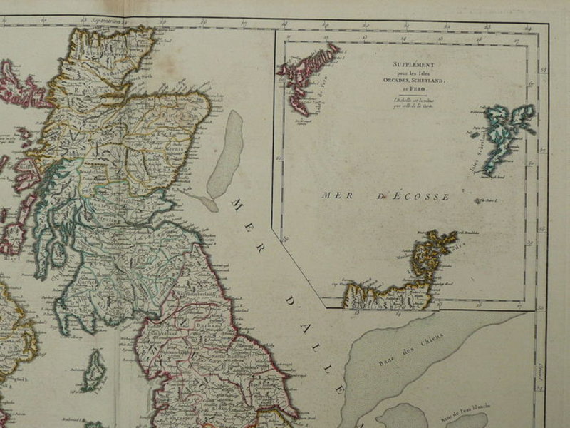
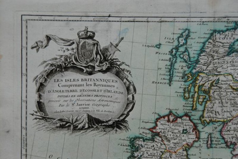
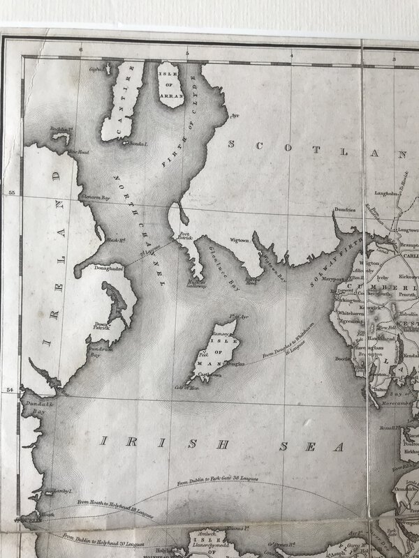
 Les Isles Britanniques Comprenant les Royaumes D'Angleterre, D'Ecosse et D'Irlande
Book ID: 1795More details Price: £55.00
Les Isles Britanniques Comprenant les Royaumes D'Angleterre, D'Ecosse et D'Irlande
Book ID: 1795More details Price: £55.00 -
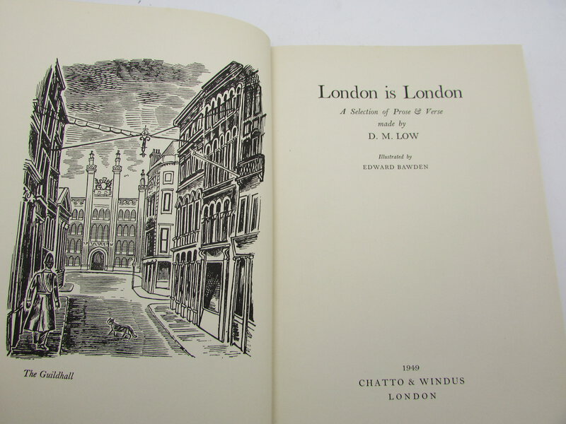
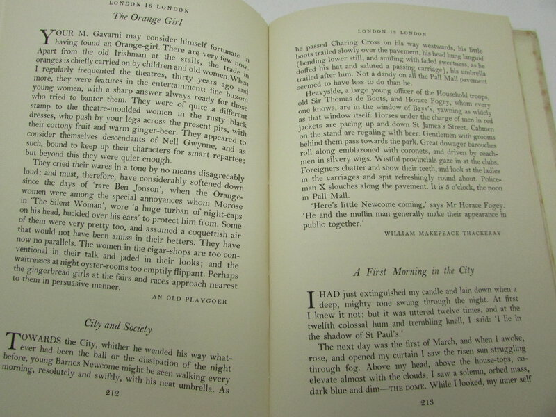
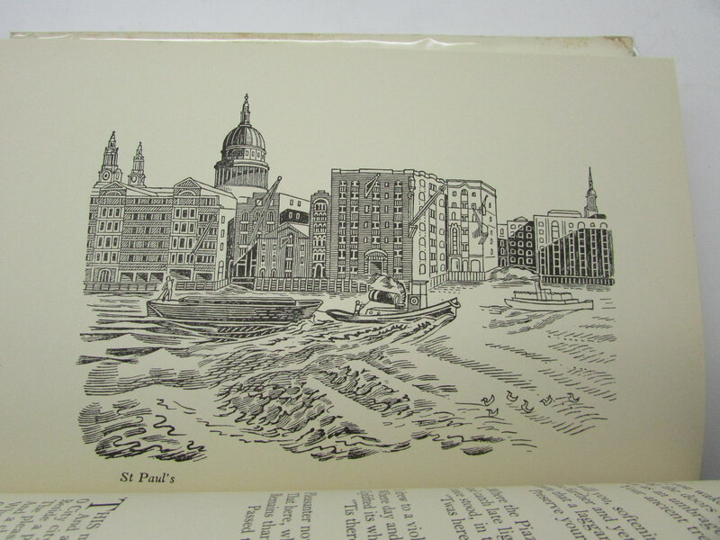
 London is London. A Selection of Prose and Verse. Illustrated by Edward Bawden.
London: Chatto & Windus, 1949. First edition. Dust wrapper. The wrapper has a couple of closed tears, and a chip to the head of the spine (about 1 cm). Blue cloth is clean. The book itself is in very good condition, with fractional foxing to the end papers and closed page edge only. Gift inscription to end paper. 300 pages. 210 x 140 mm (8¼ x 5½ inches).
Book ID: 2451More details Price: £60.00 -
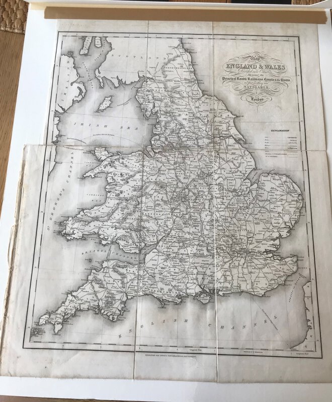
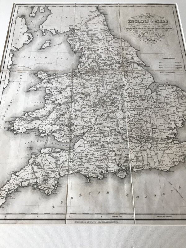
 Map of England & Wales Divided into Counties Shewing the Principal Roads, Railways, Canals & the Rivers as far as they are Navigable
London: S. Lewis and Co, 1848. Large folding map, now tipped on to card and behind cream passe-partout. From Lewis's "Atlas to the Topographical Dictionaries of England and Wales". In very good condition. Perfect for framing. 480 x 390 mm (19 x 15¼ inches).
Book ID: 3003More details Price: £40.00 -
 Map of Middlesex, from Britannia Depicta by Thomas Bowles.
Book ID: 2156More details Price: £50.00
Map of Middlesex, from Britannia Depicta by Thomas Bowles.
Book ID: 2156More details Price: £50.00 -
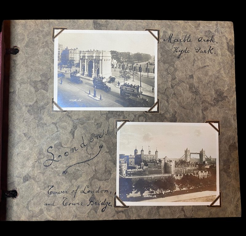
 Photograph Album of London.
Book ID: 3827More details Price: £90.00
Photograph Album of London.
Book ID: 3827More details Price: £90.00 -
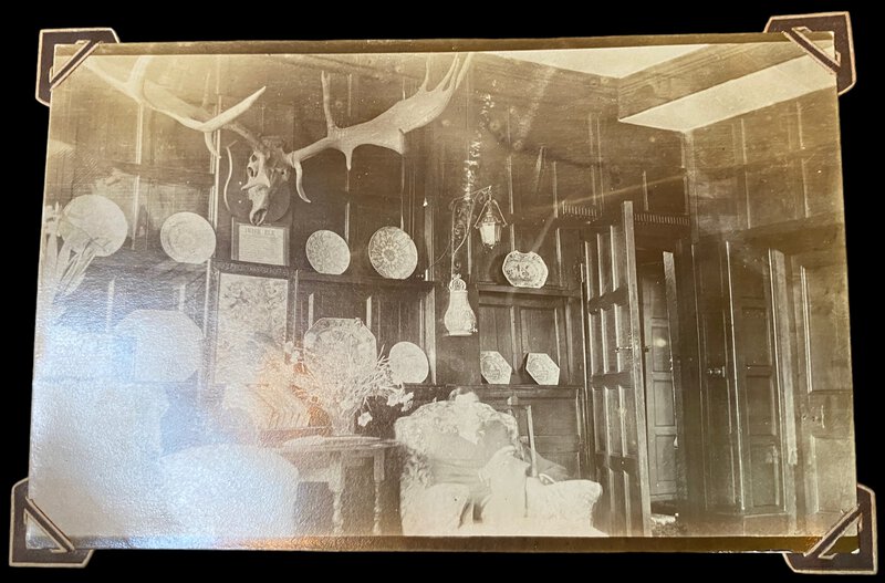
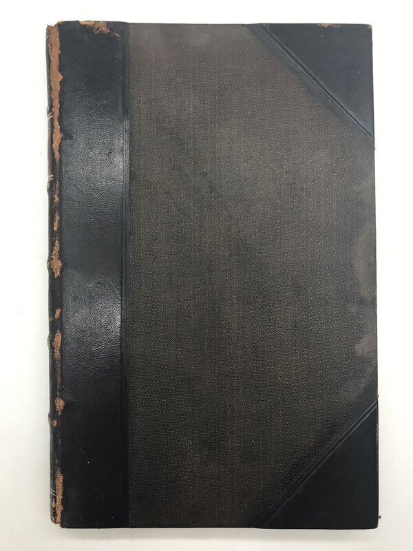
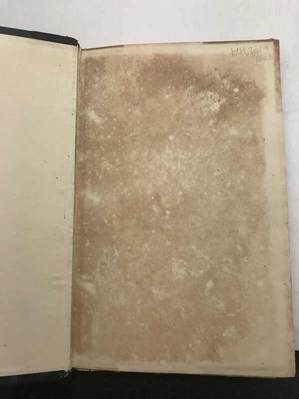
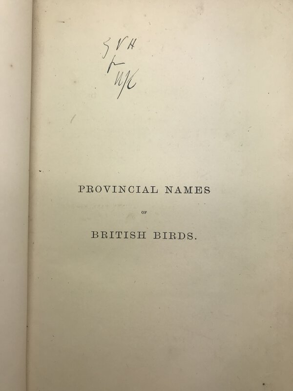
 Provincial Names and Folk Lore of British Birds.
London: Published by Trübner and Co. For The English Dialect Society, 1885. First edition, in half-leather hardback binding. With raised bands and gilt title to spine. Boards are quite rubbed, particularly to spine, and a damp stain to fore-edge of front board. Foxing to front free end paper. Neat initials to half title. Inside, one or two spots of foxing, but minimal. 243 pages. 235 x 155 mm (9¼ x 6 inches).
Book ID: 3019More details Price: £50.00 -
![Rade de Plimouth 1829. by [ANON]](https://images.vialibri.net/production/20/3342-1---200.jpg?v=1652176108) Rade de Plimouth 1829.
Original watercolour
Rade de Plimouth 1829.
Original watercolour
n/a, 1829. An attractive original watercolour of the beach and harbour at Plymouth, with title and date of 1829. By unknown French artist. Mounted on white card (somewhat darkened). The picture itself is in very good, bright condition. Held in a later (mid 20th century) wooden frame. Watercolour is 13.5cm x 9cm Frame is 22cm x 18cm. Une jolie aquarelle française de la plage et du port de Plymouth, avec titre et date de 1829. Montée sur carton blanc (un peu assombri). L'image elle-même est en très bon état lumineux. Tenu dans un cadre en bois plus tard (milieu du XXe siècle). L'aquarelle mesure 13,5 cm x 9 cm. Le cadre mesure 22 cm x 18 cm.
Book ID: 3342More details Price: £75.00 -
 Royaume d'Angleterre, Partie Méridionale.
Par M. Bonne, Ingenieur-Hydrographe de la Marine.
Book ID: 2312More details Price: £80.00
Royaume d'Angleterre, Partie Méridionale.
Par M. Bonne, Ingenieur-Hydrographe de la Marine.
Book ID: 2312More details Price: £80.00 -
![The Antient and Modern History of the Famous City of York; and in a Particular Manner Of its Magnificent Cathedral, commonly call'd York Minster by T. G. [GENT, Thomas]](https://images.vialibri.net/production/20/2258-1---200.JPG?v=1559468766) The Antient and Modern History of the Famous City of York; and in a Particular Manner Of its Magnificent Cathedral, commonly call'd York Minster
Book ID: 2258More details Price: £175.00
The Antient and Modern History of the Famous City of York; and in a Particular Manner Of its Magnificent Cathedral, commonly call'd York Minster
Book ID: 2258More details Price: £175.00 -
![The Antiquities of Furness; by [WEST, Thomas]](https://images.vialibri.net/production/20/1121-1---200.JPG?v=1536304843) The Antiquities of Furness;
Or, an Account of the Royal Abbey of St. Mary, in the Vale of Nightshade, Near Dalton in Furness, Belonging to the Right Honorable Lord George Cavendish
The Antiquities of Furness;
Or, an Account of the Royal Abbey of St. Mary, in the Vale of Nightshade, Near Dalton in Furness, Belonging to the Right Honorable Lord George Cavendish
Edition: First Edition
Book ID: 1121More details Price: £125.00 -
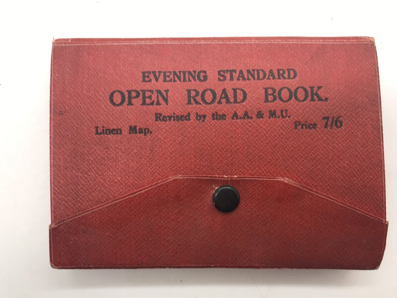
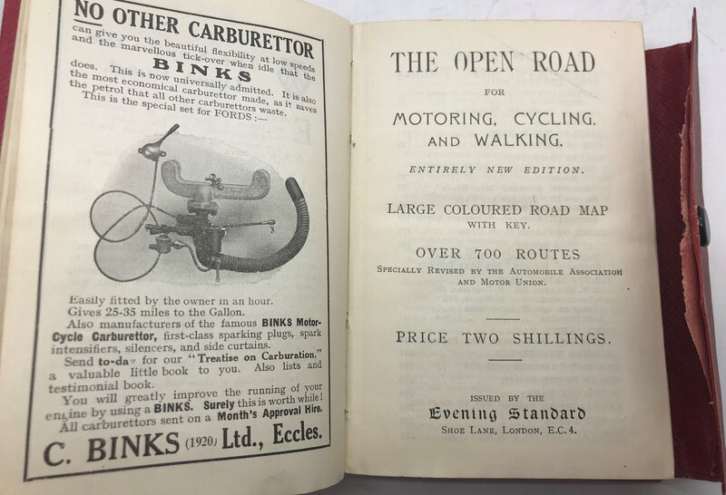
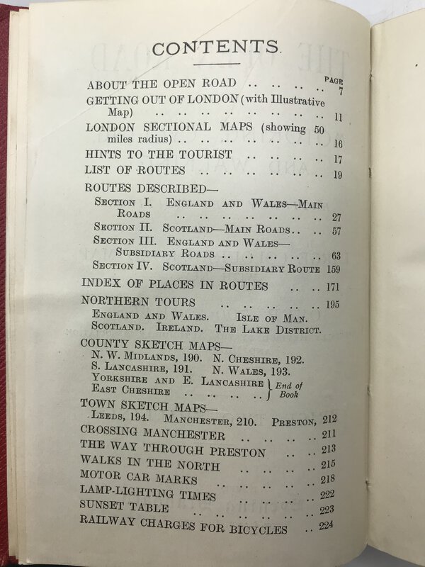
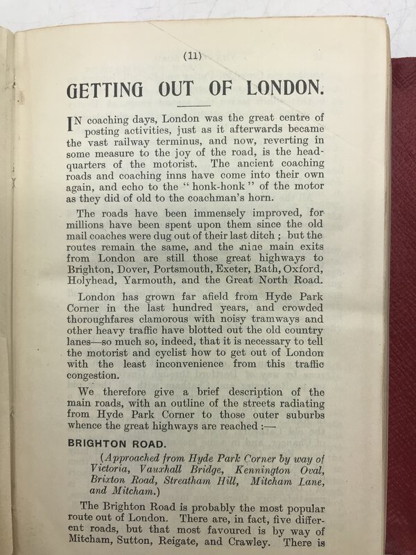
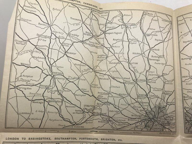
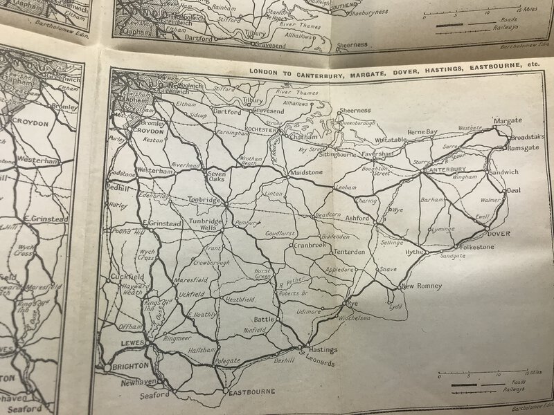
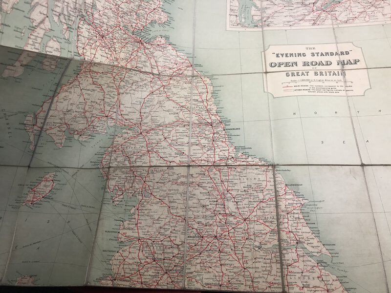
 The Evening Standard Open Road for Motoring, Cycling, and Walking.
With separate large coloured linen road map.
The Evening Standard Open Road for Motoring, Cycling, and Walking.
With separate large coloured linen road map.
London: The Evening Standard, 1920. Hardback book, in fold-over red cover (similar to a Baedeker) which fastens down neatly with a popper. Includes large loose linen colour folded map in a pocket at the back. Revised edition, circa 1920. Several b/w fold-out maps inside, including one entitled: How to get out of London! With 224 pages of advice, routes and advertisements for relevant items - plus the maps. It's a charming item, and we can't find any other copies available. 224 pages + folding map. 145 x 105 mm (5¾ x 4¼ inches).
Book ID: 3004More details Price: £60.00 -
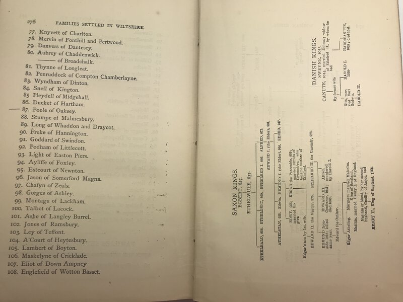
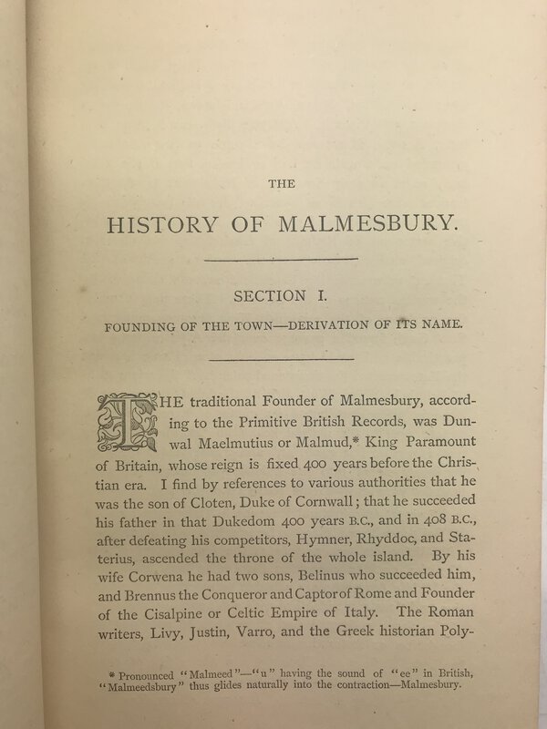
 The History of the Town of Malmesbury and of its Ancient Abbey. Together with Memoirs of Eminent Natives Who Were Connected with the Abbey or Town.
1876. First Edition. Hardback. History of the lovely Wiltshire town of Malmesbury, and its abbey. Self-published after four years of research. Dark brown marbled hardback. Boards are a little rubbed to corners. There are previous owners' ink names written on the FFEP. Sadly, the first gather is detached, but present. Minor foxing to some pages. All engravings are present. 276 pages. 215 x 140 mm (8½ x 5½ inches).
Book ID: 2935More details Price: £40.00


![[GREAT BRITAIN] – HEDENDAAGSCHE HISTORIE, Of Tegenwoordige Staat Van Groot Brittannie. [Vol. I-II] by [SALMON, Thomas.] & TIRION, Isaak](https://images.vialibri.net/production/20/3701-01---800.jpg?v=1671543216)
![Another image of [GREAT BRITAIN] – HEDENDAAGSCHE HISTORIE, Of Tegenwoordige Staat Van Groot Brittannie. [Vol. I-II] by [SALMON, Thomas.] & TIRION, Isaak](https://images.vialibri.net/production/20/3701-02---800.jpg?v=1671543245)
![Another image of [GREAT BRITAIN] – HEDENDAAGSCHE HISTORIE, Of Tegenwoordige Staat Van Groot Brittannie. [Vol. I-II] by [SALMON, Thomas.] & TIRION, Isaak](https://images.vialibri.net/production/20/3701-03---800.jpg?v=1671543225)
![Another image of [GREAT BRITAIN] – HEDENDAAGSCHE HISTORIE, Of Tegenwoordige Staat Van Groot Brittannie. [Vol. I-II] by [SALMON, Thomas.] & TIRION, Isaak](https://images.vialibri.net/production/20/3701-04---800.jpg?v=1671543242)
![Another image of [GREAT BRITAIN] – HEDENDAAGSCHE HISTORIE, Of Tegenwoordige Staat Van Groot Brittannie. [Vol. I-II] by [SALMON, Thomas.] & TIRION, Isaak](https://images.vialibri.net/production/20/3701-05---800.jpg?v=1671543218)
![Another image of [GREAT BRITAIN] – HEDENDAAGSCHE HISTORIE, Of Tegenwoordige Staat Van Groot Brittannie. [Vol. I-II] by [SALMON, Thomas.] & TIRION, Isaak](https://images.vialibri.net/production/20/3701-06---800.jpg?v=1671543215)
![Another image of [GREAT BRITAIN] – HEDENDAAGSCHE HISTORIE, Of Tegenwoordige Staat Van Groot Brittannie. [Vol. I-II] by [SALMON, Thomas.] & TIRION, Isaak](https://images.vialibri.net/production/20/3701-07---800.jpg?v=1671543232)
![Another image of [GREAT BRITAIN] – HEDENDAAGSCHE HISTORIE, Of Tegenwoordige Staat Van Groot Brittannie. [Vol. I-II] by [SALMON, Thomas.] & TIRION, Isaak](https://images.vialibri.net/production/20/3701-08---800.jpg?v=1671543217)
![Another image of [GREAT BRITAIN] – HEDENDAAGSCHE HISTORIE, Of Tegenwoordige Staat Van Groot Brittannie. [Vol. I-II] by [SALMON, Thomas.] & TIRION, Isaak](https://images.vialibri.net/production/20/3701-09---800.jpg?v=1671543224)


![Rade de Plimouth 1829. by [ANON]](https://images.vialibri.net/production/20/3342-1---800.jpg?v=1652176108)
![Another image of Rade de Plimouth 1829. by [ANON]](https://images.vialibri.net/production/20/3342-2---800.jpg?v=1652176117)
![Another image of Rade de Plimouth 1829. by [ANON]](https://images.vialibri.net/production/20/3342-3---800.jpg?v=1652176116)

![The Antient and Modern History of the Famous City of York; and in a Particular Manner Of its Magnificent Cathedral, commonly call'd York Minster by T. G. [GENT, Thomas]](https://images.vialibri.net/production/20/2258-1---800.JPG?v=1559468766)
![Another image of The Antient and Modern History of the Famous City of York; and in a Particular Manner Of its Magnificent Cathedral, commonly call'd York Minster by T. G. [GENT, Thomas]](https://images.vialibri.net/production/20/2258-10---800.JPG?v=1559468781)
![Another image of The Antient and Modern History of the Famous City of York; and in a Particular Manner Of its Magnificent Cathedral, commonly call'd York Minster by T. G. [GENT, Thomas]](https://images.vialibri.net/production/20/2258-2---800.jpeg?v=1559468742)
![Another image of The Antient and Modern History of the Famous City of York; and in a Particular Manner Of its Magnificent Cathedral, commonly call'd York Minster by T. G. [GENT, Thomas]](https://images.vialibri.net/production/20/2258-3---800.JPG?v=1559468778)
![Another image of The Antient and Modern History of the Famous City of York; and in a Particular Manner Of its Magnificent Cathedral, commonly call'd York Minster by T. G. [GENT, Thomas]](https://images.vialibri.net/production/20/2258-4---800.JPG?v=1559468762)
![Another image of The Antient and Modern History of the Famous City of York; and in a Particular Manner Of its Magnificent Cathedral, commonly call'd York Minster by T. G. [GENT, Thomas]](https://images.vialibri.net/production/20/2258-5---800.JPG?v=1559468767)
![Another image of The Antient and Modern History of the Famous City of York; and in a Particular Manner Of its Magnificent Cathedral, commonly call'd York Minster by T. G. [GENT, Thomas]](https://images.vialibri.net/production/20/2258-6---800.JPG?v=1559468757)
![Another image of The Antient and Modern History of the Famous City of York; and in a Particular Manner Of its Magnificent Cathedral, commonly call'd York Minster by T. G. [GENT, Thomas]](https://images.vialibri.net/production/20/2258-7---800.JPG?v=1559468780)
![Another image of The Antient and Modern History of the Famous City of York; and in a Particular Manner Of its Magnificent Cathedral, commonly call'd York Minster by T. G. [GENT, Thomas]](https://images.vialibri.net/production/20/2258-8---800.JPG?v=1559468773)
![Another image of The Antient and Modern History of the Famous City of York; and in a Particular Manner Of its Magnificent Cathedral, commonly call'd York Minster by T. G. [GENT, Thomas]](https://images.vialibri.net/production/20/2258-9---800.JPG?v=1559468775)
![The Antiquities of Furness; by [WEST, Thomas]](https://images.vialibri.net/production/20/1121-1---800.JPG?v=1536304843)
![Another image of The Antiquities of Furness; by [WEST, Thomas]](https://images.vialibri.net/production/20/1121-2---800.JPG?v=1536304843)
![Another image of The Antiquities of Furness; by [WEST, Thomas]](https://images.vialibri.net/production/20/1121-3---800.JPG?v=1536304847)
![Another image of The Antiquities of Furness; by [WEST, Thomas]](https://images.vialibri.net/production/20/1121-4---800.JPG?v=1536304847)
![Another image of The Antiquities of Furness; by [WEST, Thomas]](https://images.vialibri.net/production/20/1121-5---800.JPG?v=1536304849)
![Another image of The Antiquities of Furness; by [WEST, Thomas]](https://images.vialibri.net/production/20/1121-6---800.JPG?v=1536304852)