- Category = British Topography,European Travel & Exploration,Maps & Atlases,Polar,Rest of the World,Travel Guides
-
![12 Vues - Souvenir de Paris. Serie 1. by [ANON]](https://images.vialibri.net/production/20/3507-01---200.jpg?v=1663704044) 12 Vues - Souvenir de Paris. Serie 1.
Book ID: 3507More details Price: £175.00
12 Vues - Souvenir de Paris. Serie 1.
Book ID: 3507More details Price: £175.00 -
![8 Lithographs et carte for Fraid-Aigue, Saint Prex, Vaud by [ANON]](https://images.vialibri.net/production/20/4207-01---200.jpg?v=1705339800) 8 Lithographs et carte for Fraid-Aigue, Saint Prex, Vaud
Book ID: 4207More details Price: £475.00
8 Lithographs et carte for Fraid-Aigue, Saint Prex, Vaud
Book ID: 4207More details Price: £475.00 -
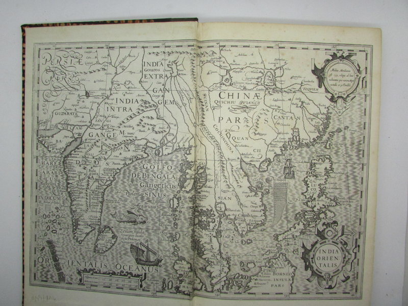
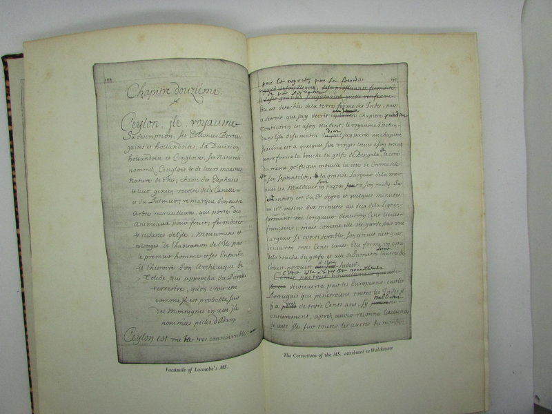
 A Compendium of the East. Being an Account of Voyages to the Grand Indies Made By the Sieur Jean De Lacombe, of Quercy, Formerly Captain at Arms in the Service of the Company of the Indies of Holland.
Now Published for the First Time [from the Bordeaux Manuscript of 1681] in an English translation by Stephanie & Denis Clark. Edited, with an Introduction by Ashley Gibson.
A Compendium of the East. Being an Account of Voyages to the Grand Indies Made By the Sieur Jean De Lacombe, of Quercy, Formerly Captain at Arms in the Service of the Company of the Indies of Holland.
Now Published for the First Time [from the Bordeaux Manuscript of 1681] in an English translation by Stephanie & Denis Clark. Edited, with an Introduction by Ashley Gibson.
London: The Golden Cockerel Press, 1937. First Thus. Limited: # 86 of 300 copies. Black cloth spine, batik covered boards. Printed in Perpetua type on Arnold's hand-made paper. Contemporary Engravings of the principal places visited reproduced from Schouten's Oost-Indische Reyse [Amsterdam, 1676]. Maps used as end papers are from a contemporary Mercator Atlas. Double page plates, double page facsimile from original manuscript. 209, [1] pp. Bookplate of Herbert Eberhard Hering, a noted German-Brazilian bibliophile and book collector, appears on the inside front paste down. The black spine has a little nicking to the top and tail of the spine. Overall in good, clean condition though. Internally clean with a few foxing spots only. Text in English. 320 x 200 mm (12½ x 7¾ inches).
Book ID: 2244More details Price: £225.00 -
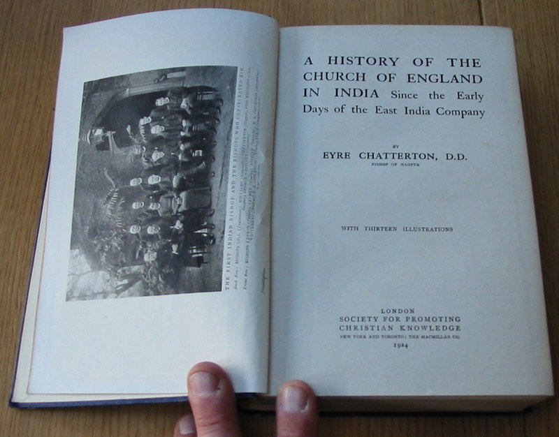
 A History of the Church of England in India Since the Early Days of the East India Company.
London: Society for the Promotion of Christian Knowledge (SPCK), 1924. Original blue cloth with gilt titles. Frontis photograph of the first Indian Bishop. Thirteen illustrations.
Condition: Very nice condition. The blue cloth is clean and tidy with just a little handling to the head and tail of the spine. Inside, there are two gift inscriptions to the front end paper. A little light foxing to the pages.
Book ID: 1536More details Price: £15.00 -
 A Mortal Flower
Book ID: 3740More details Price: £28.00
A Mortal Flower
Book ID: 3740More details Price: £28.00 -
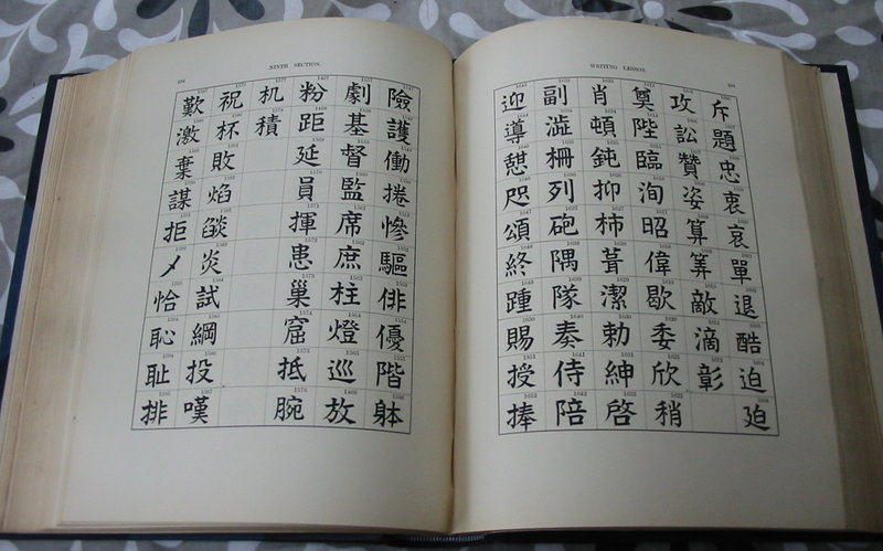
 A Practical Introduction to the Study of Japanese Writing.
Edition: First Edition
Book ID: 1669More details Price: £350.00 -
 A Voyage to Senegal;
Or, Historical, Philosophical, and Political Memoirs, Relative To The Discoveries, Establishments, and Commerce of Europeans In The Atlantic Ocean, From Cape Blanco to the River of Sierra Leone. To Which Is Added An Account Of A Journey From Isle St. Louis To Galam.
A Voyage to Senegal;
Or, Historical, Philosophical, and Political Memoirs, Relative To The Discoveries, Establishments, and Commerce of Europeans In The Atlantic Ocean, From Cape Blanco to the River of Sierra Leone. To Which Is Added An Account Of A Journey From Isle St. Louis To Galam.
London: Richard Phillips, 1806. First English edition. Recent half leather binding with marbled boards and matching endpapers. Translated from the French. Fold out frontis map entitled: 'Western Coast of Africa, from Cape Blanco to the River of Sierra Leone with the courses of the Rivers Senegal and Gambia, Shewing the Journey of M. Durand from Senegal to Galam', plus seven aquatint plates. Contents have foxing throughout. Two plates are in facsimile. 181 + (3) pp. 215 x 135 mm (8½ x 5¼ inches).
Condition: .
Book ID: 2620More details Price: £240.00 -
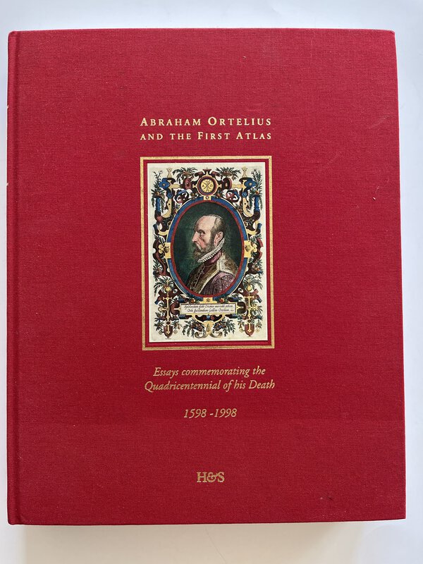
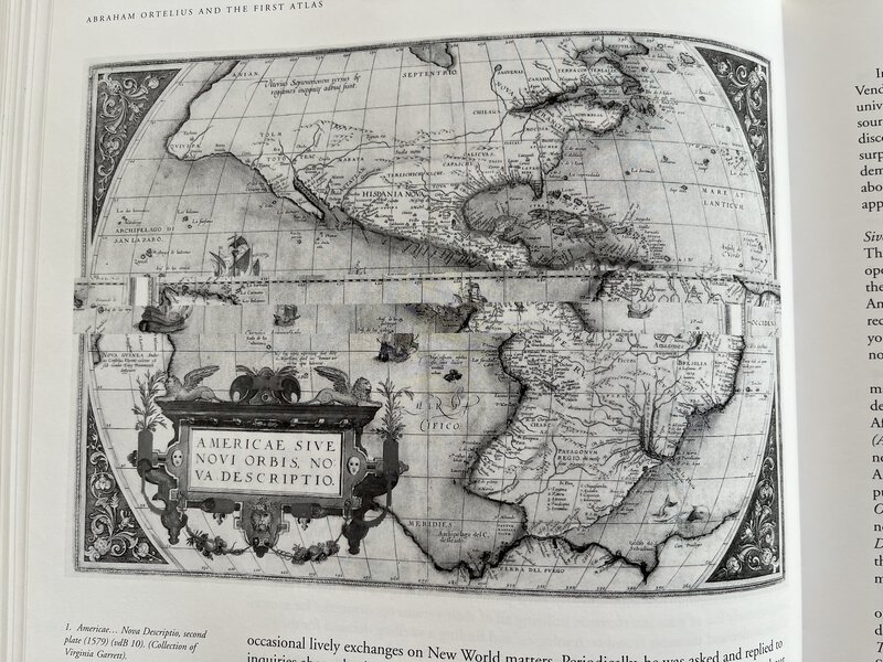
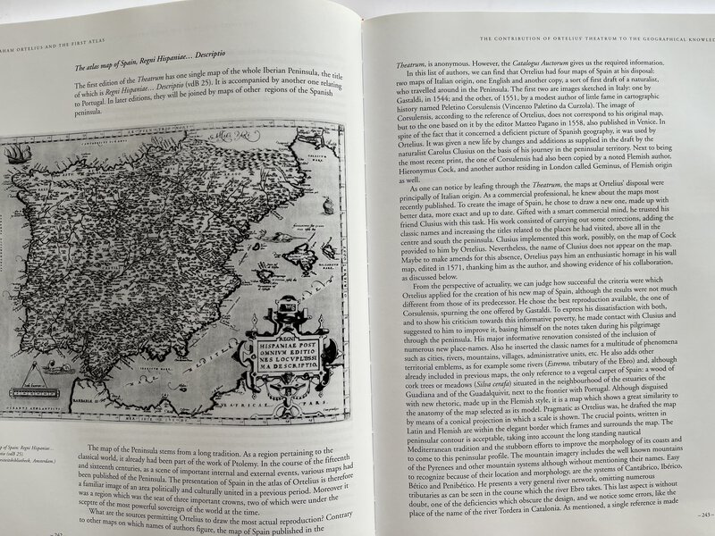
 Abraham Ortelius and the First Atlas. Essays commemorating the Quadricentennial of his Death. 1598 - 1998.
With an introduction by Leon Voet.
Abraham Ortelius and the First Atlas. Essays commemorating the Quadricentennial of his Death. 1598 - 1998.
With an introduction by Leon Voet.
Utrecht: Hes Publishers BV, 1998. First edition. Hardback in red publisher's cloth with tipped on colour portrait to front board, with gilt title to front and spine. Fully illustrated in b/w. Fascinating insights in to "the father of historical cartography". Text in English. 432 pages. In very good condition. 310 x 240 mm (12¼ x 9½ inches).
Book ID: 3864More details Price: £75.00 -
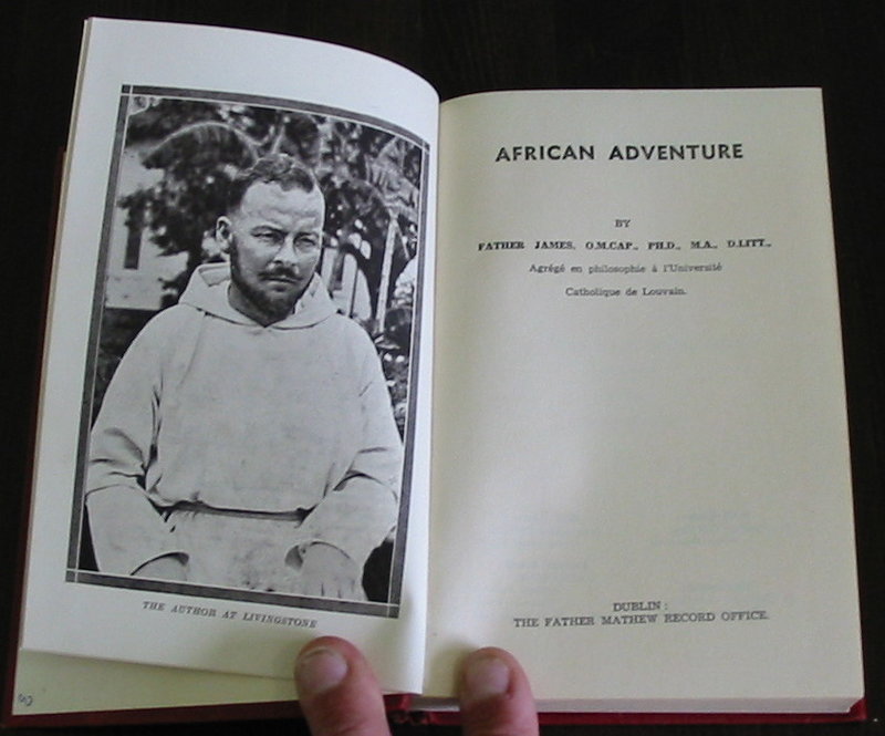
 African Adventure
Edition: First Edition
Dublin: Father Mathew Record Office, 1936. Original Red cloth with black embossed titles. Bookplate of Syon Abbey, South Brent to the inside board. Frontis illustration and black and white illus. throughout. Folding map to rear. A very nice copy of this book. The red cloth is clean and tidy, with marginal bumping only. No significant marks. Internally clean and tidy throughout. 202 pp. + Plates.
Book ID: 1192More details Price: £15.00 -
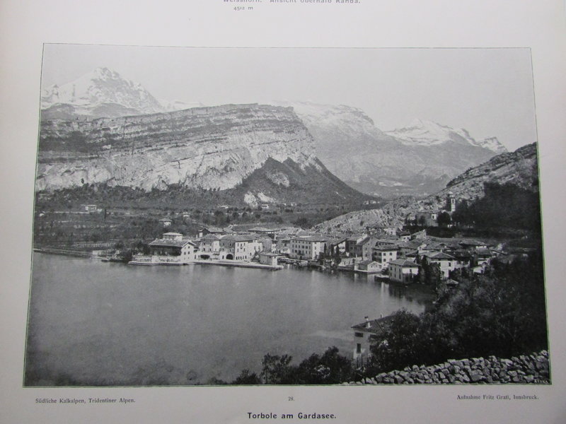
 Alpine Majestaten Und Ihr Gefolge.
Die Gebirgswelt der Erde in Bildern. Dritter Band
Alpine Majestaten Und Ihr Gefolge.
Die Gebirgswelt der Erde in Bildern. Dritter Band
Munchen: Vereinigte Kunstanstalen, 1903. First edition. Volume three only (of four). Pictorial boards with alpine picture and art nouveau decoration around. Gilt end papers. Library stamps for the Erasmiaansch Gymnasium Rotterdam. Map of the Alps showing regions, 268 photographs of peaks and features on glossy paper, several are folding plates. Cloth boards are a little stained and darkened, particularly to the front cover. Still attractive though. Moderate foxing to the first few. The rest the book is in very good condition with only light foxing. 440 by 300 mm (17¼ by 11¾ inches).
Book ID: 2246More details Price: £60.00 -
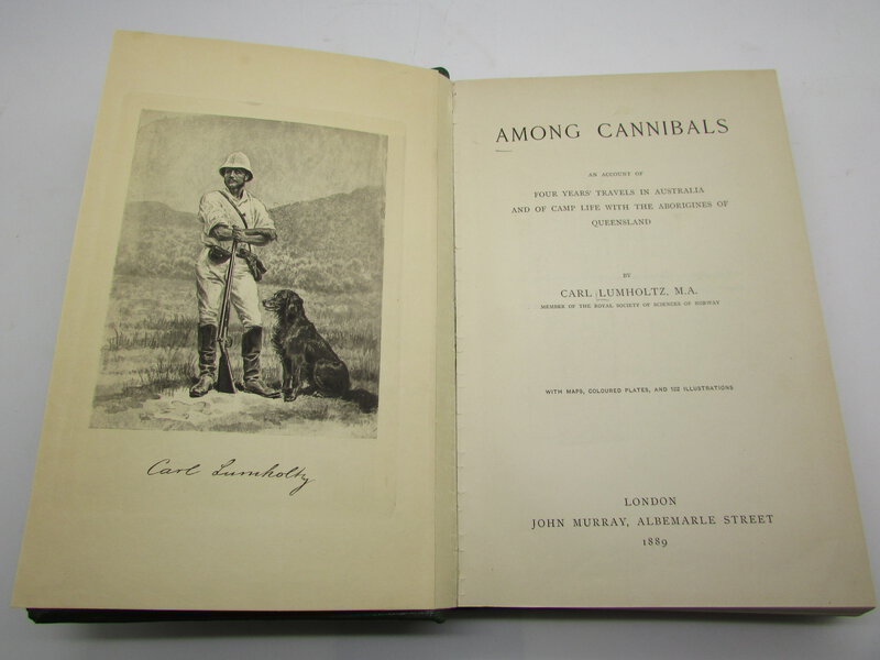
 Among Cannibals. An account of four years travels in Australia and of camp life with the Aborigines of Queensland.
London: John Murray, 1889. 1st Edition. Two coloured folding maps, 24 plates, frontis and four coloured lithographs. Complete. Recent green library buckram (but does not appear to be a library copy). Internally clean and tidy, but one plate is almost detached. Otherwise in very good condition. XX, 396 pp. 230 x 155 mm (9 x 6 inches).
Book ID: 2449More details Price: £200.00 -
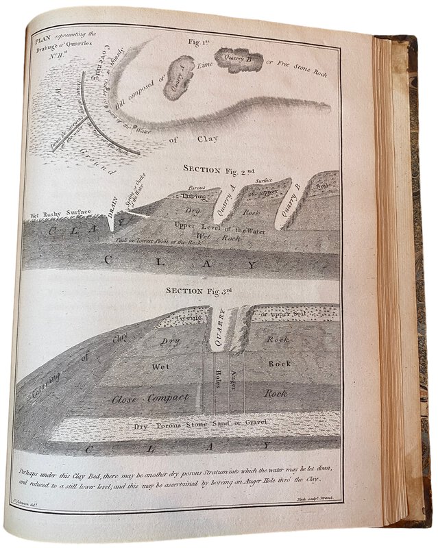
 An Account of the Most Approved Mode of Draining Land; according to the System practised by Mr Joseph Elkington.
With an appendix containing hints for the further improvements of Bogs and other Marshy Ground after draining;
Book ID: 3812More details Price: £480.00
An Account of the Most Approved Mode of Draining Land; according to the System practised by Mr Joseph Elkington.
With an appendix containing hints for the further improvements of Bogs and other Marshy Ground after draining;
Book ID: 3812More details Price: £480.00 -
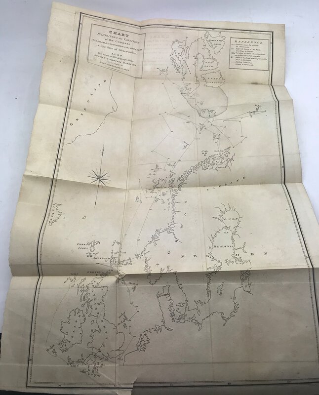
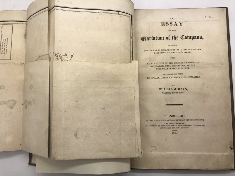
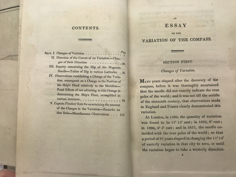
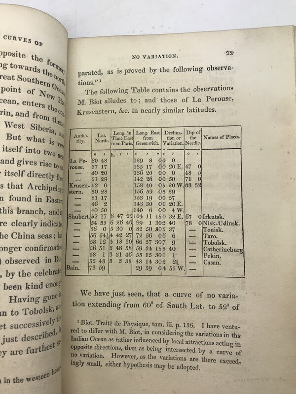
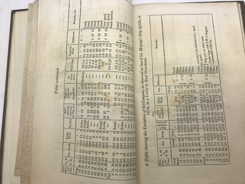
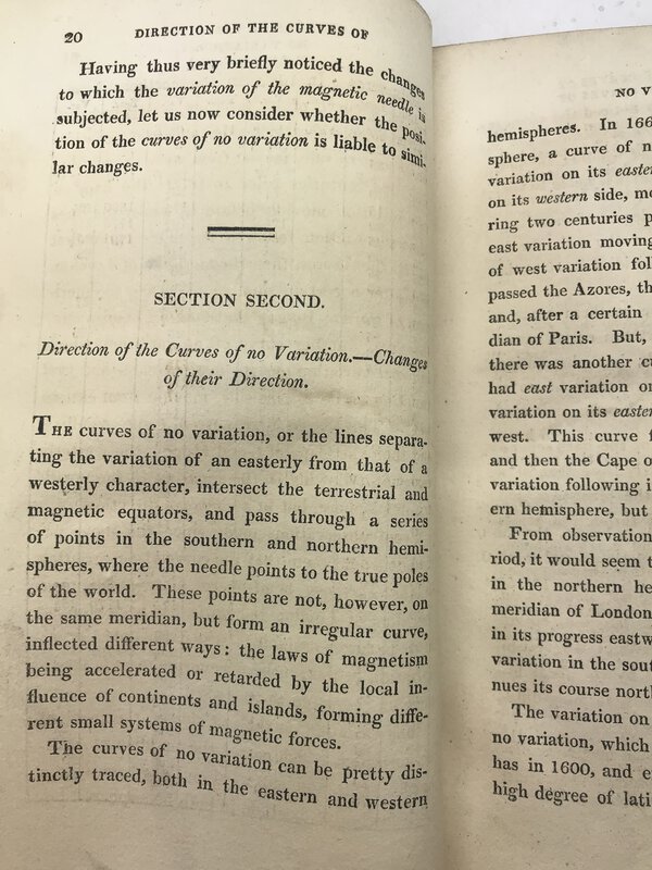
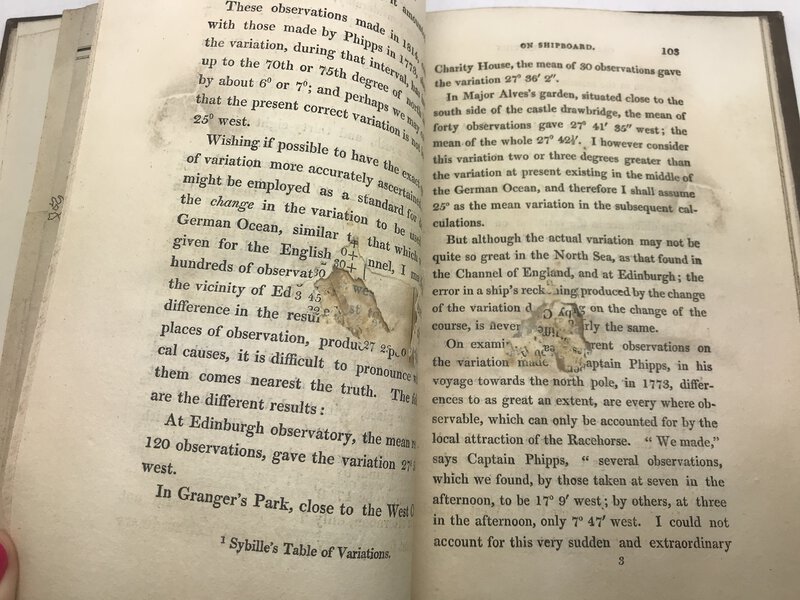
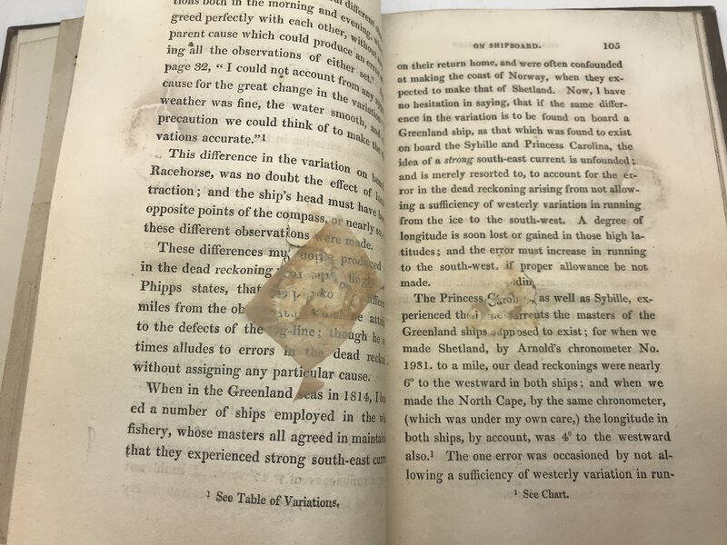
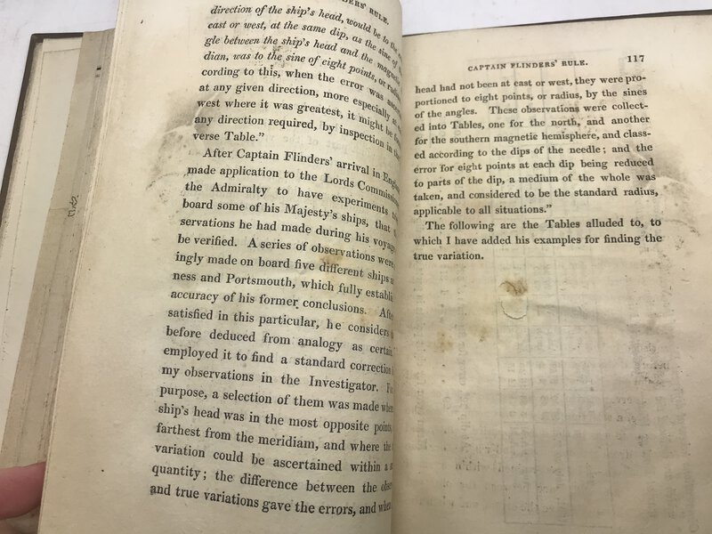
 An Essay on the Variation of the Compass,
shewing how far it is influenced by a change in the direction of the ship's head, with an exposition of the dangers arising to navigators from not allowing for this change of variation. Interspersed with Practical, Observations and Remarks.
Book ID: 2909More details Price: £85.00
An Essay on the Variation of the Compass,
shewing how far it is influenced by a change in the direction of the ship's head, with an exposition of the dangers arising to navigators from not allowing for this change of variation. Interspersed with Practical, Observations and Remarks.
Book ID: 2909More details Price: £85.00 -
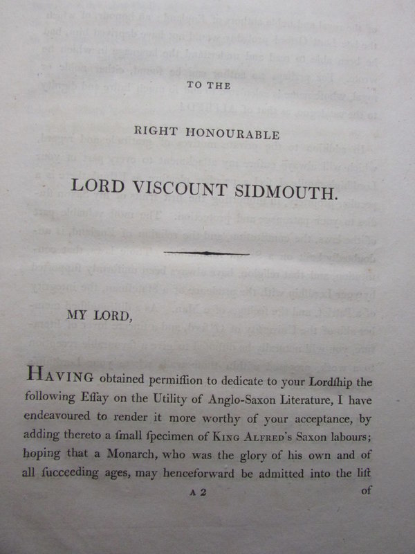
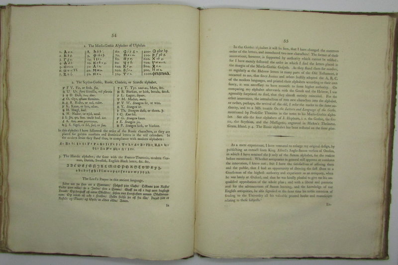
 An Inaugural Lecture on the Utility of Anglo-Saxon Literature.
To which is added the Geography of Europe by King Alfred, including his Account of the Discovery of the North Cape in the Ninth Century.
Book ID: 2206More details Price: £150.00
An Inaugural Lecture on the Utility of Anglo-Saxon Literature.
To which is added the Geography of Europe by King Alfred, including his Account of the Discovery of the North Cape in the Ninth Century.
Book ID: 2206More details Price: £150.00 -
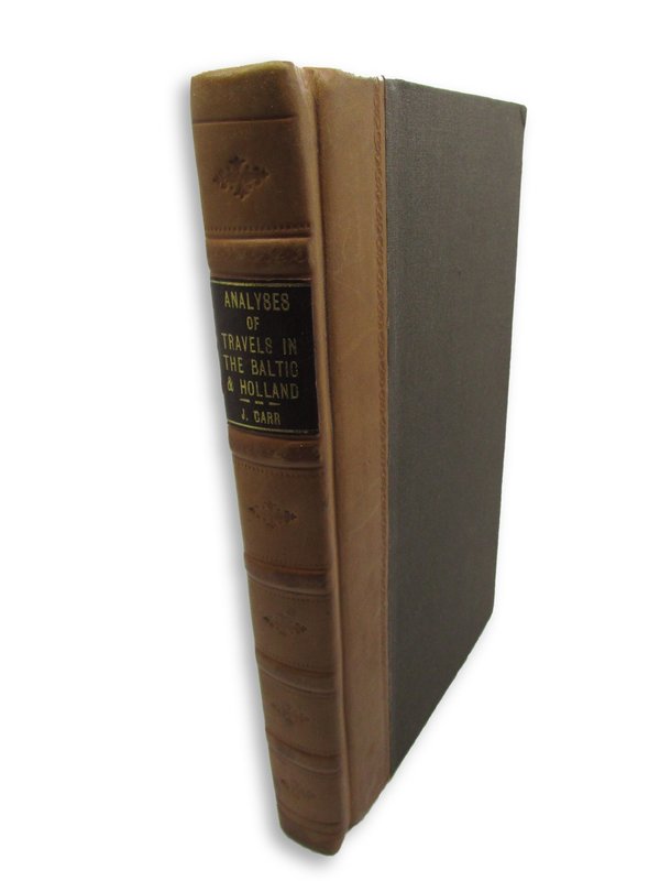
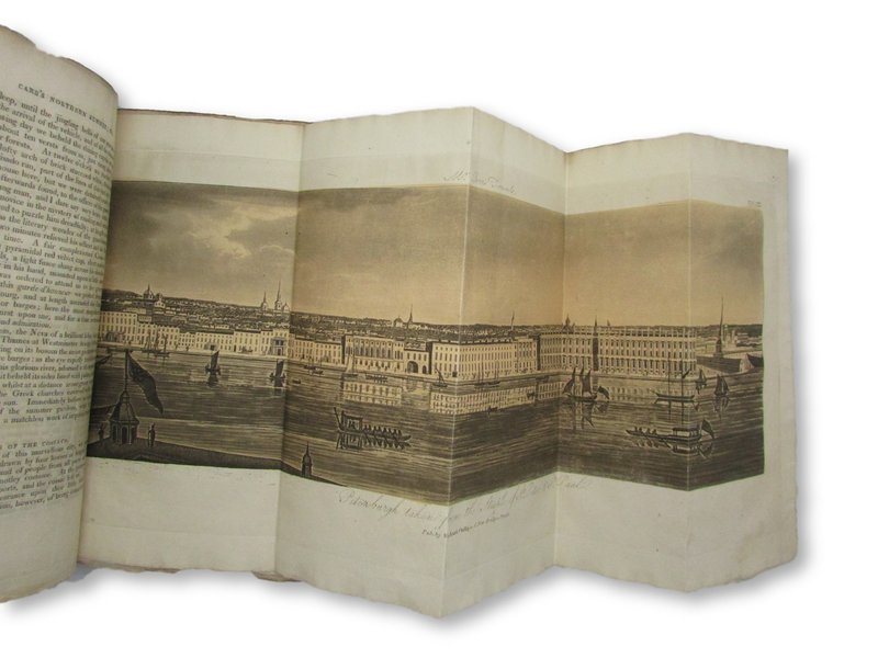
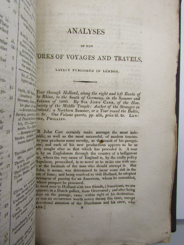
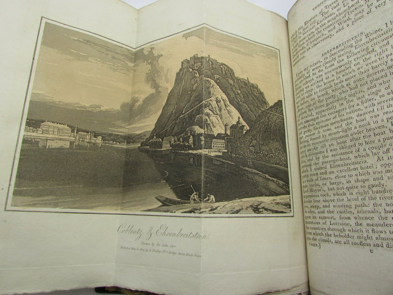
 Analyses of New Voyages and Travels, lately published in London.
Two abstracts from "A Northern Summer" and "A Tour through Holland."
Book ID: 2196More details Price: £350.00
Analyses of New Voyages and Travels, lately published in London.
Two abstracts from "A Northern Summer" and "A Tour through Holland."
Book ID: 2196More details Price: £350.00 -
 Annals of the Propagation of the Faith:
Volume XIV. January 1853. Number LXXXII.
Annals of the Propagation of the Faith:
Volume XIV. January 1853. Number LXXXII.
Edition: First Edition
London: Association for the Propagation of the Faith: 1853. A Periodical Collection of Letters from the Bishops and Missionaries Employed in the Missions of the Old and New. Pale blue paper covers. Uncut pages. The bulk of this issue is dealing with the missions to China. A quite reasonable copy of this individual issue of the Annals. sound, but somewhat darkened and dusty pale blue paper covers. Internally clean and tidy throughout, although there is a little darkening to the first page. Uncut pages. The Association for the Propagation of the Faith is a Roman Catholic institution which is dedicated to supporting with prayer and funds the Catholic Missionaries who work overseas (I.e. not in the United Kingdom). pp. [i]-[1]-58.
Book ID: 1142More details Price: £10.00 -
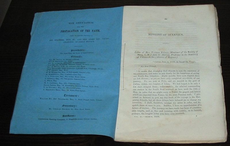
 Annals of the Propagation of the Faith:
Volume XI. March 1850. Number LXV.
Annals of the Propagation of the Faith:
Volume XI. March 1850. Number LXV.
Edition: First Edition
London: Association for the Propagation of the Faith: 1850. A Periodical Collection of Letters from the Bishops and Missionaries Employed in the Missions of the Old and New. Pale blue paper covers. Uncut pages. The bulk of this issue is dealing with the missions to Oceanica and China. A quite reasonable copy of this individual issue of the Annals. sound, but somewhat darkened and dusty pale blue paper covers. Internally clean and tidy throughout, although there is a little darkening to the first page. Uncut pages. The Association for the Propagation of the Faith is a Roman Catholic institution which is dedicated to supporting with prayer and funds the Catholic Missionaries who work overseas (I.e. not in the United Kingdom). pp. 53-119
Book ID: 1143More details Price: £10.00 -
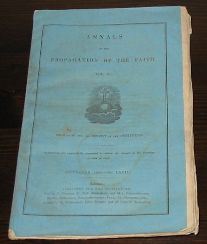
 Annals of the Propagation of the Faith:
Volume XI. September 1850. Number LXVIII.
Annals of the Propagation of the Faith:
Volume XI. September 1850. Number LXVIII.
Edition: First Edition
Book ID: 1144More details Price: £10.00 -
 Annals of the Propagation of the Faith:
Volume X. January 1849. Number LVIII.
Annals of the Propagation of the Faith:
Volume X. January 1849. Number LVIII.
Edition: First Edition
Book ID: 1146More details Price: £10.00 -
 Annals of the Propagation of the Faith:
Volume X. May 1849. Number LX.
Annals of the Propagation of the Faith:
Volume X. May 1849. Number LX.
Edition: First Edition
London: Association for the Propagation of the Faith: 1849. A Periodical Collection of Letters from the Bishops and Missionaries Employed in the Missions of the Old and New. Pale blue paper covers. Uncut pages. This issue is largely dealing with the missions in China and America. A very nice copy of this individual issue of the Annals. Clean and tidy pale blue paper covers. Internally clean and tidy throughout. Uncut pages. A tiny amount of foxing to the front cover of the wrapper and first page. Light crease to the front cover. The Association for the Propagation of the Faith is a Roman Catholic institution which is dedicated to supporting with prayer and funds the Catholic Missionaries who work overseas (I.e. not in the United Kingdom). pp. 137-215.
Book ID: 1147More details Price: £10.00
![12 Vues - Souvenir de Paris. Serie 1. by [ANON]](https://images.vialibri.net/production/20/3507-01---800.jpg?v=1663704044)
![Another image of 12 Vues - Souvenir de Paris. Serie 1. by [ANON]](https://images.vialibri.net/production/20/3507-02---800.jpg?v=1663703958)
![Another image of 12 Vues - Souvenir de Paris. Serie 1. by [ANON]](https://images.vialibri.net/production/20/3507-02a---800.jpg?v=1663704043)
![Another image of 12 Vues - Souvenir de Paris. Serie 1. by [ANON]](https://images.vialibri.net/production/20/3507-03---800.jpg?v=1663703965)
![Another image of 12 Vues - Souvenir de Paris. Serie 1. by [ANON]](https://images.vialibri.net/production/20/3507-04---800.jpg?v=1663703961)
![Another image of 12 Vues - Souvenir de Paris. Serie 1. by [ANON]](https://images.vialibri.net/production/20/3507-05---800.jpg?v=1663703948)
![Another image of 12 Vues - Souvenir de Paris. Serie 1. by [ANON]](https://images.vialibri.net/production/20/3507-06---800.jpg?v=1663703961)
![Another image of 12 Vues - Souvenir de Paris. Serie 1. by [ANON]](https://images.vialibri.net/production/20/3507-07---800.jpg?v=1663703962)
![Another image of 12 Vues - Souvenir de Paris. Serie 1. by [ANON]](https://images.vialibri.net/production/20/3507-08---800.jpg?v=1663703967)
![Another image of 12 Vues - Souvenir de Paris. Serie 1. by [ANON]](https://images.vialibri.net/production/20/3507-09---800.jpg?v=1663703950)
![8 Lithographs et carte for Fraid-Aigue, Saint Prex, Vaud by [ANON]](https://images.vialibri.net/production/20/4207-01---800.jpg?v=1705339800)
![Another image of 8 Lithographs et carte for Fraid-Aigue, Saint Prex, Vaud by [ANON]](https://images.vialibri.net/production/20/4207-02---800.jpg?v=1705339818)
![Another image of 8 Lithographs et carte for Fraid-Aigue, Saint Prex, Vaud by [ANON]](https://images.vialibri.net/production/20/4207-03---800.jpg?v=1705339822)
![Another image of 8 Lithographs et carte for Fraid-Aigue, Saint Prex, Vaud by [ANON]](https://images.vialibri.net/production/20/4207-04---800.jpg?v=1705339812)
![Another image of 8 Lithographs et carte for Fraid-Aigue, Saint Prex, Vaud by [ANON]](https://images.vialibri.net/production/20/4207-05---800.jpg?v=1705339820)
![Another image of 8 Lithographs et carte for Fraid-Aigue, Saint Prex, Vaud by [ANON]](https://images.vialibri.net/production/20/4207-06---800.jpg?v=1705339825)
![Another image of 8 Lithographs et carte for Fraid-Aigue, Saint Prex, Vaud by [ANON]](https://images.vialibri.net/production/20/4207-07---800.jpg?v=1705339829)
![Another image of 8 Lithographs et carte for Fraid-Aigue, Saint Prex, Vaud by [ANON]](https://images.vialibri.net/production/20/4207-08---800.jpg?v=1705339832)
![Another image of 8 Lithographs et carte for Fraid-Aigue, Saint Prex, Vaud by [ANON]](https://images.vialibri.net/production/20/4207-09---800.jpg?v=1705339835)
![Another image of 8 Lithographs et carte for Fraid-Aigue, Saint Prex, Vaud by [ANON]](https://images.vialibri.net/production/20/4207-091---800.jpg?v=1705339822)
![Another image of 8 Lithographs et carte for Fraid-Aigue, Saint Prex, Vaud by [ANON]](https://images.vialibri.net/production/20/4207-092---800.jpg?v=1705339824)