- Category = British Topography,European Travel & Exploration,Maps & Atlases,Polar,Rest of the World,Travel Guides
-
 Hotel Formentor, Mallorca, Iles Baleares.
Book ID: 4107More details Price: £100.00
Hotel Formentor, Mallorca, Iles Baleares.
Book ID: 4107More details Price: £100.00 -
 Hove 1936-7
With illustrations by A.K. Macdonald and Helen McKie
Book ID: 4338More details Price: £75.00
Hove 1936-7
With illustrations by A.K. Macdonald and Helen McKie
Book ID: 4338More details Price: £75.00 -
![[îles du Pacifique] by BONNE, Rigobert](https://images.vialibri.net/production/20/1805-1---200.JPG?v=1531510859) [îles du Pacifique]
Esquisse de la Baye Dusky dans la Nouvelle Zéelande. - Isles de Wallis. - I. Turtle. - I. des Cocos. I. des Traitres. - Palmerston I. - I. Sauvage. - I. d'Hervey. - I. des Pasques. - I. Pitcairn.
[îles du Pacifique]
Esquisse de la Baye Dusky dans la Nouvelle Zéelande. - Isles de Wallis. - I. Turtle. - I. des Cocos. I. des Traitres. - Palmerston I. - I. Sauvage. - I. d'Hervey. - I. des Pasques. - I. Pitcairn.
Paris: Bonne, 1780. Copper engraving with hand colouring. Condition: very good, with a fold mark (as issued). Dimensions: 230 x 340 mm. Gravure sur cuivre coloriée à la main. Condition : très bon, avec une marque de pli (comme publié). Dimensions : 230 x 340 mm.
Book ID: 1805More details Price: £80.00 -
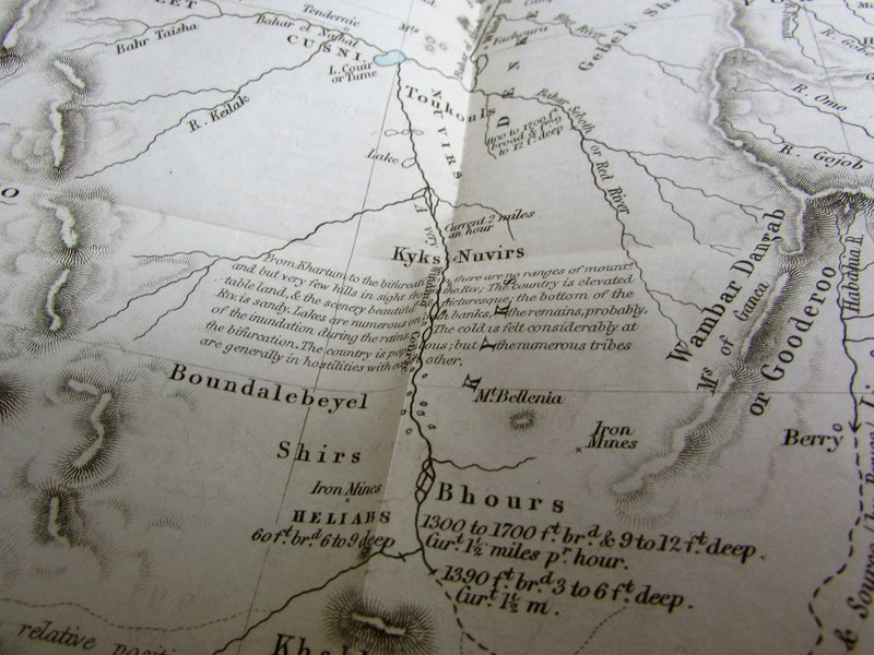
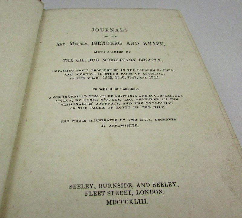
 Journals of the Rev. Messrs. Isenberg and Krapf, missionaries of the Church Missionary Society,
Detailing their proceedings in the Kingdom of Shoa, and Journeys in other parts of Abyssinia, in the years 1839, 1840, 1841 and 1842.
Journals of the Rev. Messrs. Isenberg and Krapf, missionaries of the Church Missionary Society,
Detailing their proceedings in the Kingdom of Shoa, and Journeys in other parts of Abyssinia, in the years 1839, 1840, 1841 and 1842.
Edition: First Edition
Book ID: 1920More details Price: £1,500.00 -
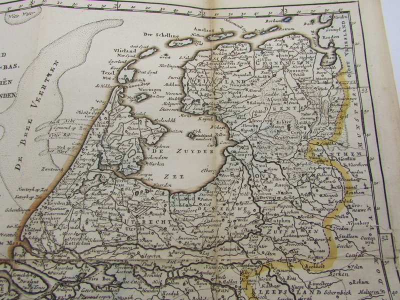
 Kaart van het gebied in het noorden van Nederland getroffen door de overstromingen in 1825.
Book ID: 2185More details Price: £120.00
Kaart van het gebied in het noorden van Nederland getroffen door de overstromingen in 1825.
Book ID: 2185More details Price: £120.00 -
 Kent
Kent
London: J. Cary, 1793. An engraved map of Kent, hand coloured in outline. The detail from Cary's atlas for Kent is visible and legible to the verso. Framed in a simple pale green mounting board. Protected by acid free plastic. John Cary worked from London as a mapmaker, engraver and publisher, towards the last quarter of the 18th century up to around 1830. His "New and Correct English Atlas", first published around 1776, was a benchmark in British topography. He used Copper plates for all his work, despite steel engraving becoming more common at this stage.
Condition: Very nice clean condition. There is fractional foxing to the edge of the written page (verso) the map itself is clean and tidy with the merest hint of darkening. A couple of tiny marks not affecting detail.
Book ID: 1279More details Price: £10.00 -
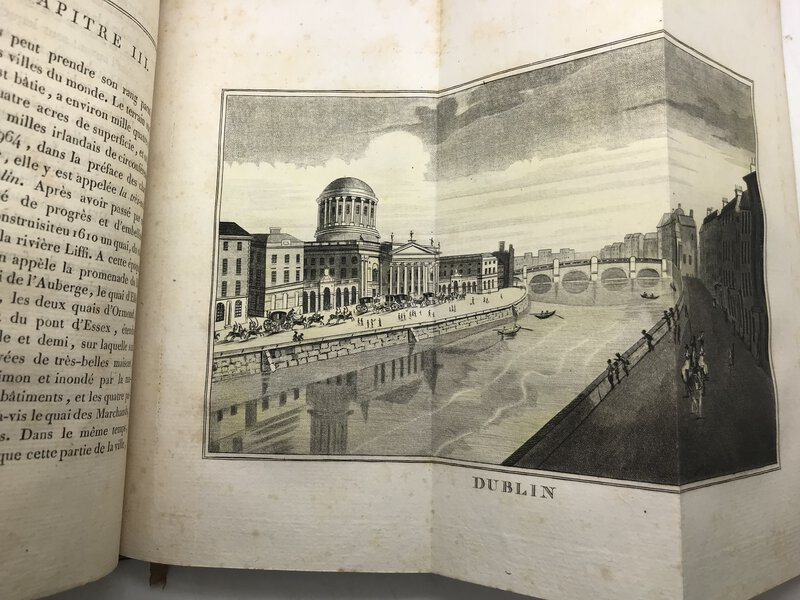
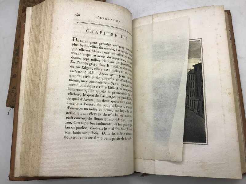
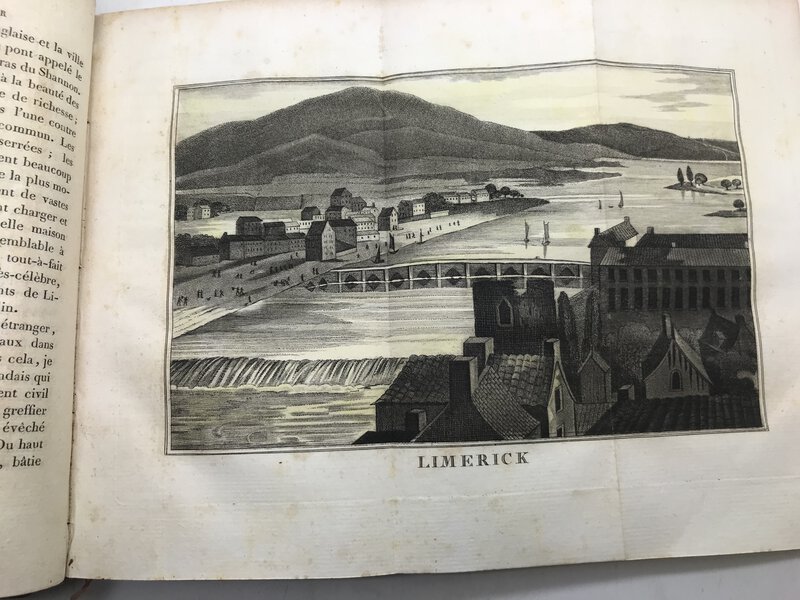
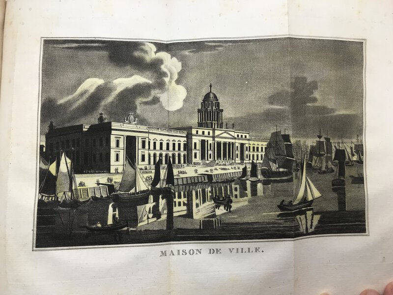
 L'Étranger en Irlande, ou voyage dans les parties méridionales et occidentales de cette isle, dans l'année 1805.
Book ID: 3304More details Price: £800.00
L'Étranger en Irlande, ou voyage dans les parties méridionales et occidentales de cette isle, dans l'année 1805.
Book ID: 3304More details Price: £800.00 -
 L'Irlande suivant les Nouvelles Observations de Messrs. de l' Academie Royale des Sciences, etc.
Book ID: 1784More details Price: £180.00
L'Irlande suivant les Nouvelles Observations de Messrs. de l' Academie Royale des Sciences, etc.
Book ID: 1784More details Price: £180.00 -
 La Flandre et l'Artois. Recueil de documents sur l'architecture civile. Epoque médiévale XVIe et XVIIIe siècle. Avec une introduction et des notices.
Book ID: 4119More details Price: £120.00
La Flandre et l'Artois. Recueil de documents sur l'architecture civile. Epoque médiévale XVIe et XVIIIe siècle. Avec une introduction et des notices.
Book ID: 4119More details Price: £120.00 -
 La Géographie Françoise contenant les Descriptions, les Cartes, et le Blason des Provinces de France.
Paris: Chez l'auteur, 1677. Scarce. Original full leather binding. Gilt decorations and title to spine. Marbled endpapers. Beautifully illustrated with a double-page engraved title and hand numbered double page table of contents. Contains 34 double-page engraved maps, mounted on tabs. Uncoloured. Boards are a little rubbed at edges, contents in very good condition. 165 x 110 mm (6½ x 4¼ inches).
. Rare. Reliure d'origine plein cuir. Décors dorés et titre au dos. Gardes marbrées. Magnifiquement illustré avec un titre gravé en double page et une table des matières en double page numérotée à la main. Contient 34 cartes gravées en double page, montées sur onglets. Incolore. Plats un peu frottés sur les bords, contenu en très bon état. 165 × 110 mm.
Book ID: 3856More details Price: £850.00 -
 La Suisse Illustrée.
Description et histoire de ses vingt-deux cantons. Ornée de jolies vues gravées sur acier, de costumes coloriés et d'une carte de la Suisse.
Book ID: 1848More details Price: £320.00
La Suisse Illustrée.
Description et histoire de ses vingt-deux cantons. Ornée de jolies vues gravées sur acier, de costumes coloriés et d'une carte de la Suisse.
Book ID: 1848More details Price: £320.00 -
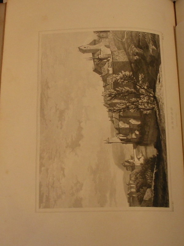
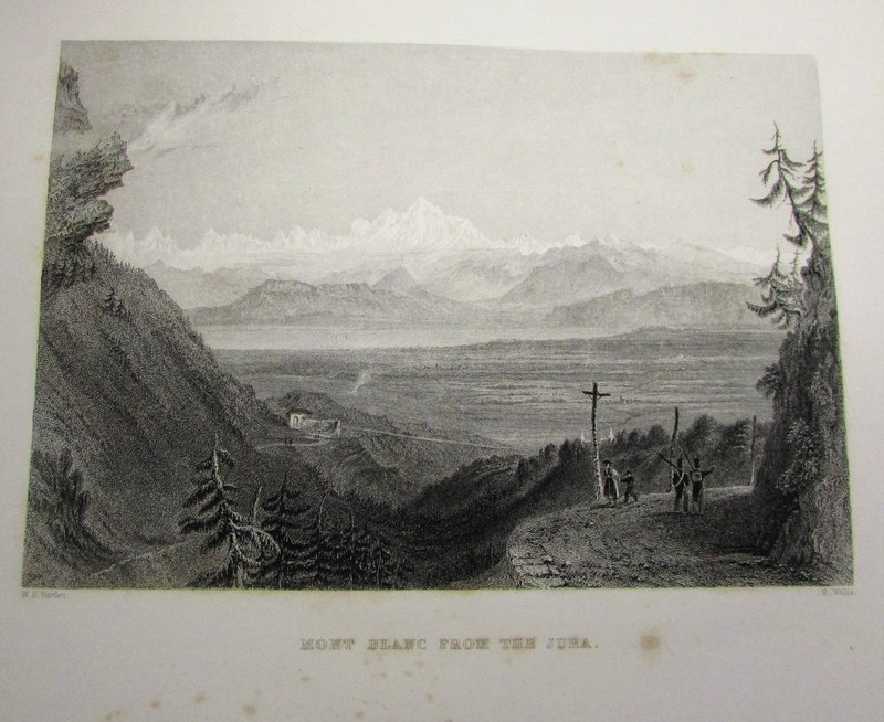
 La Suisse Pittoresque.
Ornée de vues dessinées spécialement pour cet ouvrage par W. H. Bartlett. esq.... Traduit de L'Anglais par L. De Bauclas.
Book ID: 1896More details Price: £400.00
La Suisse Pittoresque.
Ornée de vues dessinées spécialement pour cet ouvrage par W. H. Bartlett. esq.... Traduit de L'Anglais par L. De Bauclas.
Book ID: 1896More details Price: £400.00 -
 Le Charme de Venise. Illustrations en couleurs de Henri Cassiers
Book ID: 4254More details Price: £120.00
Le Charme de Venise. Illustrations en couleurs de Henri Cassiers
Book ID: 4254More details Price: £120.00 -
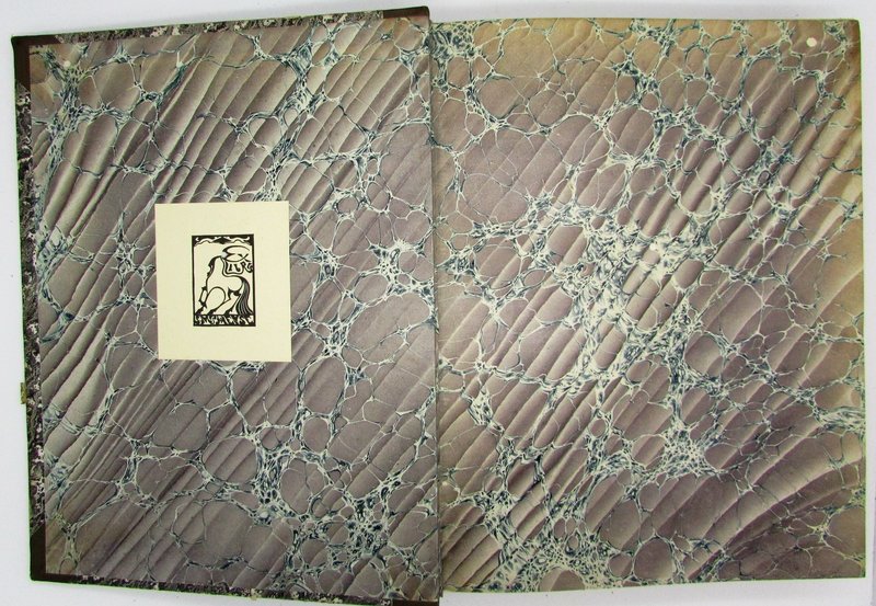
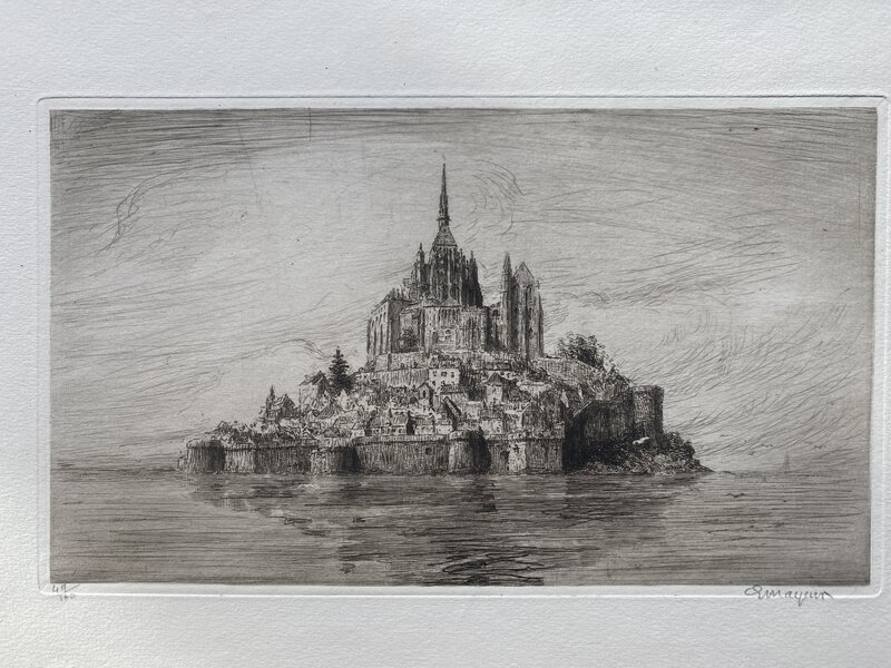
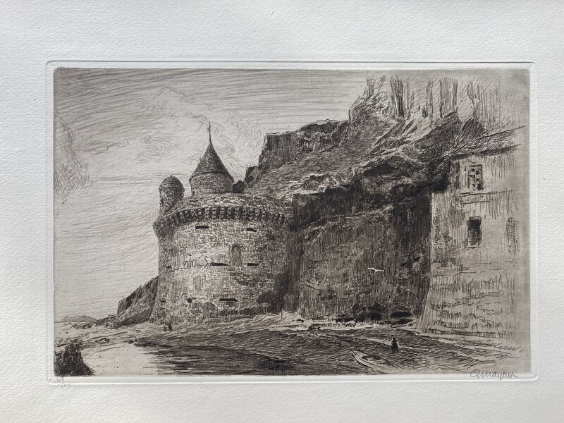
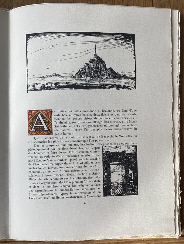
 Le Mont Saint-Michel et ses abords.
Dix eaux-fortes originales par Mayeur avec Introduction et bois originaux du même auteur
Book ID: 3164More details Price: £325.00
Le Mont Saint-Michel et ses abords.
Dix eaux-fortes originales par Mayeur avec Introduction et bois originaux du même auteur
Book ID: 3164More details Price: £325.00 -
 Les héros du désert: Moffat et Livingstone.
Rouen: Megard et Cie, 1881. First Edition. Part of the Bibliothèque Morale de La Jeunesse. Original dark green buckram with black embossed designs and gilt detail. A touch of handling to the binding only. Internally clean and tidy with just a little darkening to the pages. 224pp. Frontis of Livingstone. 250 by 170mm (9¾ by 6¾ inches). Première édition. Fait partie de la Bibliothèque Morale de La Jeunesse. Percaline vert foncé originale avec des motifs en relief noirs et des détails dorés. Une touche de manipulation à la reliure uniquement. Intérieurement propre et bien rangé avec juste un peu d'assombrissement des pages. 224pp. Frontis de Livingstone. 250 par 170mm
Book ID: 2406More details Price: £20.00 -
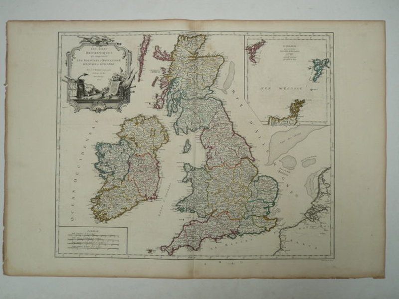
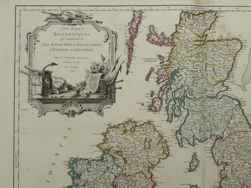
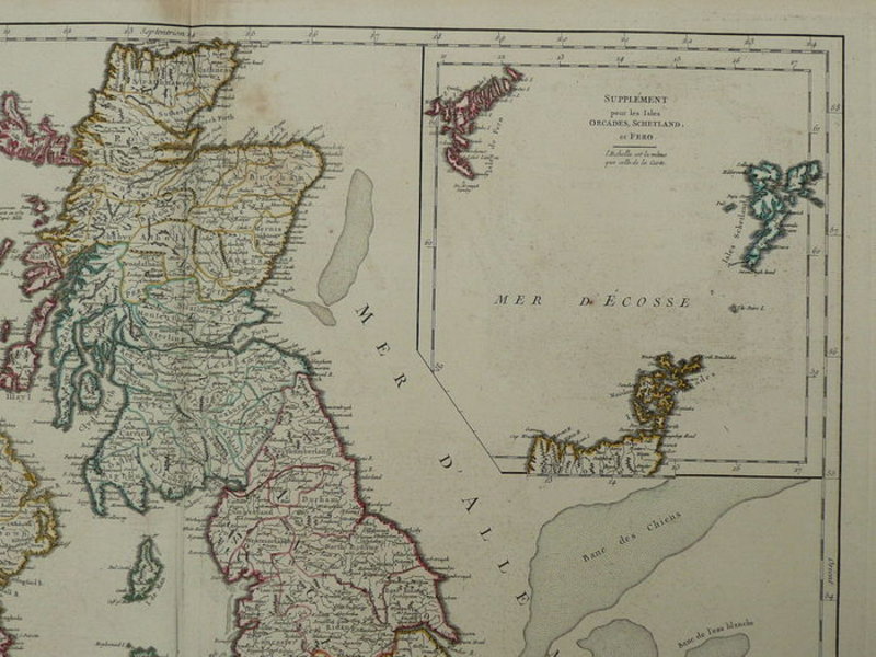
 Les Isles Britanniques.
Paris: Robert de Vaugondy, 1754. Large-folio map of England, Ireland and Scotland. Contemporary border coloured. Copper engraving appeared in "Atlas Universel" Very good. Centrefold as published. Small tears in the margins. Light stains. Printers fold top centre. Verso: blank with the indication Isles Britannique. 480 x 590 mm (19 x 23¼ inches). Carte à grand folio de l'Angleterre, de l'Irlande et de l'Écosse. Bordure contemporaine colorée. Gravure sur cuivre parue dans "Atlas Universel" Très bonne. Pli central tel que publié. Petites déchirures dans les marges. Taches légères. Les imprimantes se replient en haut au centre. Verso : vierge avec l'indication Isles Britanniques. 480 x 590 mm.
Book ID: 1787More details Price: £130.00 -
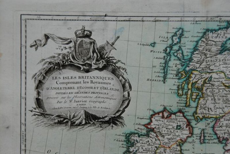
 Les Isles Britanniques Comprenant les Royaumes D'Angleterre, D'Ecosse et D'Irlande
Book ID: 1795More details Price: £55.00
Les Isles Britanniques Comprenant les Royaumes D'Angleterre, D'Ecosse et D'Irlande
Book ID: 1795More details Price: £55.00 -
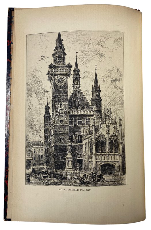
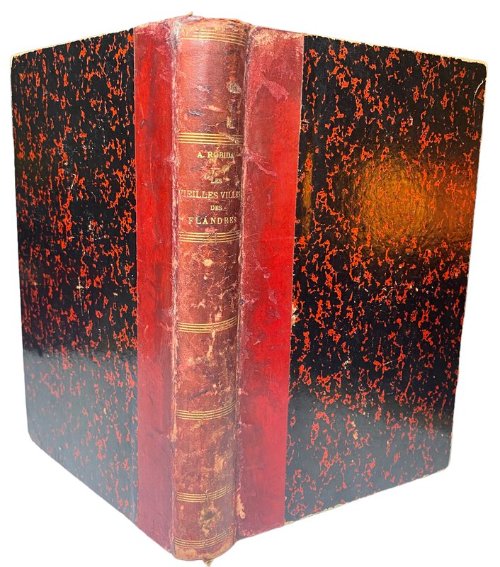
 Les vieilles villes de Flandres, Belgique et Flandre Française,
illustré par l'auteur de 155 compositions originales, dont 25 hors-texte et d'une eau-forte.
Book ID: 3741More details Price: £60.00
Les vieilles villes de Flandres, Belgique et Flandre Française,
illustré par l'auteur de 155 compositions originales, dont 25 hors-texte et d'une eau-forte.
Book ID: 3741More details Price: £60.00 -
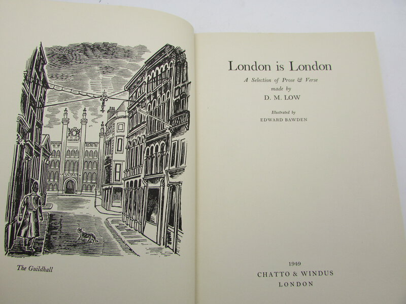
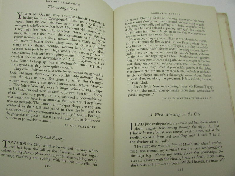
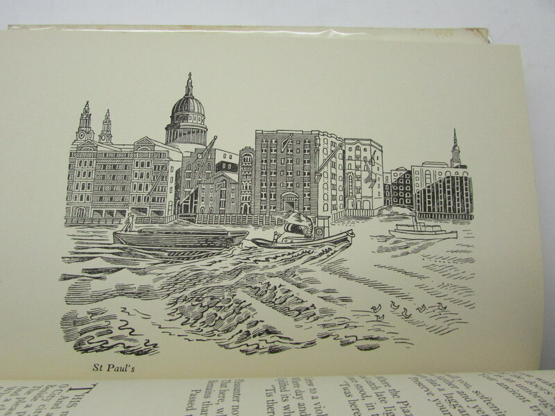
 London is London. A Selection of Prose and Verse. Illustrated by Edward Bawden.
London: Chatto & Windus, 1949. First edition. Dust wrapper. The wrapper has a couple of closed tears, and a chip to the head of the spine (about 1 cm). Blue cloth is clean. The book itself is in very good condition, with fractional foxing to the end papers and closed page edge only. Gift inscription to end paper. 300 pages. 210 x 140 mm (8¼ x 5½ inches).
Book ID: 2451More details Price: £60.00 -
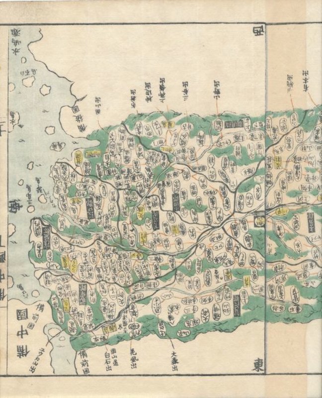
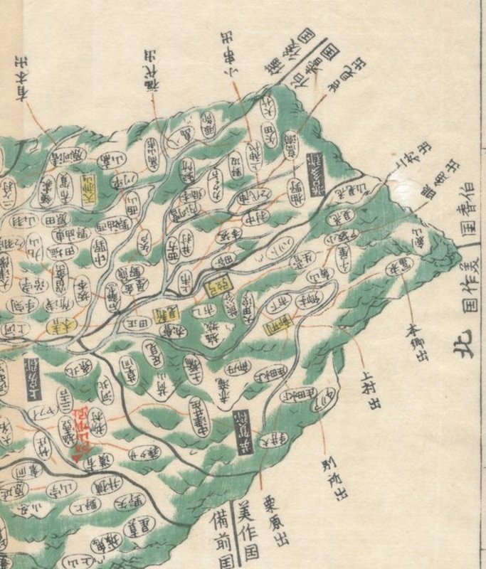
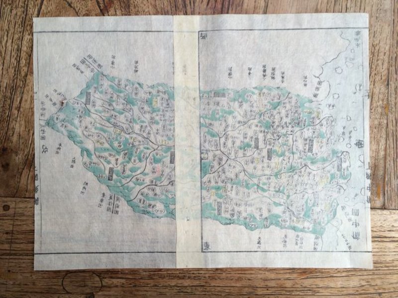
 Map of Bitchū (備中国, Bitchū no kuni), taken from Kokugun Zenzu / Atlas of Japan (De luxe version)
Book ID: 1767More details Price: £80.00
Map of Bitchū (備中国, Bitchū no kuni), taken from Kokugun Zenzu / Atlas of Japan (De luxe version)
Book ID: 1767More details Price: £80.00


![[îles du Pacifique] by BONNE, Rigobert](https://images.vialibri.net/production/20/1805-1---800.JPG?v=1531510859)
![Another image of [îles du Pacifique] by BONNE, Rigobert](https://images.vialibri.net/production/20/1805-2---800.JPG?v=1531510086)
![Another image of [îles du Pacifique] by BONNE, Rigobert](https://images.vialibri.net/production/20/1805-3---800.JPG?v=1531510203)
![Another image of [îles du Pacifique] by BONNE, Rigobert](https://images.vialibri.net/production/20/1805-4---800.JPG?v=1531510182)