- Category = British Topography,European Travel & Exploration,Maps & Atlases,Polar,Rest of the World,Travel Guides
-
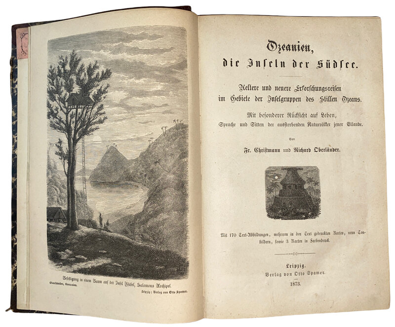
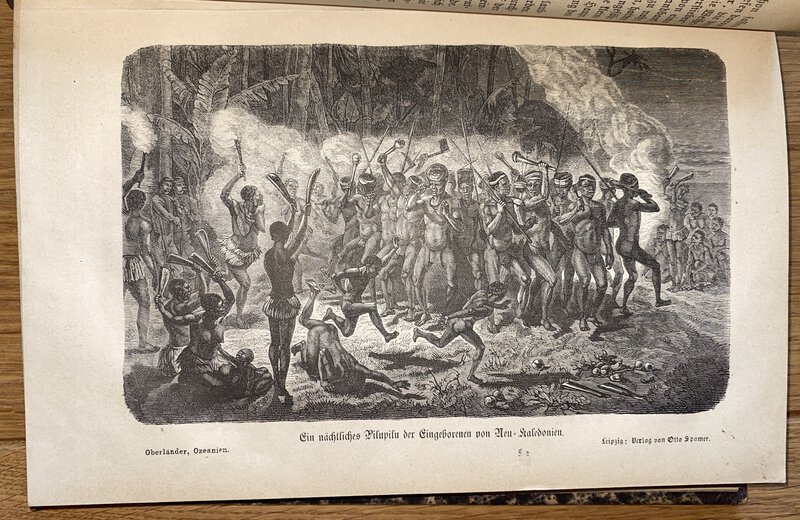
 Ozeanien, die Inseln der Südsee. Ältere und neuere Erforschungsreisen im Gebiet der Inselgruppen des Stillen Ozeans. Mit besonderer Rücksicht auf Leben, Sprache und Sitten der aussterbenden Naturvölker jener Eilande. Mit 170 Textabbildungen, mehreren in den Text gedruckten Karten
Ozeanien II: Die Inselwelt des Stillen Ozeans in Melanesiuen, Polynesien und Mikronesien.
Ozeanien, die Inseln der Südsee. Ältere und neuere Erforschungsreisen im Gebiet der Inselgruppen des Stillen Ozeans. Mit besonderer Rücksicht auf Leben, Sprache und Sitten der aussterbenden Naturvölker jener Eilande. Mit 170 Textabbildungen, mehreren in den Text gedruckten Karten
Ozeanien II: Die Inselwelt des Stillen Ozeans in Melanesiuen, Polynesien und Mikronesien.
Leipzig: Otto Spamer, 1873. Vol 2 only. Richly illustrated work on the Pacific islands. Half leather with marbled boards. Gilt titles to spine. Frontispiece, maps, views and numerous illustrations in the text on Hawaii. Binding in good, clean condition. Slight weakness to the rear hinge. Slight darkening to the pages. XXVI, VIII, 376 pp. 225 by 150mm (8¾ by 6 inches).
Book ID: 3260More details Price: £60.00 -
 Paris.
Book ID: 3207More details Price: £50.00
Paris.
Book ID: 3207More details Price: £50.00 -
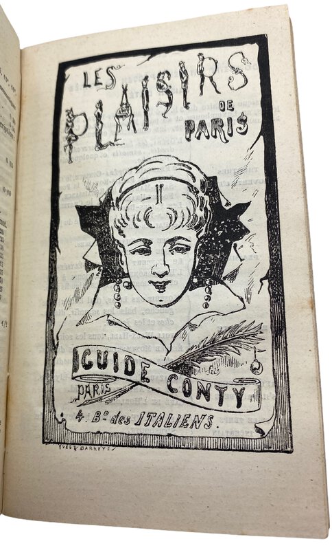
 Paris en Poche, Guide Pratique Conty.
Collection des guides Conty.
Book ID: 3202More details Price: £50.00
Paris en Poche, Guide Pratique Conty.
Collection des guides Conty.
Book ID: 3202More details Price: £50.00 -
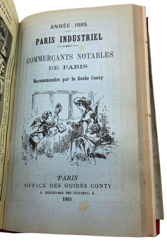
 Petit Atlas National des Départmens de la France et de ses Colonies.
100 cartes ornées de vues des monuments les plus remarquables, dressées par V. Monin, gravées sur acier par Alès Nouvelle Edition
Book ID: 3968More details Price: £275.00
Petit Atlas National des Départmens de la France et de ses Colonies.
100 cartes ornées de vues des monuments les plus remarquables, dressées par V. Monin, gravées sur acier par Alès Nouvelle Edition
Book ID: 3968More details Price: £275.00 -
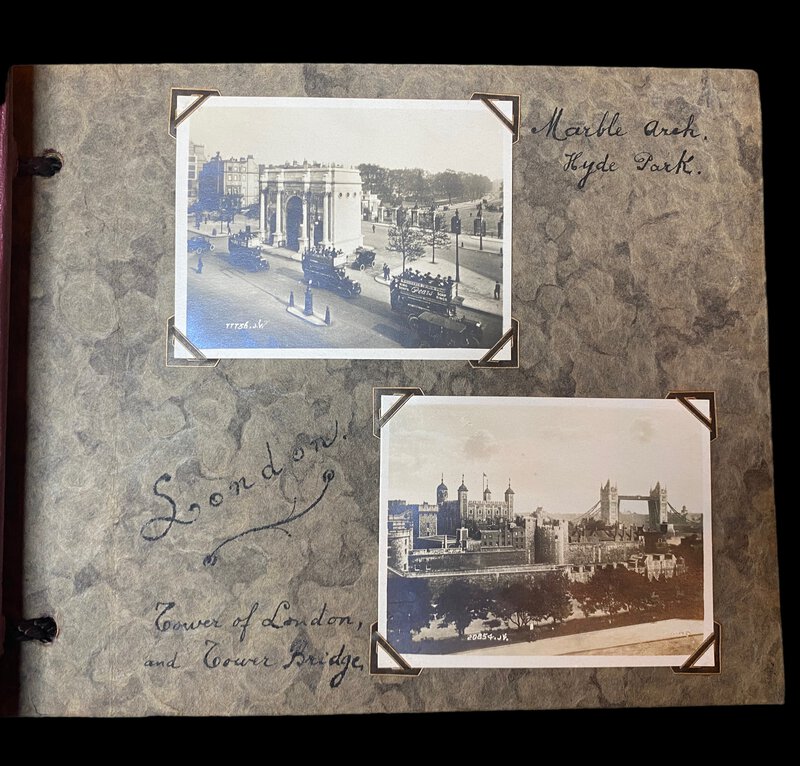
 Photograph Album of London.
Book ID: 3827More details Price: £90.00
Photograph Album of London.
Book ID: 3827More details Price: £90.00 -
![Photograph of the inside of the Mezquita de Córdoba by [ANON]](https://images.vialibri.net/production/20/3768-01---200.JPG?v=1674754848) Photograph of the inside of the Mezquita de Córdoba
Photograph of the inside of the Mezquita de Córdoba
Cordoba (Spain): NA, 1880. An attractive photograph of the pillars inside the Mezquita de Córdoba (The mosque). By an unknown photographer. Circa 1880-1890. Pasted onto a stiff grey mounting card, with calligraphic title beneath ("Del inre af Kathedralen i Cordova"). It bears the number 8 in the negative, so may be a tourist photograph. The photograph is in good condition with a couple of small nicks to the edges. The mounting card is in good clean condition. Dating from this period, it is difficult to distinguish between and albumen print and an early silver gelatin card mounted photograph. We lean towards the latter. Photograph size is 220mm x 280mm. The mount size is 345mm x 410mm.
Book ID: 3768More details Price: £80.00 -
![Photograph of the River & Bridge at Cordoba by [ANON]](https://images.vialibri.net/production/20/3744-01---200.jpg?v=1673876815) Photograph of the River & Bridge at Cordoba
Book ID: 3744More details Price: £80.00
Photograph of the River & Bridge at Cordoba
Book ID: 3744More details Price: £80.00 -
![Photograph of the Rock of Gibraltar by [ANON]](https://images.vialibri.net/production/20/3725-01---200.jpg?v=1673264996) Photograph of the Rock of Gibraltar
Photograph of the Rock of Gibraltar
NA. An attractive photograph of the rock of Gibraltar, by an unknown photographer. Circa 1880-1890. Pasted onto a stiff grey mounting card, with gilt border. The photograph is in good condition, with a slight marking to the top left corner of the sky. The mounting card is in good clean condition. Dating from this period, it is difficult to distinguish between and albumen print and an early silver gelatin card mounted photograph. We lean towards the latter. Photograph size is 160mm x 205mm. The mount size is 290mm x 370mm.
Book ID: 3725More details Price: £60.00 -
![Photograph of two gentleman by the Rock of Gibraltar by [ANON]](https://images.vialibri.net/production/20/3726-01---200.jpg?v=1673264987) Photograph of two gentleman by the Rock of Gibraltar
Book ID: 3726More details Price: £60.00
Photograph of two gentleman by the Rock of Gibraltar
Book ID: 3726More details Price: £60.00 -
 Picturesque China.
Architecture and Landscape. A Journey through twelve provinces.
Book ID: 2996More details Price: £300.00
Picturesque China.
Architecture and Landscape. A Journey through twelve provinces.
Book ID: 2996More details Price: £300.00 -
 Picturesque Views on the River Thames, from its source in Gloucestershire to the Nore; with Observations on the Public Buildings and other Works of Art in its Vicinity in Two Volumes
Book ID: 3850More details Price: £350.00
Picturesque Views on the River Thames, from its source in Gloucestershire to the Nore; with Observations on the Public Buildings and other Works of Art in its Vicinity in Two Volumes
Book ID: 3850More details Price: £350.00 -
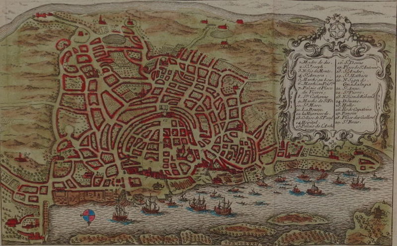
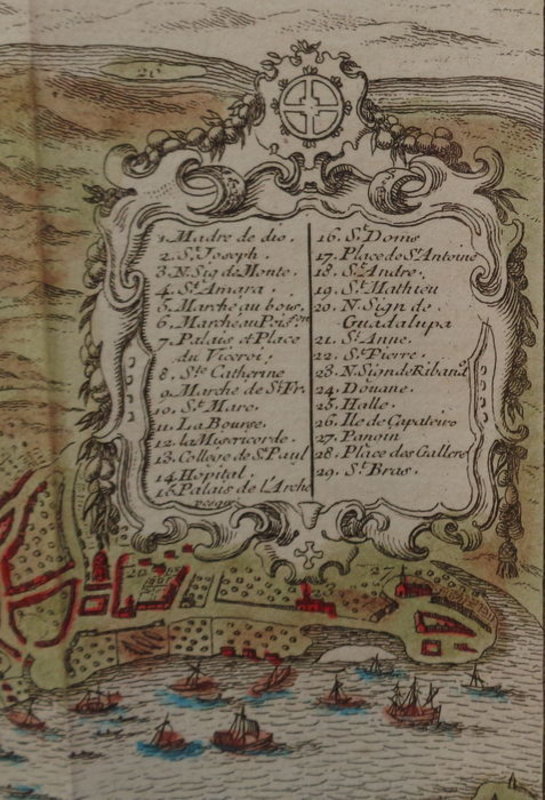
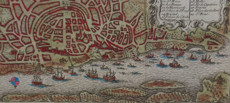
 Plan de Goa
Hand-coloured copper engraving of the Indian State of Goa.
Plan de Goa
Hand-coloured copper engraving of the Indian State of Goa.
1754. Hand-coloured map, of the Indian state Goa, by Jacques-Nicolas Bellin. Appeared in "Le Petit Atlas Maritime" by Jacques-Nicolas Bellin, 1754. Condition: good. Sufficient margins. Four vertical folds as published. Firm paper. Bright colours. A title cartouche with description on top right. Verso: blank. Dimensions: 11 x 17.8 cm (16.8 x 21.4 cm entire sheet) Carte coloriée à la main, de l'état indien de Goa, par Jacques-Nicolas Bellin. Paru dans "Le Petit Atlas Maritime" de Jacques-Nicolas Bellin, 1754. Etat : bon. Des marges suffisantes. Quatre plis verticaux tel que publié. Papier ferme. Couleurs vives. Un cartouche de titre avec description en haut à droite. Verso: vierge. Dimensions : 110 x 178 mm (1,8 x 214 mm feuille entière).
Book ID: 1800More details Price: £85.00 -
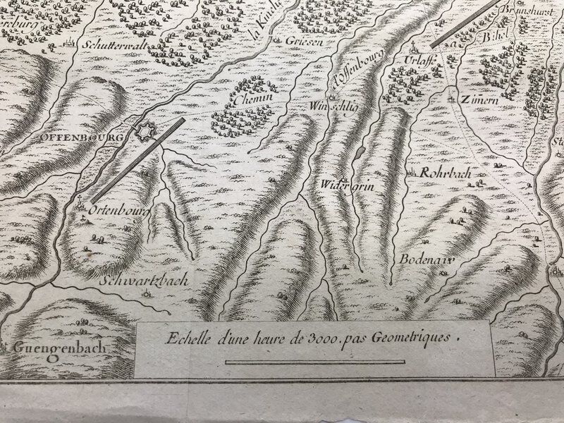
 Plan des Differens Camps du Vicomte de Turenne & du Comte Montecuculli,
dans l'Ortnaw; en l'Aneé 1675.
Book ID: 2755More details Price: £40.00
Plan des Differens Camps du Vicomte de Turenne & du Comte Montecuculli,
dans l'Ortnaw; en l'Aneé 1675.
Book ID: 2755More details Price: £40.00 -
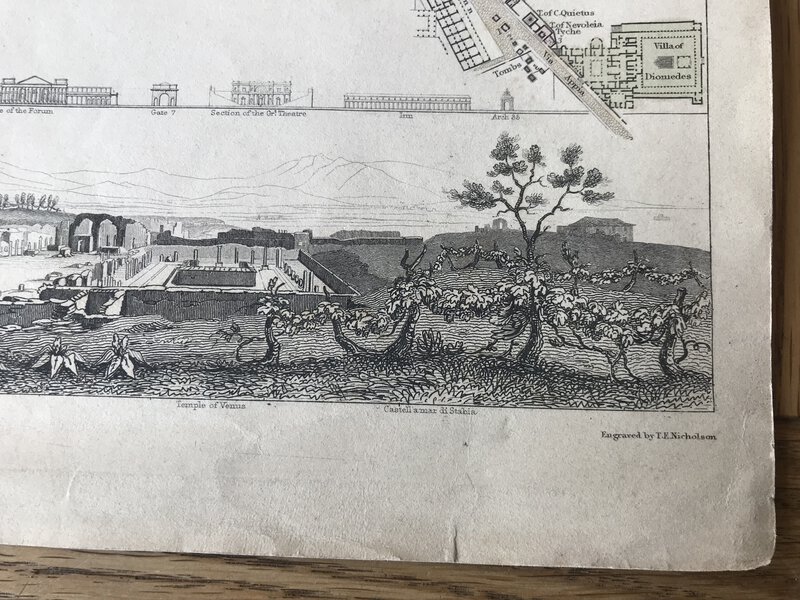
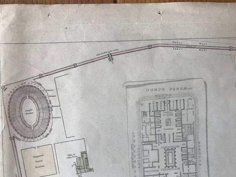
 Pompeii - engraved town map
Book ID: 3043More details Price: £60.00
Pompeii - engraved town map
Book ID: 3043More details Price: £60.00 -
![ponts et chaussées Commune de Ports, Département d' Indre Loire Service Hydraulique by [ANON]](https://images.vialibri.net/production/20/4056-01---200.jpg?v=1698138157) ponts et chaussées Commune de Ports, Département d' Indre Loire Service Hydraulique
Book ID: 4056More details Price: £120.00
ponts et chaussées Commune de Ports, Département d' Indre Loire Service Hydraulique
Book ID: 4056More details Price: £120.00 -
 Prince Arumugam, the Steadfast Indian Convert.
Translated from the German of A. v. B.
Prince Arumugam, the Steadfast Indian Convert.
Translated from the German of A. v. B.
Edition: First Edition
Freiburg im Breisgau: B. Herder, 1895. First edition. Original cloth-backed decorated boards. A title in the series: Tales of Foreign Lands. A Series of Illustrated Tales for the Young. Collected by the Rev. Jos. Spillmann. Illustrations by R. E. Kepler. A very good copy - A touch of darkening to the tan boards only. Pages are fractionally darkened only. pp. (vi). 86. 3 plates.
Book ID: 1078More details Price: £20.00 -
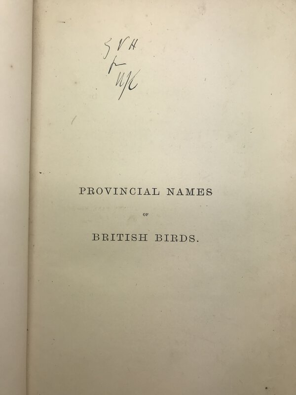
 Provincial Names and Folk Lore of British Birds.
London: Published by Trübner and Co. For The English Dialect Society, 1885. First edition, in half-leather hardback binding. With raised bands and gilt title to spine. Boards are quite rubbed, particularly to spine, and a damp stain to fore-edge of front board. Foxing to front free end paper. Neat initials to half title. Inside, one or two spots of foxing, but minimal. 243 pages. 235 x 155 mm (9¼ x 6 inches).
Book ID: 3019More details Price: £50.00 -
![Rade de Plimouth 1829. by [ANON]](https://images.vialibri.net/production/20/3342-1---200.jpg?v=1652176108) Rade de Plimouth 1829.
Original watercolour
Rade de Plimouth 1829.
Original watercolour
n/a, 1829. An attractive original watercolour of the beach and harbour at Plymouth, with title and date of 1829. By unknown French artist. Mounted on white card (somewhat darkened). The picture itself is in very good, bright condition. Held in a later (mid 20th century) wooden frame. Watercolour is 13.5cm x 9cm Frame is 22cm x 18cm. Une jolie aquarelle française de la plage et du port de Plymouth, avec titre et date de 1829. Montée sur carton blanc (un peu assombri). L'image elle-même est en très bon état lumineux. Tenu dans un cadre en bois plus tard (milieu du XXe siècle). L'aquarelle mesure 13,5 cm x 9 cm. Le cadre mesure 22 cm x 18 cm.
Book ID: 3342More details Price: £75.00 -
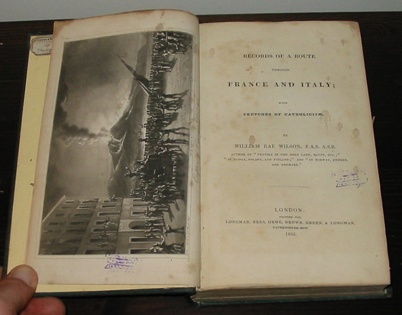
 Records of a Route Through France and Italy;
With Sketches of Catholicism.
Records of a Route Through France and Italy;
With Sketches of Catholicism.
Edition: First Edition
Book ID: 1157More details Price: £100.00 -
 Royaume d'Angleterre, Partie Méridionale.
Par M. Bonne, Ingenieur-Hydrographe de la Marine.
Book ID: 2312More details Price: £80.00
Royaume d'Angleterre, Partie Méridionale.
Par M. Bonne, Ingenieur-Hydrographe de la Marine.
Book ID: 2312More details Price: £80.00


![Photograph of the inside of the Mezquita de Córdoba by [ANON]](https://images.vialibri.net/production/20/3768-01---800.JPG?v=1674754848)
![Another image of Photograph of the inside of the Mezquita de Córdoba by [ANON]](https://images.vialibri.net/production/20/3768-02---800.jpg?v=1674754834)
![Another image of Photograph of the inside of the Mezquita de Córdoba by [ANON]](https://images.vialibri.net/production/20/3768-03---800.jpg?v=1674754835)
![Another image of Photograph of the inside of the Mezquita de Córdoba by [ANON]](https://images.vialibri.net/production/20/3768-04---800.JPG?v=1674754836)
![Photograph of the River & Bridge at Cordoba by [ANON]](https://images.vialibri.net/production/20/3744-01---800.jpg?v=1673876815)
![Another image of Photograph of the River & Bridge at Cordoba by [ANON]](https://images.vialibri.net/production/20/3744-02---800.JPG?v=1673876819)
![Another image of Photograph of the River & Bridge at Cordoba by [ANON]](https://images.vialibri.net/production/20/3744-03---800.JPG?v=1673876831)
![Another image of Photograph of the River & Bridge at Cordoba by [ANON]](https://images.vialibri.net/production/20/3744-04---800.JPG?v=1673876823)
![Photograph of the Rock of Gibraltar by [ANON]](https://images.vialibri.net/production/20/3725-01---800.jpg?v=1673264996)
![Another image of Photograph of the Rock of Gibraltar by [ANON]](https://images.vialibri.net/production/20/3725-02---800.jpg?v=1673264988)
![Another image of Photograph of the Rock of Gibraltar by [ANON]](https://images.vialibri.net/production/20/3725-03---800.JPG?v=1673264968)
![Photograph of two gentleman by the Rock of Gibraltar by [ANON]](https://images.vialibri.net/production/20/3726-01---800.jpg?v=1673264987)
![Another image of Photograph of two gentleman by the Rock of Gibraltar by [ANON]](https://images.vialibri.net/production/20/3726-02---800.jpg?v=1673264986)
![Another image of Photograph of two gentleman by the Rock of Gibraltar by [ANON]](https://images.vialibri.net/production/20/3726-03---800.jpg?v=1673264974)


![ponts et chaussées Commune de Ports, Département d' Indre Loire Service Hydraulique by [ANON]](https://images.vialibri.net/production/20/4056-01---800.jpg?v=1698138157)
![Another image of ponts et chaussées Commune de Ports, Département d' Indre Loire Service Hydraulique by [ANON]](https://images.vialibri.net/production/20/4056-02---800.jpg?v=1698138170)
![Another image of ponts et chaussées Commune de Ports, Département d' Indre Loire Service Hydraulique by [ANON]](https://images.vialibri.net/production/20/4056-03---800.jpg?v=1698138149)
![Another image of ponts et chaussées Commune de Ports, Département d' Indre Loire Service Hydraulique by [ANON]](https://images.vialibri.net/production/20/4056-04---800.jpg?v=1698138165)


![Rade de Plimouth 1829. by [ANON]](https://images.vialibri.net/production/20/3342-1---800.jpg?v=1652176108)
![Another image of Rade de Plimouth 1829. by [ANON]](https://images.vialibri.net/production/20/3342-2---800.jpg?v=1652176117)
![Another image of Rade de Plimouth 1829. by [ANON]](https://images.vialibri.net/production/20/3342-3---800.jpg?v=1652176116)