- Category = european travel & exploration
-
![Photograph of the Rock of Gibraltar by [ANON]](https://images.vialibri.net/production/20/3725-01---200.jpg?v=1673264996) Photograph of the Rock of Gibraltar
Photograph of the Rock of Gibraltar
NA. An attractive photograph of the rock of Gibraltar, by an unknown photographer. Circa 1880-1890. Pasted onto a stiff grey mounting card, with gilt border. The photograph is in good condition, with a slight marking to the top left corner of the sky. The mounting card is in good clean condition. Dating from this period, it is difficult to distinguish between and albumen print and an early silver gelatin card mounted photograph. We lean towards the latter. Photograph size is 160mm x 205mm. The mount size is 290mm x 370mm.
Book ID: 3725More details Price: £60.00 -
![Photograph of two gentleman by the Rock of Gibraltar by [ANON]](https://images.vialibri.net/production/20/3726-01---200.jpg?v=1673264987) Photograph of two gentleman by the Rock of Gibraltar
Book ID: 3726More details Price: £60.00
Photograph of two gentleman by the Rock of Gibraltar
Book ID: 3726More details Price: £60.00 -
 Picturesque Views on the River Thames, from its source in Gloucestershire to the Nore; with Observations on the Public Buildings and other Works of Art in its Vicinity in Two Volumes
Book ID: 3850More details Price: £350.00
Picturesque Views on the River Thames, from its source in Gloucestershire to the Nore; with Observations on the Public Buildings and other Works of Art in its Vicinity in Two Volumes
Book ID: 3850More details Price: £350.00 -
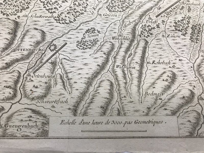
 Plan des Differens Camps du Vicomte de Turenne & du Comte Montecuculli,
dans l'Ortnaw; en l'Aneé 1675.
Book ID: 2755More details Price: £40.00
Plan des Differens Camps du Vicomte de Turenne & du Comte Montecuculli,
dans l'Ortnaw; en l'Aneé 1675.
Book ID: 2755More details Price: £40.00 -
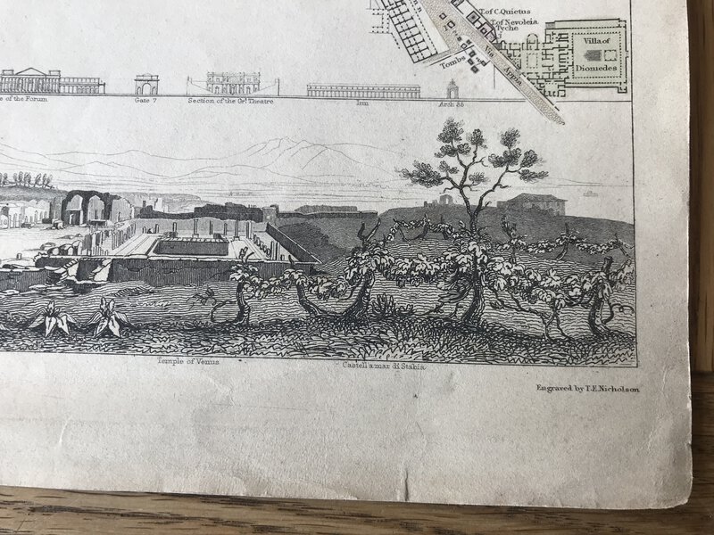
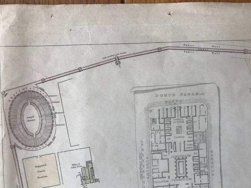
 Pompeii - engraved town map
Book ID: 3043More details Price: £60.00
Pompeii - engraved town map
Book ID: 3043More details Price: £60.00 -
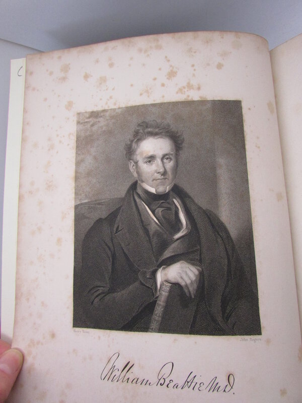
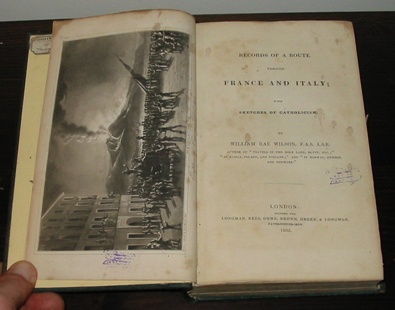
 Records of a Route Through France and Italy;
With Sketches of Catholicism.
Records of a Route Through France and Italy;
With Sketches of Catholicism.
Edition: First Edition
Book ID: 1157More details Price: £100.00 -
 South Wales
part of "A Set of Fifty New and Correct Maps of England and Wales"
South Wales
part of "A Set of Fifty New and Correct Maps of England and Wales"
Edition: First Edition
Book ID: 1277More details Price: £70.00 -
![Souvenir De Voyage 1895-1899. by [ANON]](https://images.vialibri.net/production/20/2916-1---200.jpg?v=1613638983) Souvenir De Voyage 1895-1899.
Book ID: 2916More details Price: £395.00
Souvenir De Voyage 1895-1899.
Book ID: 2916More details Price: £395.00 -
![Souvenirs des vues de la Bretagne. by [ANON]](https://images.vialibri.net/production/20/3201-01---200.jpg?v=1638098557) Souvenirs des vues de la Bretagne.
Book ID: 3201More details Price: £250.00
Souvenirs des vues de la Bretagne.
Book ID: 3201More details Price: £250.00 -
 Suede et Norvége et les principales routes a travers Le Danemark.
Book ID: 3351More details Price: £30.00
Suede et Norvége et les principales routes a travers Le Danemark.
Book ID: 3351More details Price: £30.00 -
 Tableau de la Grande-Bretagne, de L'Irlande et des possessions Angloises dans les quatre parties du monde
Book ID: 4052More details Price: £1,900.00
Tableau de la Grande-Bretagne, de L'Irlande et des possessions Angloises dans les quatre parties du monde
Book ID: 4052More details Price: £1,900.00 -
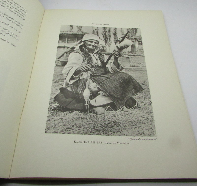
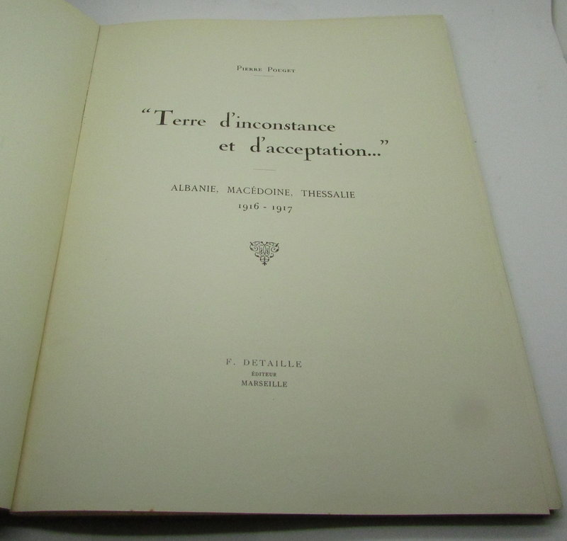
 Terre d'Inconstance et d'Acceptation. Albanie, Macédoine, Thessalie 1916-1917.
Book ID: 2267More details Price: £180.00
Terre d'Inconstance et d'Acceptation. Albanie, Macédoine, Thessalie 1916-1917.
Book ID: 2267More details Price: £180.00 -
![The Camera Series. Album of Views of Brighton. by [ANON]](https://images.vialibri.net/production/20/4110-01---200.jpg?v=1700771815) The Camera Series. Album of Views of Brighton.
The Camera Series. Album of Views of Brighton.
Liverpool: Brown & Rawcliffe, 1898. Red hardback boards, with gilt cover title. One continuous leaf of plates: b/w illustrations; folded concertina style. Many familiar Circa 1898. No date, but includes mention of the Old Chain Pier having been destroyed by fire in 1896. Boards a little darkened and back board has a bend / break in it. See photos. Contents clean but delicate on some folds. Loosely inserted contemporary advertisement. 220 x 305 mm (8¾ x 12 inches).
Book ID: 4110More details Price: £30.00 -
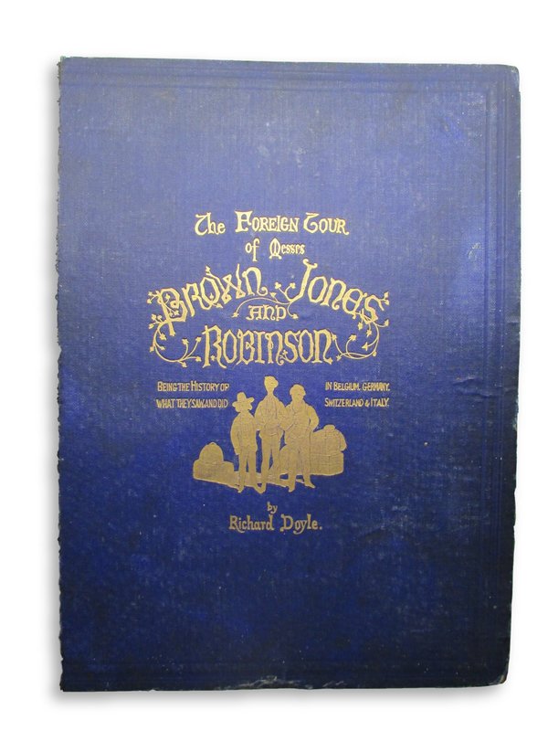
 The Foreign Tour of Messrs Brown, Jones and Robinson:
Being the History of What They Saw and Did In Belgium, Germany, Switzerland and Italy.
Book ID: 2288More details Price: £60.00
The Foreign Tour of Messrs Brown, Jones and Robinson:
Being the History of What They Saw and Did In Belgium, Germany, Switzerland and Italy.
Book ID: 2288More details Price: £60.00 -
 The Foreigner's Guide: Or, a necessary and instructive Companion. Both for the Foreigner and Native, in their Tour through the Cities of London and Westminster.
Le Guide des Étrangers: ou le Compagnon. Néccessaire & instructif à L'Étranger & au Naturel du Pays, En faisant le Tour des Villes des Londres, et de Westminster.
Book ID: 4019More details Price: £350.00
The Foreigner's Guide: Or, a necessary and instructive Companion. Both for the Foreigner and Native, in their Tour through the Cities of London and Westminster.
Le Guide des Étrangers: ou le Compagnon. Néccessaire & instructif à L'Étranger & au Naturel du Pays, En faisant le Tour des Villes des Londres, et de Westminster.
Book ID: 4019More details Price: £350.00 -
 The History of the City and State of Geneva, From Its First Foundation to This Present Time. Faithfully Collected From Several Manuscripts of Jacobus Gothofredus, Monsieur Chorier, and Others.
London: Bernard White, 1687. A lovely copy of this first edition. Original boards with restored spine (sympathetically re-backed with original label). Complete with 5 engraved illustrations - frontis, folding map, plan, plate and engraved plate in text. small ink annotations to end papers. A touch of darkening to the edges, and a touch of very light foxing but overall in excellent condition. (vi); 250; (vi) pp. 330 by 200mm (13 by 7¾ inches). See Wing S5017
Book ID: 3405More details Price: £550.00 -
 The Islands - Anglesey, Wight Vectis Olim, Garnesay & Iarsay.
Book ID: 1278More details Price: £150.00
The Islands - Anglesey, Wight Vectis Olim, Garnesay & Iarsay.
Book ID: 1278More details Price: £150.00 -
![The Spirit of Paris [Presentation Copy] by SOMMERVILLE, Frankfort](https://images.vialibri.net/production/20/2961-1---200.JPG?v=1617204460) The Spirit of Paris [Presentation Copy]
With twenty full-page illustrations in colour by Gustave Fraipont, Lucien Gautier, Raphael Kirchner, Maurice de Lambert, A Marcel-Clement, G Riom
Book ID: 2961More details Price: £40.00
The Spirit of Paris [Presentation Copy]
With twenty full-page illustrations in colour by Gustave Fraipont, Lucien Gautier, Raphael Kirchner, Maurice de Lambert, A Marcel-Clement, G Riom
Book ID: 2961More details Price: £40.00 -
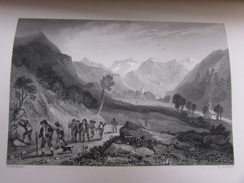
 The Waldenses, or Protestant Valleys of Piedmont, Dauphiny, and the Ban de la Roche.
Book ID: 2728More details Price: £380.00
The Waldenses, or Protestant Valleys of Piedmont, Dauphiny, and the Ban de la Roche.
Book ID: 2728More details Price: £380.00 -
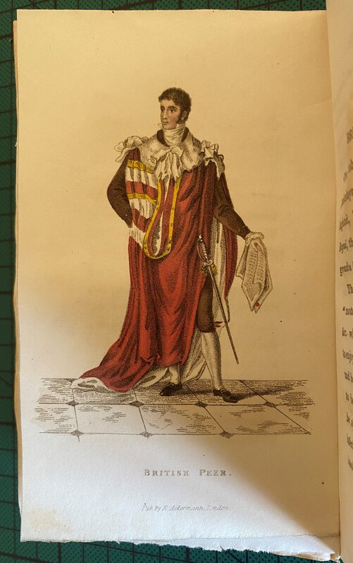
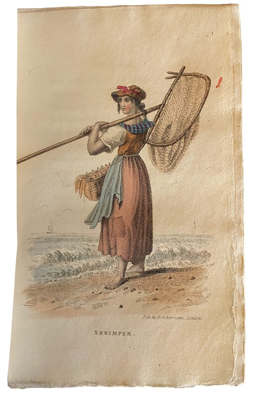
 The World in Miniature; England, Scotland, and Ireland;
Containing a description of the character, manners, customs, dress, diversions and other peculiarities of the inhabitants of Great Britain. In Four Volumes.
Book ID: 3841More details Price: £680.00
The World in Miniature; England, Scotland, and Ireland;
Containing a description of the character, manners, customs, dress, diversions and other peculiarities of the inhabitants of Great Britain. In Four Volumes.
Book ID: 3841More details Price: £680.00
![Photograph of the Rock of Gibraltar by [ANON]](https://images.vialibri.net/production/20/3725-01---800.jpg?v=1673264996)
![Another image of Photograph of the Rock of Gibraltar by [ANON]](https://images.vialibri.net/production/20/3725-02---800.jpg?v=1673264988)
![Another image of Photograph of the Rock of Gibraltar by [ANON]](https://images.vialibri.net/production/20/3725-03---800.JPG?v=1673264968)
![Photograph of two gentleman by the Rock of Gibraltar by [ANON]](https://images.vialibri.net/production/20/3726-01---800.jpg?v=1673264987)
![Another image of Photograph of two gentleman by the Rock of Gibraltar by [ANON]](https://images.vialibri.net/production/20/3726-02---800.jpg?v=1673264986)
![Another image of Photograph of two gentleman by the Rock of Gibraltar by [ANON]](https://images.vialibri.net/production/20/3726-03---800.jpg?v=1673264974)


![Souvenir De Voyage 1895-1899. by [ANON]](https://images.vialibri.net/production/20/2916-1---800.jpg?v=1613638983)
![Another image of Souvenir De Voyage 1895-1899. by [ANON]](https://images.vialibri.net/production/20/2916-2---800.jpg?v=1613638983)
![Another image of Souvenir De Voyage 1895-1899. by [ANON]](https://images.vialibri.net/production/20/2916-3---800.jpg?v=1613638994)
![Another image of Souvenir De Voyage 1895-1899. by [ANON]](https://images.vialibri.net/production/20/2916-4---800.jpg?v=1613638987)
![Another image of Souvenir De Voyage 1895-1899. by [ANON]](https://images.vialibri.net/production/20/2916-6---800.jpg?v=1613638986)
![Another image of Souvenir De Voyage 1895-1899. by [ANON]](https://images.vialibri.net/production/20/2916-7---800.jpg?v=1613639009)
![Another image of Souvenir De Voyage 1895-1899. by [ANON]](https://images.vialibri.net/production/20/2916-8---800.jpg?v=1613639011)
![Another image of Souvenir De Voyage 1895-1899. by [ANON]](https://images.vialibri.net/production/20/2916-9---800.jpg?v=1613638999)
![Another image of Souvenir De Voyage 1895-1899. by [ANON]](https://images.vialibri.net/production/20/2916-9a---800.jpg?v=1613638998)
![Another image of Souvenir De Voyage 1895-1899. by [ANON]](https://images.vialibri.net/production/20/2916-9b---800.jpg?v=1613639001)
![Another image of Souvenir De Voyage 1895-1899. by [ANON]](https://images.vialibri.net/production/20/2916-9c---800.jpg?v=1613639012)
![Another image of Souvenir De Voyage 1895-1899. by [ANON]](https://images.vialibri.net/production/20/2916-9d---800.jpg?v=1613638996)
![Another image of Souvenir De Voyage 1895-1899. by [ANON]](https://images.vialibri.net/production/20/2916-9e---800.jpg?v=1613639000)
![Another image of Souvenir De Voyage 1895-1899. by [ANON]](https://images.vialibri.net/production/20/2916-9f---800.jpg?v=1613638996)
![Another image of Souvenir De Voyage 1895-1899. by [ANON]](https://images.vialibri.net/production/20/2916-9g---800.jpg?v=1613639013)
![Another image of Souvenir De Voyage 1895-1899. by [ANON]](https://images.vialibri.net/production/20/2916-_5---800.jpg?v=1613638990)
![Souvenirs des vues de la Bretagne. by [ANON]](https://images.vialibri.net/production/20/3201-01---800.jpg?v=1638098557)
![Another image of Souvenirs des vues de la Bretagne. by [ANON]](https://images.vialibri.net/production/20/3201-02---800.jpg?v=1638098560)
![Another image of Souvenirs des vues de la Bretagne. by [ANON]](https://images.vialibri.net/production/20/3201-03---800.jpg?v=1638098555)
![Another image of Souvenirs des vues de la Bretagne. by [ANON]](https://images.vialibri.net/production/20/3201-04---800.jpg?v=1638098563)
![Another image of Souvenirs des vues de la Bretagne. by [ANON]](https://images.vialibri.net/production/20/3201-05---800.jpg?v=1638098562)
![Another image of Souvenirs des vues de la Bretagne. by [ANON]](https://images.vialibri.net/production/20/3201-06---800.jpg?v=1638098557)
![Another image of Souvenirs des vues de la Bretagne. by [ANON]](https://images.vialibri.net/production/20/3201-07---800.jpg?v=1638098560)


![The Camera Series. Album of Views of Brighton. by [ANON]](https://images.vialibri.net/production/20/4110-01---800.jpg?v=1700771815)
![Another image of The Camera Series. Album of Views of Brighton. by [ANON]](https://images.vialibri.net/production/20/4110-02---800.jpg?v=1700771794)
![Another image of The Camera Series. Album of Views of Brighton. by [ANON]](https://images.vialibri.net/production/20/4110-03---800.jpg?v=1700771809)
![Another image of The Camera Series. Album of Views of Brighton. by [ANON]](https://images.vialibri.net/production/20/4110-04---800.jpg?v=1700771801)
![Another image of The Camera Series. Album of Views of Brighton. by [ANON]](https://images.vialibri.net/production/20/4110-05---800.jpg?v=1700771812)
![Another image of The Camera Series. Album of Views of Brighton. by [ANON]](https://images.vialibri.net/production/20/4110-06---800.jpg?v=1700771808)
![Another image of The Camera Series. Album of Views of Brighton. by [ANON]](https://images.vialibri.net/production/20/4110-07---800.jpg?v=1700771807)


![The Spirit of Paris [Presentation Copy] by SOMMERVILLE, Frankfort](https://images.vialibri.net/production/20/2961-1---800.JPG?v=1617204460)
![Another image of The Spirit of Paris [Presentation Copy] by SOMMERVILLE, Frankfort](https://images.vialibri.net/production/20/2961-2---800.JPG?v=1617204476)
![Another image of The Spirit of Paris [Presentation Copy] by SOMMERVILLE, Frankfort](https://images.vialibri.net/production/20/2961-3---800.JPG?v=1617204467)
![Another image of The Spirit of Paris [Presentation Copy] by SOMMERVILLE, Frankfort](https://images.vialibri.net/production/20/2961-3a---800.JPG?v=1617204474)
![Another image of The Spirit of Paris [Presentation Copy] by SOMMERVILLE, Frankfort](https://images.vialibri.net/production/20/2961-3b---800.JPG?v=1617204474)
![Another image of The Spirit of Paris [Presentation Copy] by SOMMERVILLE, Frankfort](https://images.vialibri.net/production/20/2961-3c---800.JPG?v=1617204477)
![Another image of The Spirit of Paris [Presentation Copy] by SOMMERVILLE, Frankfort](https://images.vialibri.net/production/20/2961-3d---800.JPG?v=1617204477)
![Another image of The Spirit of Paris [Presentation Copy] by SOMMERVILLE, Frankfort](https://images.vialibri.net/production/20/2961-3e---800.JPG?v=1617204466)
![Another image of The Spirit of Paris [Presentation Copy] by SOMMERVILLE, Frankfort](https://images.vialibri.net/production/20/2961-4---800.JPG?v=1617204466)
![Another image of The Spirit of Paris [Presentation Copy] by SOMMERVILLE, Frankfort](https://images.vialibri.net/production/20/2961-4a---800.JPG?v=1617204473)
![Another image of The Spirit of Paris [Presentation Copy] by SOMMERVILLE, Frankfort](https://images.vialibri.net/production/20/2961-5---800.JPG?v=1617204474)
![Another image of The Spirit of Paris [Presentation Copy] by SOMMERVILLE, Frankfort](https://images.vialibri.net/production/20/2961-6---800.JPG?v=1617204479)
![Another image of The Spirit of Paris [Presentation Copy] by SOMMERVILLE, Frankfort](https://images.vialibri.net/production/20/2961-7---800.JPG?v=1617204472)
![Another image of The Spirit of Paris [Presentation Copy] by SOMMERVILLE, Frankfort](https://images.vialibri.net/production/20/2961-8---800.JPG?v=1617204466)
![Another image of The Spirit of Paris [Presentation Copy] by SOMMERVILLE, Frankfort](https://images.vialibri.net/production/20/2961-9---800.JPG?v=1617204469)
![Another image of The Spirit of Paris [Presentation Copy] by SOMMERVILLE, Frankfort](https://images.vialibri.net/production/20/2961-9a---800.JPG?v=1617204472)