- Category = British Topography,European Travel & Exploration,Maps & Atlases,Polar,Rest of the World,Travel Guides
-
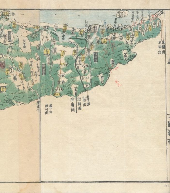
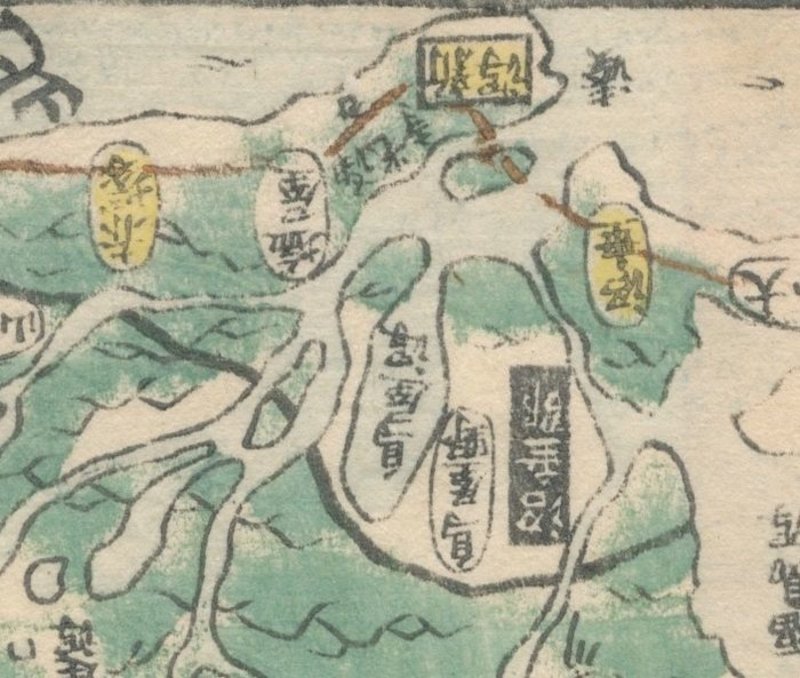
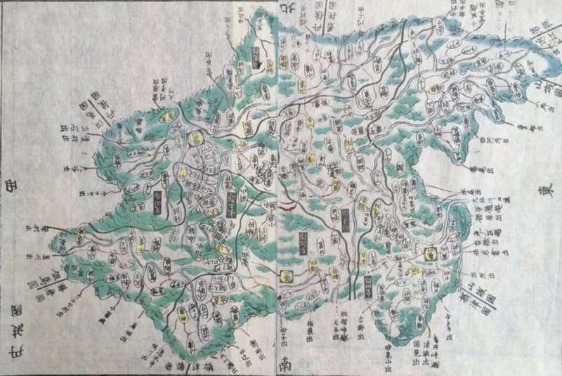
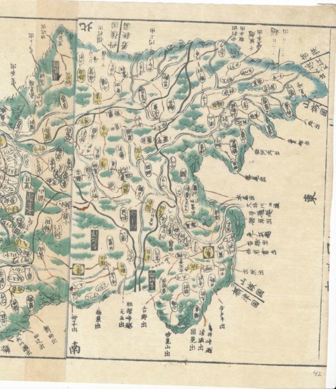
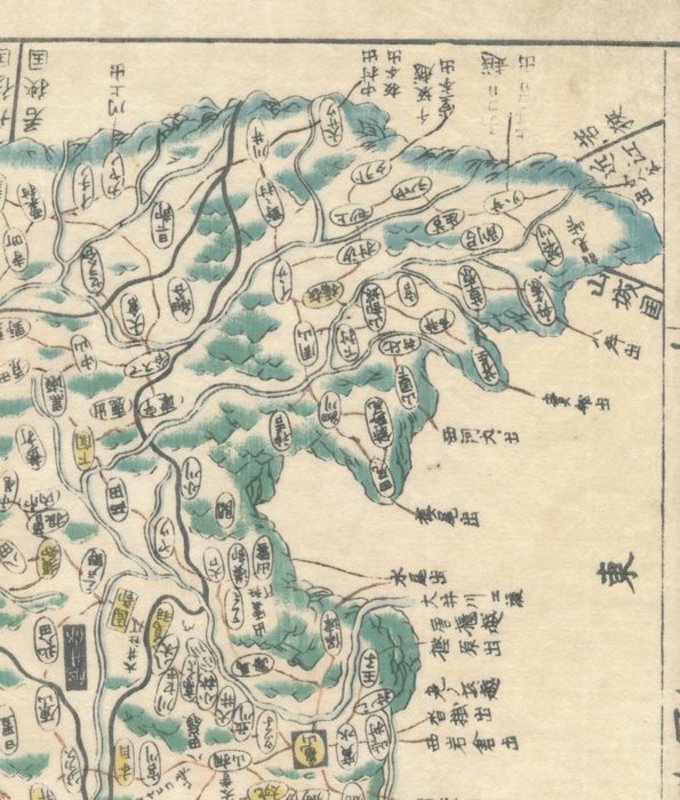
 Map of East Echigo (越後国, Echigo no kuni) , taken from Kokugun Zenzu / Atlas of Japan (De luxe version)
Book ID: 1742More details Price: £85.00
Map of East Echigo (越後国, Echigo no kuni) , taken from Kokugun Zenzu / Atlas of Japan (De luxe version)
Book ID: 1742More details Price: £85.00 -
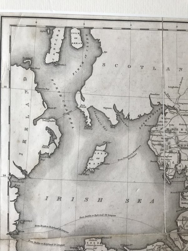
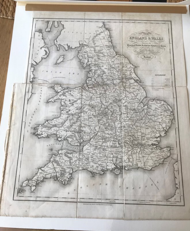
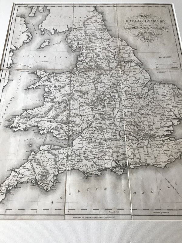
 Map of England & Wales Divided into Counties Shewing the Principal Roads, Railways, Canals & the Rivers as far as they are Navigable
London: S. Lewis and Co, 1848. Large folding map, now tipped on to card and behind cream passe-partout. From Lewis's "Atlas to the Topographical Dictionaries of England and Wales". In very good condition. Perfect for framing. 480 x 390 mm (19 x 15¼ inches).
Book ID: 3003More details Price: £40.00 -
 Map of Middlesex, from Britannia Depicta by Thomas Bowles.
Book ID: 2156More details Price: £50.00
Map of Middlesex, from Britannia Depicta by Thomas Bowles.
Book ID: 2156More details Price: £50.00 -
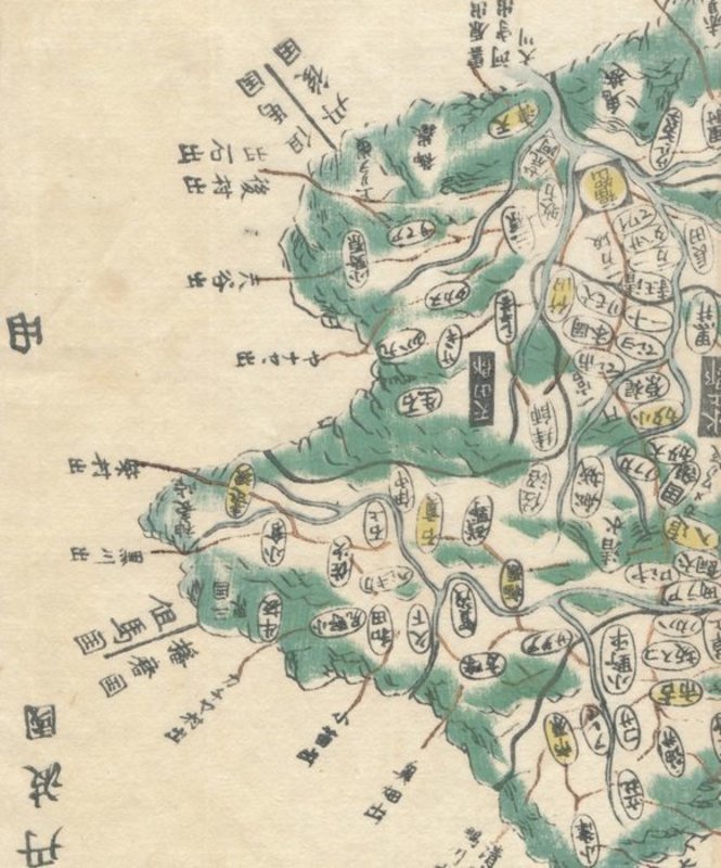
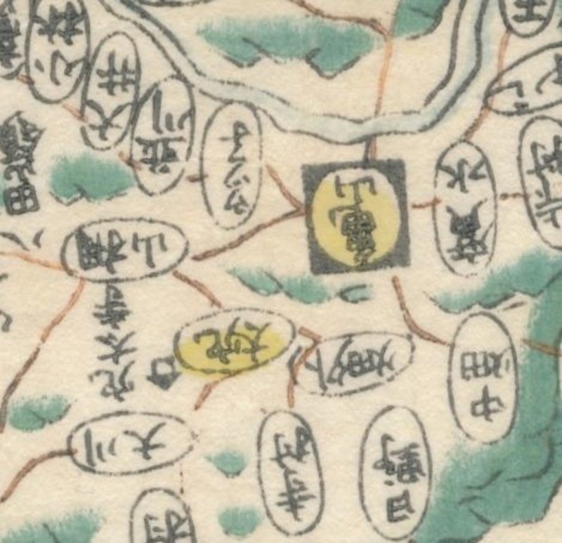
 Map of Settsu Province (摂津国, Settsu no kuni), taken from Kokugun Zenzu / Atlas of Japan (De luxe version)
Book ID: 1740More details Price: £85.00
Map of Settsu Province (摂津国, Settsu no kuni), taken from Kokugun Zenzu / Atlas of Japan (De luxe version)
Book ID: 1740More details Price: £85.00 -
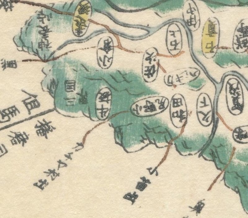
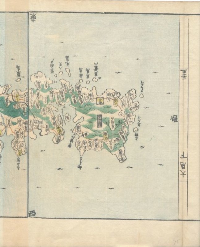
 Map of Tsushima (対馬国, Tsushima-no kuni), taken from Kokugun Zenzu / Atlas of Japan (De luxe version)
Book ID: 1761More details Price: £90.00
Map of Tsushima (対馬国, Tsushima-no kuni), taken from Kokugun Zenzu / Atlas of Japan (De luxe version)
Book ID: 1761More details Price: £90.00 -
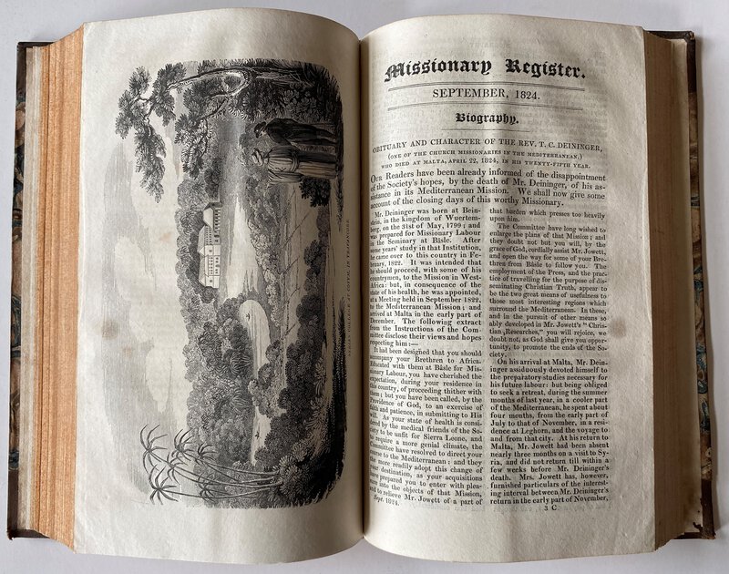
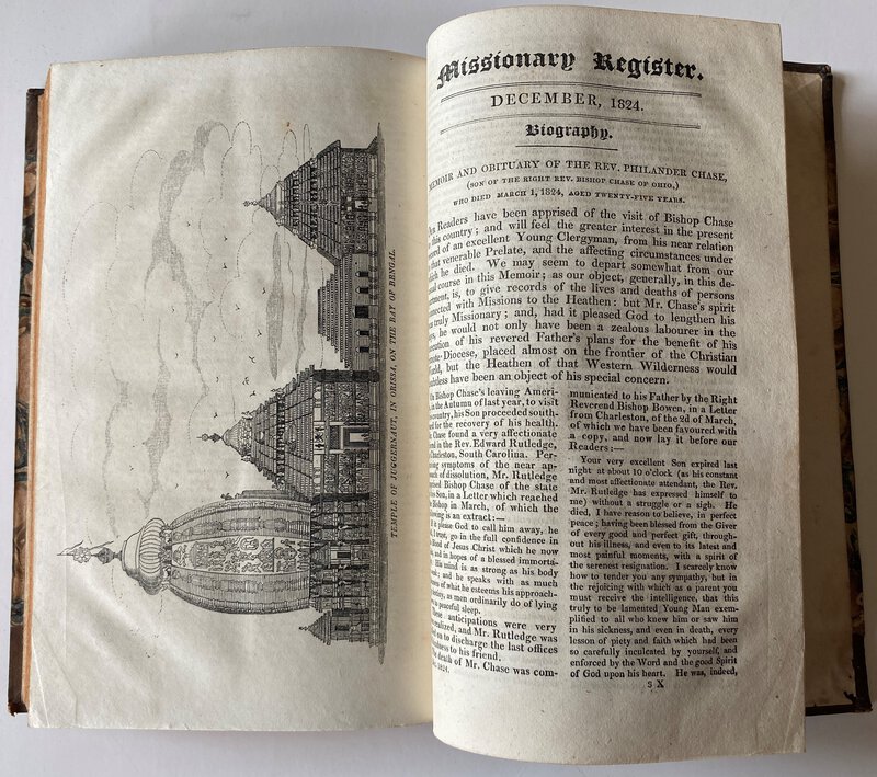
 Missionary Register.
Survey of the Protestant Missionary Stations throughout the world in their geographical order. Full Year 1824
Book ID: 3496More details Price: £100.00
Missionary Register.
Survey of the Protestant Missionary Stations throughout the world in their geographical order. Full Year 1824
Book ID: 3496More details Price: £100.00 -
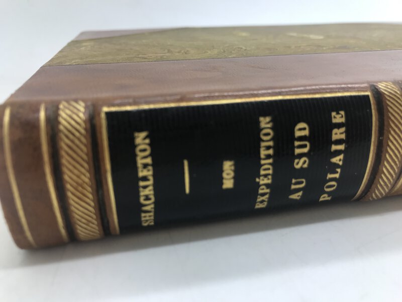
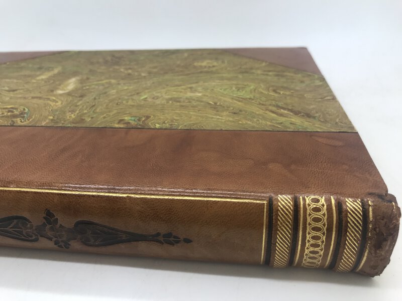
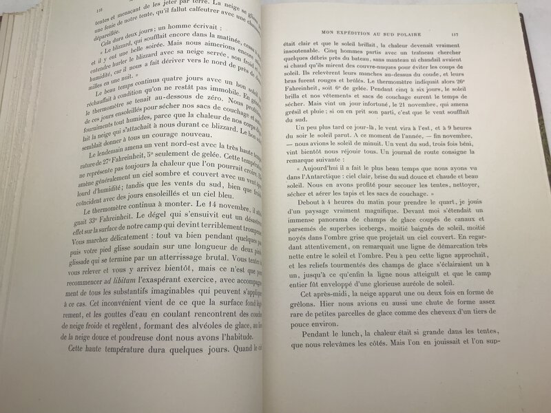
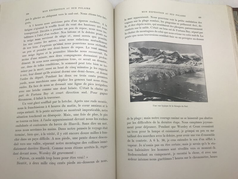
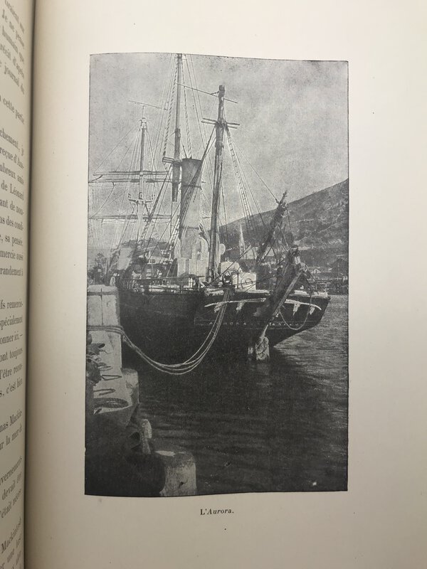
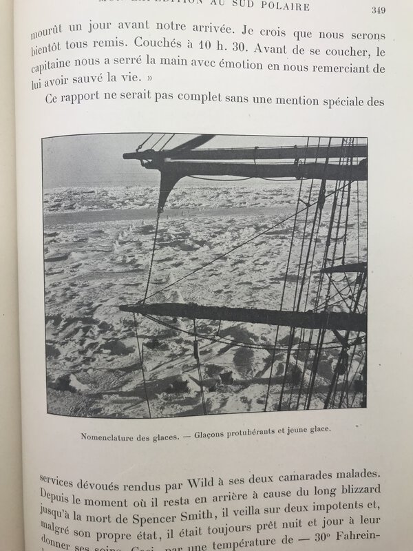
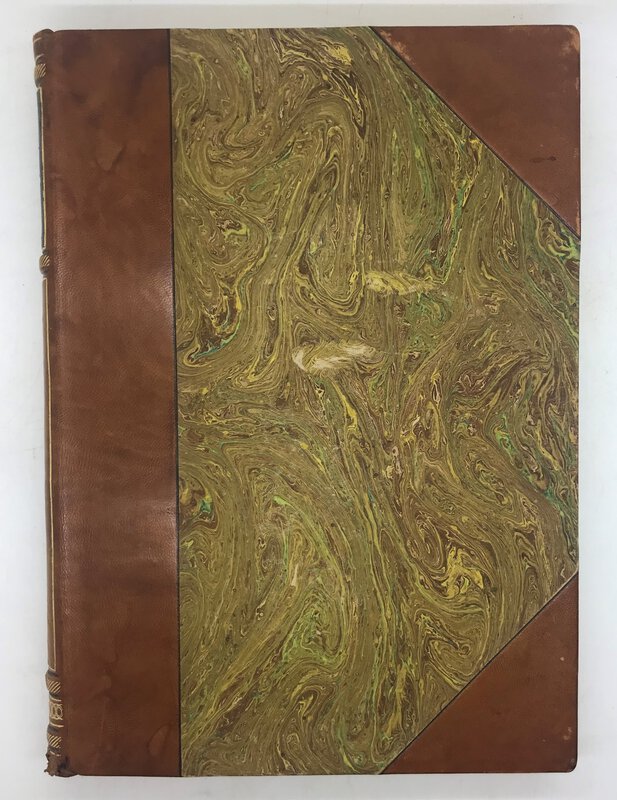
 Mon expédition au sud polaire, 1914-17.
Book ID: 3111More details Price: £30.00
Mon expédition au sud polaire, 1914-17.
Book ID: 3111More details Price: £30.00 -
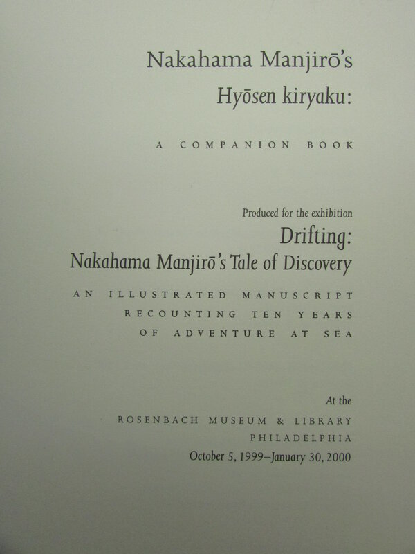
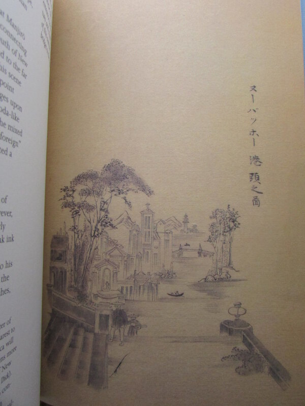
 Nakahama Manjirō's Hyōsen kiryaku.
A companion book to the exhibition 'Drifting: Nakahama Manjirō's Tale of Discovery'.
Book ID: 2583More details Price: £28.00
Nakahama Manjirō's Hyōsen kiryaku.
A companion book to the exhibition 'Drifting: Nakahama Manjirō's Tale of Discovery'.
Book ID: 2583More details Price: £28.00 -
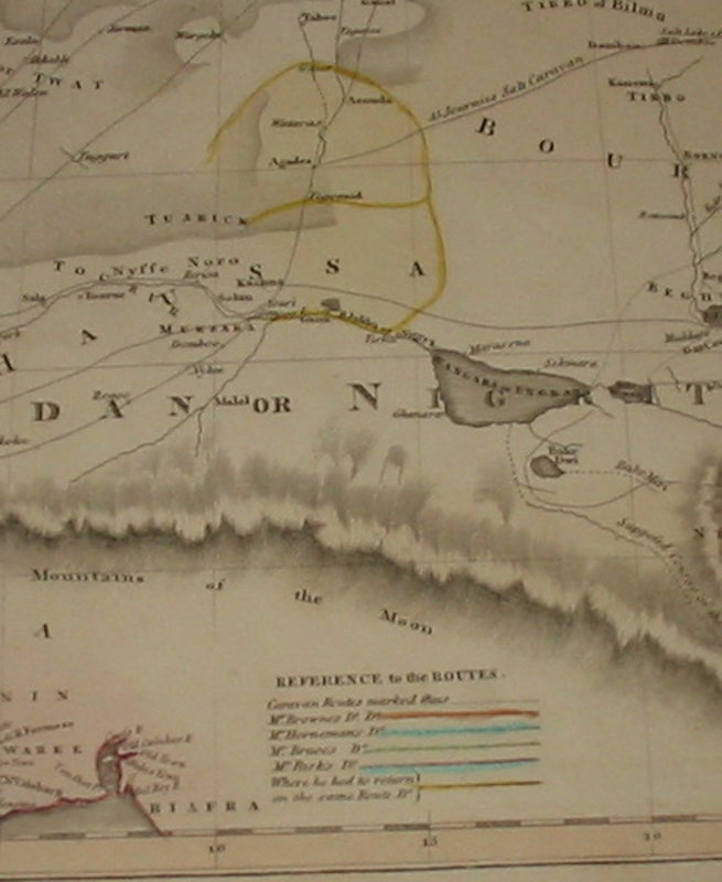
 New General Atlas
Map of North Africa showing the Routes of Explorers
New General Atlas
Map of North Africa showing the Routes of Explorers
Edinburgh: 1821. A hand coloured map, taken from Thomson's "New General Atlas". This shows North Africa (including the whole of the Sahara and West Africa). As well as the hand coloured detail, the map shows the routes of Mr Browne, Mr Horneman, Mr Bruce and Mr Parks. Originally this map was paired in a double page, folio atlas with a similar map for South Africa (not present). 280 x 515 mm (11 x 20¼ inches).
Condition: This map is in lovely condition. Clean and tidy with a little edgewear / nicking to the edges only (not affecting detail). The colour is clean and bright.
Book ID: 1533More details Price: £30.00 -
 New York. Comme je l'ai vu.
Book ID: 2700More details Price: £75.00
New York. Comme je l'ai vu.
Book ID: 2700More details Price: £75.00 -
 Nieuwe Kerk
from Beschryvinge van Amsterdam
Book ID: 4317More details Price: £125.00
Nieuwe Kerk
from Beschryvinge van Amsterdam
Book ID: 4317More details Price: £125.00 -
 Nitidissimae civitatis mechlineensis, in meditvillio Brabantiae sitae, exactis delineatio.
Panoramic view of Mechelen
Nitidissimae civitatis mechlineensis, in meditvillio Brabantiae sitae, exactis delineatio.
Panoramic view of Mechelen
Köln: G. von Kempen, 1572. Attractive panoramic city view (copper engraving) of the city of Mechelen (Machelen) removed from "Civitates Orbis Terrarum" Volume One. Nice contemporary hand colouring. Image area is 11.7cm x 47.5cm. Sheet is 14cm x 55cm. Two sheets attached to verso. To the rear of one sheet is half a page of text. Slightly dusty but very presentable copy, with bright colouring. Shows the tower and other significant landmarks. Countryside around and figures standing to the foreground.
Book ID: 4120More details Price: £250.00 -
 Nitidissimae civitatis mechlineensis, in meditvillio Brabantiae sitae, exactis delineatio.
Large map of Mechelen
Nitidissimae civitatis mechlineensis, in meditvillio Brabantiae sitae, exactis delineatio.
Large map of Mechelen
Köln: G. von Kempen, 1572. Single sheet. Attractive overhead city view / map (copper engraving) of the city of Mechelen (Machelen) removed from "Civitates Orbis Terrarum" Volume One. With the Royal coat of arms and the arms of Mechelen, as well as a title cartouche. Nice contemporary hand colouring. Image area is 33.5cm x 46cm. Sheet is 40cm x 54cm. Two sheets attached to verso. To the rear of one sheet is a page of text (with a historiated initial) about Mechelen. This is somewhat darkened and foxed. Slightly dusty but very presentable copy, with bright colouring. Shows the tower and other significant landmarks. Countryside around and figures standing to the foreground.
Book ID: 4121More details Price: £275.00 -
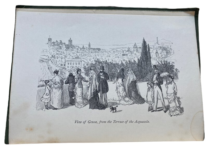
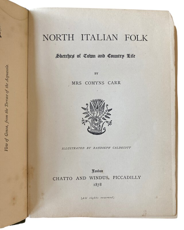
 North Italian Folk. Sketches of Town and Country Life.
London: Chatto and Windus, 1878. First Edition. Original green cloth with decoration blind stamped in black and gilt to the front board. gilt titles to the spine. A little rubbing and bumping to the boards. Owner's inscription to the front end paper. The rest of the book is in good condition, with a touch of darkening to the page edges only. xii, 282, [ii], 36 pages. Text in English. (Publisher's catalogue dated October 1877 to the rear of the book. 190 x145 mm (7½ x 5¾ inches).
Book ID: 3346More details Price: £30.00 -
 Nouvel Atlas illustré : La France et ses Colonies Cent-huit cartes.
Cent huit cartes dressées d'après les cartes du dépôt de la Guerre, des Ponts et Chaussées, de la Marine, des Travaux Publics, de l'Intérieur et des Eaux et Forêts par VUILLEMIN, THUILIER, Ch. LACOSTE, LORSIGNOL, géographes, membres de la société de géographie de Paris illustrées par M. FILLATREAU, gravées par MM. LECOCQ, LEBEL, BIZET, FONTAINE, WALTNER, F; DELANNOY, BARBIER, etc.
Book ID: 4156More details Price: £115.00
Nouvel Atlas illustré : La France et ses Colonies Cent-huit cartes.
Cent huit cartes dressées d'après les cartes du dépôt de la Guerre, des Ponts et Chaussées, de la Marine, des Travaux Publics, de l'Intérieur et des Eaux et Forêts par VUILLEMIN, THUILIER, Ch. LACOSTE, LORSIGNOL, géographes, membres de la société de géographie de Paris illustrées par M. FILLATREAU, gravées par MM. LECOCQ, LEBEL, BIZET, FONTAINE, WALTNER, F; DELANNOY, BARBIER, etc.
Book ID: 4156More details Price: £115.00 -
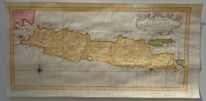
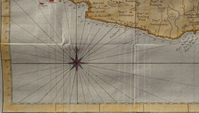
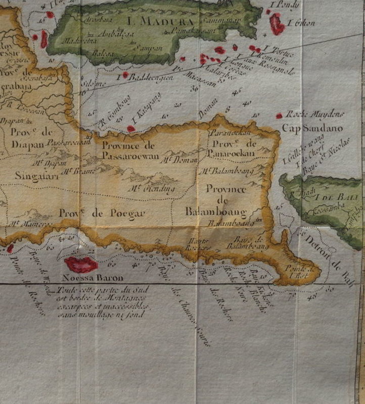
 Nouvelle Carte de L'Isle de Java.
Dressee suivant les observations les plus recentes faites par odre de la compage Holl des Indes Orientales Lieues d' Allemagne de 15 au Degre
Nouvelle Carte de L'Isle de Java.
Dressee suivant les observations les plus recentes faites par odre de la compage Holl des Indes Orientales Lieues d' Allemagne de 15 au Degre
Paris: 1754. A hand-coloured copper engraving of the Indonesian islands Java and Madeira with a small part of Sumatra and Bali. French. Verso: blank. Appeared in "Le Petit Atlas Maritime", by Jacques-Nicolas Bellin. Very good. Sufficient margins. Eight vertical and two horizontal folds as published. Bright colours. Firm paper. 202 x 433 mm (8 x 17 inches). Une gravure sur cuivre coloriée à la main des îles indonésiennes Java et Madère avec une petite partie de Sumatra et de Bali. Français. Verso : vierge. Paru dans "Le Petit Atlas Maritime", de Jacques-Nicolas Bellin. Très bien. Des marges suffisantes. Huit plis verticaux et deux plis horizontaux tels que publiés. Couleurs vives. Papier ferme. 202 x 433 mm.
Book ID: 1773More details Price: £180.00 -
 Nouvelle géographie et statistique de la France, Alger et la Belgique. Suivie d'un Traité sur le Monde entier. Ornée de 90 cartes et approuvée de l'Université.
Chatellerault: Lithographié chez l'auteur par A. Clement, 1835. Original edition. In publisher's hardback binding. Contains 89 maps: a map of France, a map of each French department (86), a map of Algiers, and a map of Belgium. Lacks the double page world map, otherwise complete - hence the price. 400 x 275 mm (15¾ x 10¾ inches).
. Édition originale. Reliure cartonnée de l'éditeur. Contient 89 cartes: une carte de France, une carte par département français (86), une carte d'Alger, une carte de Belgique. Il manque la carte du monde à double page, autrement complet - d'où le prix. 400 x 275 mm.
Book ID: 3994More details Price: £350.00 -
![Nürnberg. by [ANON]](https://images.vialibri.net/production/20/3438-1---200.JPG?v=1657644154) Nürnberg.
10 Original Kupfertiefdrucke auf Büttenkarton
Nürnberg.
10 Original Kupfertiefdrucke auf Büttenkarton
Kassel: Bruno Hausmann, 1934. First Edition. Ten original intaglio prints on laid paper. Original cardboard softback landscape format, with cord binding. 180 x 240 mm (7 x 9½ inches).
Book ID: 3438More details Price: £30.00 -
 Ooster Kerk
from Beschryvinge van Amsterdam
Book ID: 4315More details Price: £125.00
Ooster Kerk
from Beschryvinge van Amsterdam
Book ID: 4315More details Price: £125.00 -
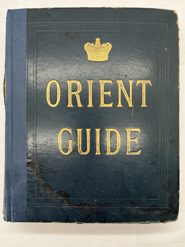
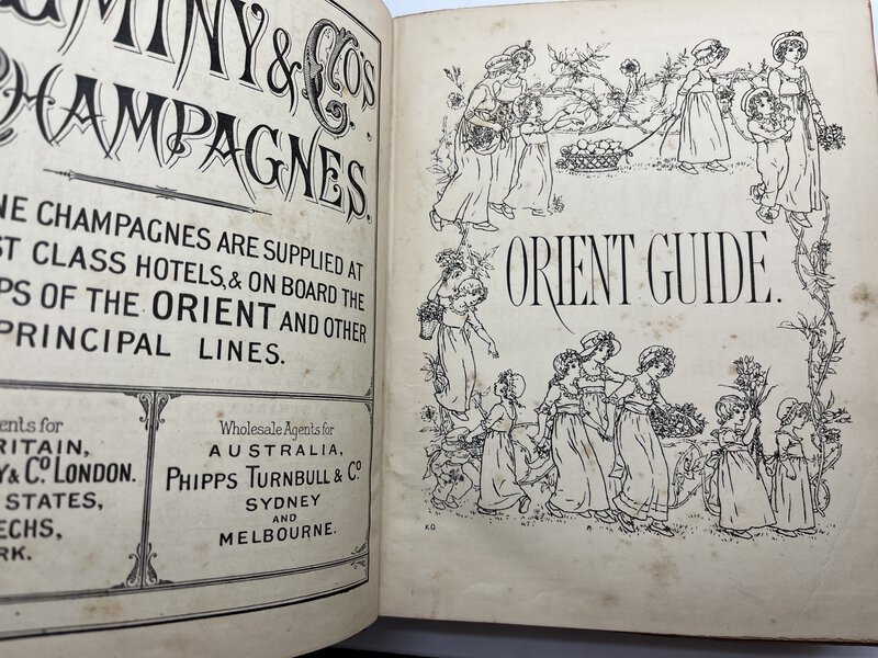
 Orient Line Guide. Chapters for Travellers by Sea and by Land.
Illustrated. The Fourth Edition, revised, with maps and plans.
Orient Line Guide. Chapters for Travellers by Sea and by Land.
Illustrated. The Fourth Edition, revised, with maps and plans.
London: Sampson Low, Marston, Searle & Rivington Ltd, 1891. Publisher's blue hardback boards with gilt title to front and cloth spine. Information for passengers, illustrations of ships, charts, maps and ship plans etc. some fold-out. Boards slightly damp stained and bumped. Sporadic foxing. Overall good condition. XL, 439 pp. including interesting b/w advertisements of the time. 215 x 175 mm (8½ x 7 inches).
The Orient Line was formed in the late 18th century, and by the middle of the 19th century was sailing its steamships all over the world. This guide predates its association with (and eventual absorption by) the Peninsular & Oriental Steam Navigation Company; or P&O.
Book ID: 3610More details Price: £95.00


![Nürnberg. by [ANON]](https://images.vialibri.net/production/20/3438-1---800.JPG?v=1657644154)
![Another image of Nürnberg. by [ANON]](https://images.vialibri.net/production/20/3438-2---800.JPG?v=1657644155)
![Another image of Nürnberg. by [ANON]](https://images.vialibri.net/production/20/3438-3---800.JPG?v=1657644166)
![Another image of Nürnberg. by [ANON]](https://images.vialibri.net/production/20/3438-4---800.JPG?v=1657644150)
![Another image of Nürnberg. by [ANON]](https://images.vialibri.net/production/20/3438-5---800.JPG?v=1657644166)
![Another image of Nürnberg. by [ANON]](https://images.vialibri.net/production/20/3438-6---800.JPG?v=1657644160)