-
 Manifeste des Peintres Futuristes (1910)
containing all thirteen complete statements of the movement.
Book ID: 4106More details Price: £175.00
Manifeste des Peintres Futuristes (1910)
containing all thirteen complete statements of the movement.
Book ID: 4106More details Price: £175.00 -
 Manners and Customs of ye Englyshe, Drawn from ye Quick by Rychard Doyle. To which be added some extracts from Mr. Pips hys Diary. Contrybuted by Percival Leigh.
London: Bradbury & Evans, 1849. First Edition. Publisher's hardback boards, three quarter red morocco with blue paper covered boards. Gilt title to front and spine. With forty full-page b/w illustrations. Boards are quite rubbed. Clean and unmarked inside. Unpaginated, but complete. 220 x 290 mm (8¾ x 11½ inches).
Book ID: 4023More details Price: £60.00 -
![Manuale Casua Conscientiae - a Manuscript in Latin describing the Roman Catholic Ritual of Mass and The Sacraments. by [ANON]](https://images.vialibri.net/production/20/2260-1---200.jpeg?v=1559469110) Manuale Casua Conscientiae - a Manuscript in Latin describing the Roman Catholic Ritual of Mass and The Sacraments.
Book ID: 2260More details Price: £200.00
Manuale Casua Conscientiae - a Manuscript in Latin describing the Roman Catholic Ritual of Mass and The Sacraments.
Book ID: 2260More details Price: £200.00 -
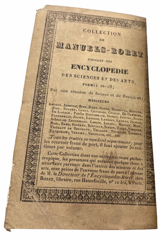
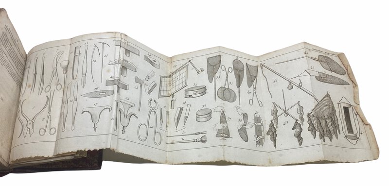
 Manuels-Roret. Nouveau manuel pour le Naturaliste Préparatoire.
l'art d'empailler les animaux, de conserve les vegetaux et les mineraux, de preparer les pieces d'anatomie normale et pathologique; suivud un tratie des embaumens.
Book ID: 3134More details Price: £120.00
Manuels-Roret. Nouveau manuel pour le Naturaliste Préparatoire.
l'art d'empailler les animaux, de conserve les vegetaux et les mineraux, de preparer les pieces d'anatomie normale et pathologique; suivud un tratie des embaumens.
Book ID: 3134More details Price: £120.00 -
![Manufacture Française d'Armes & Cycles de Saint-Étienne (Loire). by [VARIOUS]](https://images.vialibri.net/production/20/2655-1---200.JPG?v=1593957464) Manufacture Française d'Armes & Cycles de Saint-Étienne (Loire).
Armes - Munitions, Accessoires de Chasse.
Book ID: 2655More details Price: £60.00
Manufacture Française d'Armes & Cycles de Saint-Étienne (Loire).
Armes - Munitions, Accessoires de Chasse.
Book ID: 2655More details Price: £60.00 -
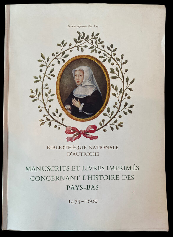
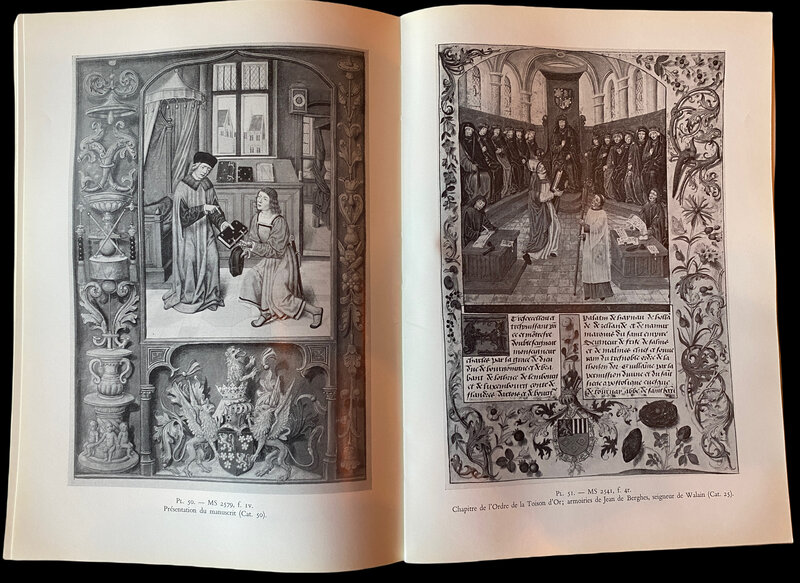
 Manuscrits et Livres Imprimes Concernant L'Histoire des Pays-Bas 1475-1600.
Bruxelles: Bibliotheque Albert, 1962. Bibliography of 159 early books in the Bibliotheque Nationale D'Autriche, with photographic examples. Softback. Clean and tidy inside and out, with very slight darkening to the page edges. A very good copy. XIV, 112 pp + 66 black and white plates. 255 by 185mm (10 by 7¼ inches). Bibliographie de 159 livres anciens de la Bibliothèque Nationale d'Autriche, avec des exemples photographiques. Couverture souple. Propre et bien rangé à l'intérieur et à l'extérieur, avec un très léger assombrissement des bords de la page. Un très bon exemplaire. XIV, 112 pp + 66 planches en noir et blanc. 255 par 185 mm
Book ID: 3235More details Price: £18.00 -
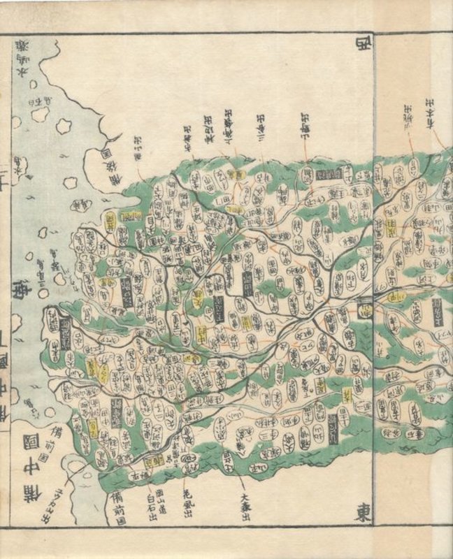
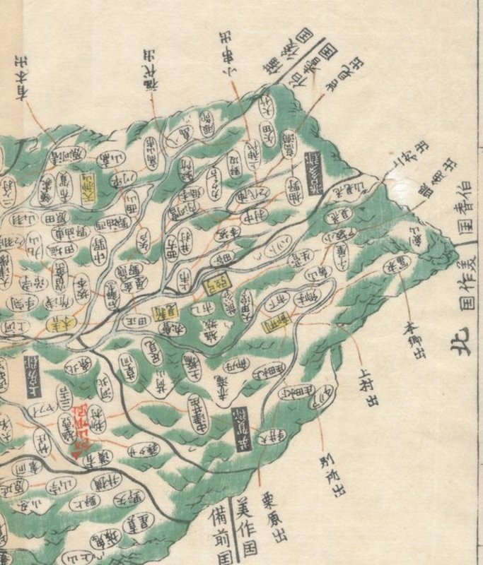
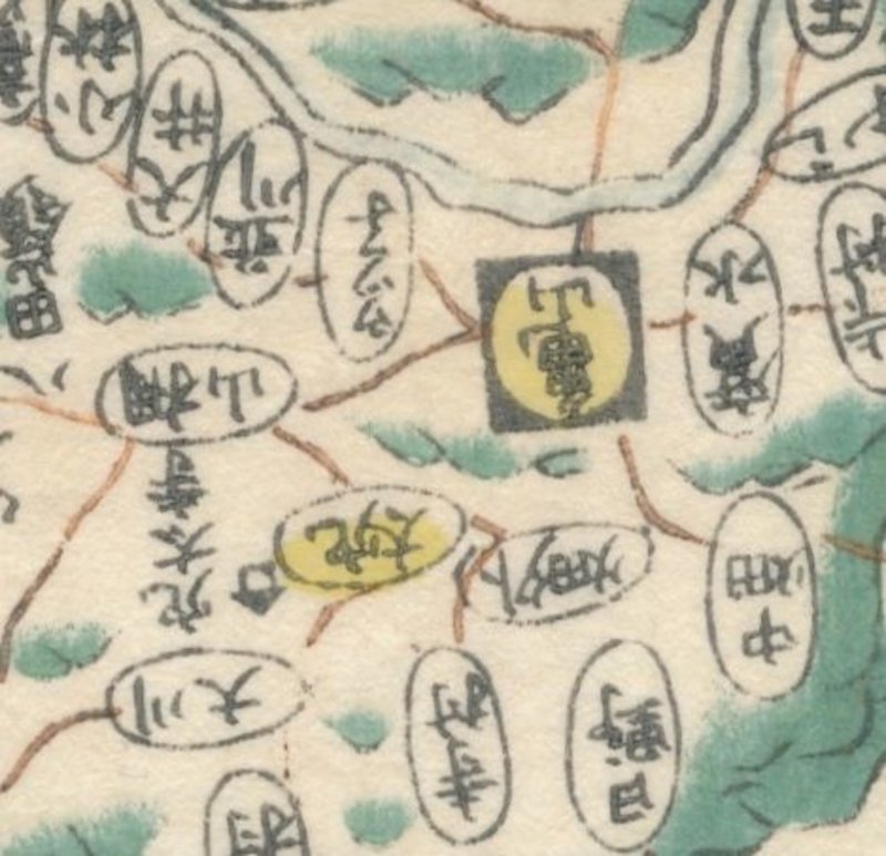
 Map of Bitchū (備中国, Bitchū no kuni), taken from Kokugun Zenzu / Atlas of Japan (De luxe version)
Book ID: 1767More details Price: £80.00
Map of Bitchū (備中国, Bitchū no kuni), taken from Kokugun Zenzu / Atlas of Japan (De luxe version)
Book ID: 1767More details Price: £80.00 -
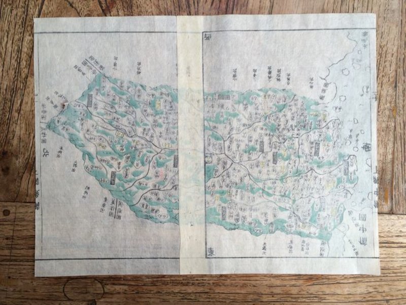
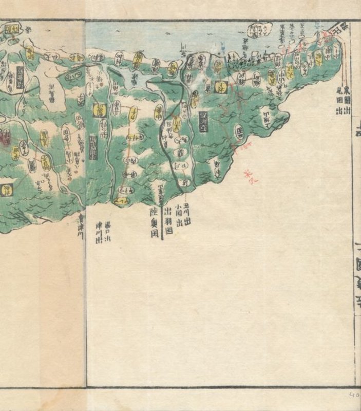
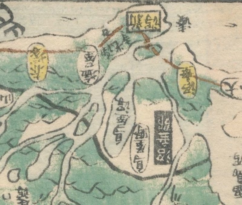
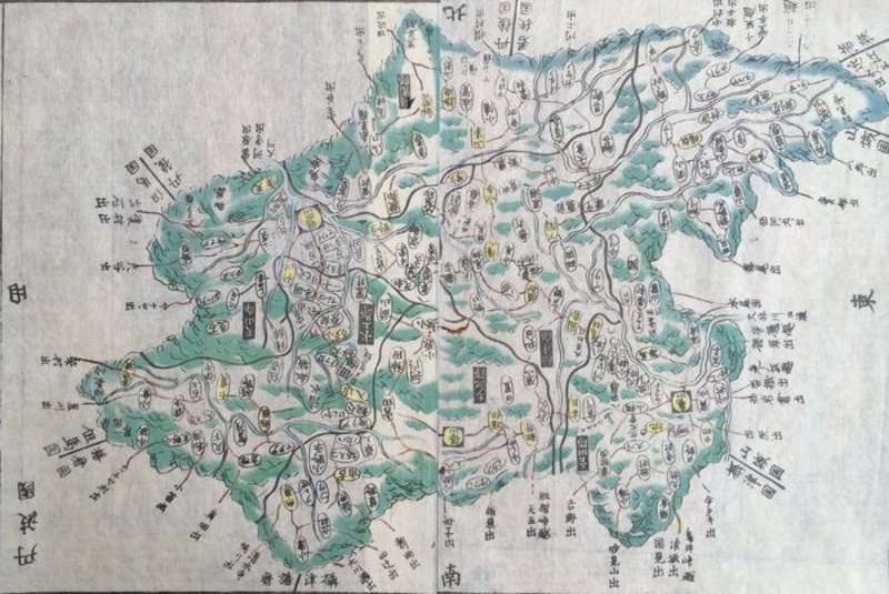
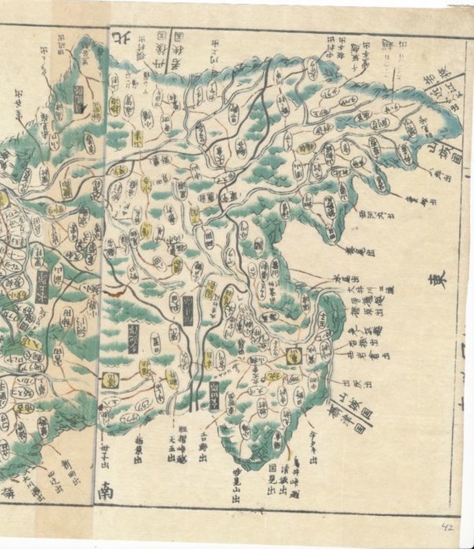
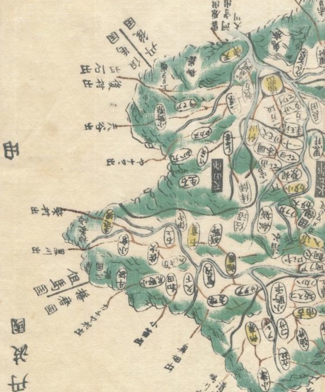
 Map of East Echigo (越後国, Echigo no kuni) , taken from Kokugun Zenzu / Atlas of Japan (De luxe version)
Book ID: 1742More details Price: £85.00
Map of East Echigo (越後国, Echigo no kuni) , taken from Kokugun Zenzu / Atlas of Japan (De luxe version)
Book ID: 1742More details Price: £85.00 -
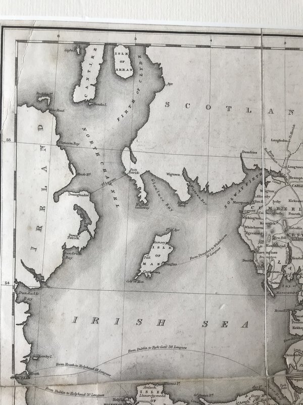
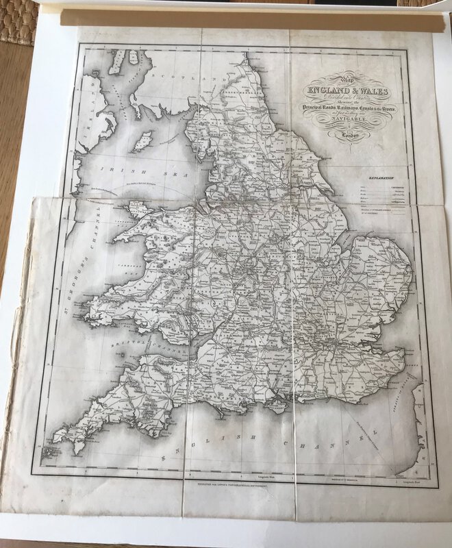
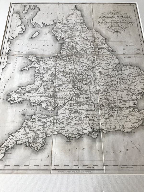
 Map of England & Wales Divided into Counties Shewing the Principal Roads, Railways, Canals & the Rivers as far as they are Navigable
London: S. Lewis and Co, 1848. Large folding map, now tipped on to card and behind cream passe-partout. From Lewis's "Atlas to the Topographical Dictionaries of England and Wales". In very good condition. Perfect for framing. 480 x 390 mm (19 x 15¼ inches).
Book ID: 3003More details Price: £40.00 -
 Map of Middlesex, from Britannia Depicta by Thomas Bowles.
Book ID: 2156More details Price: £50.00
Map of Middlesex, from Britannia Depicta by Thomas Bowles.
Book ID: 2156More details Price: £50.00 -
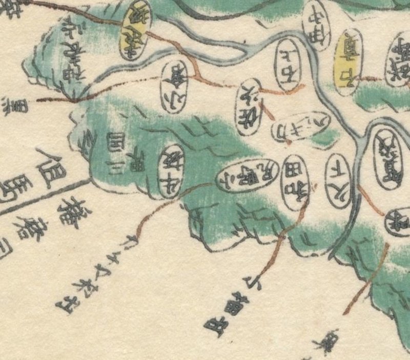
 Map of Settsu Province (摂津国, Settsu no kuni), taken from Kokugun Zenzu / Atlas of Japan (De luxe version)
Book ID: 1740More details Price: £85.00
Map of Settsu Province (摂津国, Settsu no kuni), taken from Kokugun Zenzu / Atlas of Japan (De luxe version)
Book ID: 1740More details Price: £85.00 -
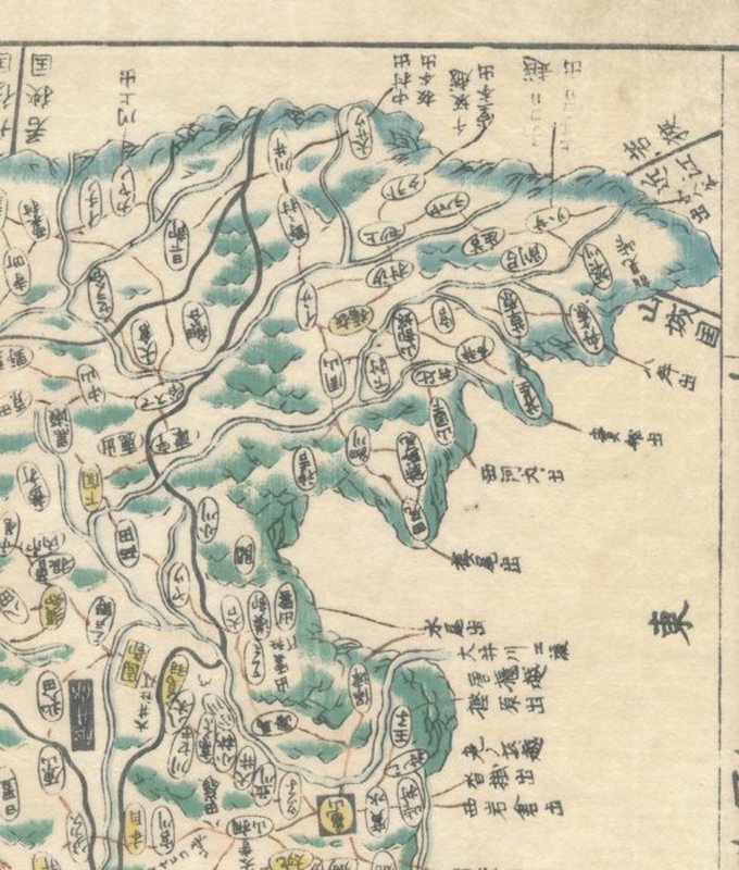
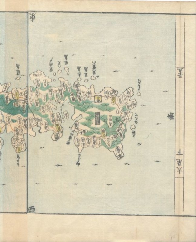
 Map of Tsushima (対馬国, Tsushima-no kuni), taken from Kokugun Zenzu / Atlas of Japan (De luxe version)
Book ID: 1761More details Price: £90.00
Map of Tsushima (対馬国, Tsushima-no kuni), taken from Kokugun Zenzu / Atlas of Japan (De luxe version)
Book ID: 1761More details Price: £90.00 -
 Märchenbilder.
Sieben Märchen der Brüder Grimm gezeichnet von Hans Fischer.
Märchenbilder.
Sieben Märchen der Brüder Grimm gezeichnet von Hans Fischer.
Zürich und Stuttgart: Artemis Verlag, 1961. First Edition. Large hardback paper covered boards, with yellow cloth spine. Stories are: Rotkäppchen, Hans im Glück, Der gestiefelte Kater, De Haas un de Swinegel, Das tapfere Schneiderlein, Hänsel und Gretel,Die sieben Raben. Boards lightly rubbed, but inside is in a near fine condition. 34 pages. 345 x 250 mm (13½ x 9¾ inches). Première édition. Grande couverture cartonnée recouverte de papier, avec un dos en tissu jaune. Les histoires sont les suivantes : Rotkäppchen, Hans im Glück, Der gestiefelte Kater, De Haas un de Swinegel, Das tapfere Schneiderlein, Hänsel und Gretel, Die sieben Raben. Les planches sont légèrement frottées, mais l'intérieur est en très bon état. 34 pages. 345 x 250 mm.
Book ID: 4335More details Price: £40.00 -
 Margery Redford and Her Friends.
Illustrated by Gordon Browne.
Margery Redford and Her Friends.
Illustrated by Gordon Browne.
London: Chatto & Windus, 1908. Signed gift inscription from the author. First edition. Green cloth boards, with illustrated vignette and gilt decorations to the front. Gilt title and decorations to the spine. Charming story, with b/w illustrations throughout. 200 x 150 mm (7¾ x 6 inches). Boards are a little bumped and rubbed. Light soiling. Page edges are toned, and prelims have some light foxing. Overall a good signed copy.
Book ID: 2710More details Price: £30.00 -
 "Marginaux" contre forces de Police.
Silver Gelatin Photograph of a West Berlin Anti-Nuclear Riot.
Book ID: 3755More details Price: £40.00
"Marginaux" contre forces de Police.
Silver Gelatin Photograph of a West Berlin Anti-Nuclear Riot.
Book ID: 3755More details Price: £40.00 -
 Marigold Garden.
London: Frederick Warne & Co, [1910]. First edition. Green cloth backed pictorial hardback boards. Beautifully illustrated. Undated, but circa 1910. Some rubbing and scuffing to covers, but clean and fresh inside. 56 pages. 250 x 200 mm (9¾ by 7¾ inches).
Book ID: 2862More details Price: £45.00 -
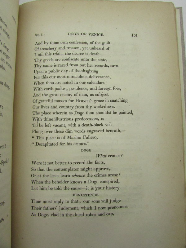
 Marino Faliero, Doge of Venice. An historical tragedy in five acts, with notes. The Prophecy of Dante, a poem.
London: John Murray, 1821. First Edition. This is the first UK edition. Nicely bound in grey boards, and light brown spine with paper label. Text body is clean. Binding is tight. Moderate foxing throughout. Edges slightly browned. xxi, 261 [2] pp. 230 x 145 mm (9 x 5¾ inches).
Book ID: 2062More details Price: £280.00 -
 Marionnettes rustiques
montrant les bonnes petites gens à leurs métiers, en douze contesavec dessins de Armand Rassenfosse.
Marionnettes rustiques
montrant les bonnes petites gens à leurs métiers, en douze contesavec dessins de Armand Rassenfosse.
Liège: Aug. Bénard. First edition. Author signed dedication to front blank page, dated 1899. This is one of the 1,000 on vélin teinté. In original softback, with sanguine illustrations to front and back covers. Undated but 1899. In very good shape, with just some age toning. 163 pages. 225 x 145 mm (8¾ x 5¾ inches).
. Première édition. Dédicace signée par l'auteur sur la première page blanche, datée de 1899. Il s'agit de l'un des 1 000 exemplaires sur vélin teinté. Couverture souple d'origine, avec des illustrations à la sanguine sur les couvertures avant et arrière. Sans daté, mais 1899. En très bon état, avec un léger assombrissement. 163 pages. 225 x 145 mm.
Book ID: 3953More details Price: £80.00 -
 Marmion: A Tale of Flodden Field.
Illustrated Edition.
Book ID: 4196More details Price: £40.00
Marmion: A Tale of Flodden Field.
Illustrated Edition.
Book ID: 4196More details Price: £40.00 -
 Masked Woman. Femme masquée.
Book ID: 4385More details Price: £100.00
Masked Woman. Femme masquée.
Book ID: 4385More details Price: £100.00


![Manuale Casua Conscientiae - a Manuscript in Latin describing the Roman Catholic Ritual of Mass and The Sacraments. by [ANON]](https://images.vialibri.net/production/20/2260-1---800.jpeg?v=1559469110)
![Another image of Manuale Casua Conscientiae - a Manuscript in Latin describing the Roman Catholic Ritual of Mass and The Sacraments. by [ANON]](https://images.vialibri.net/production/20/2260-2---800.JPG?v=1559469129)
![Another image of Manuale Casua Conscientiae - a Manuscript in Latin describing the Roman Catholic Ritual of Mass and The Sacraments. by [ANON]](https://images.vialibri.net/production/20/2260-3---800.JPG?v=1559469126)
![Another image of Manuale Casua Conscientiae - a Manuscript in Latin describing the Roman Catholic Ritual of Mass and The Sacraments. by [ANON]](https://images.vialibri.net/production/20/2260-4---800.JPG?v=1559469119)
![Another image of Manuale Casua Conscientiae - a Manuscript in Latin describing the Roman Catholic Ritual of Mass and The Sacraments. by [ANON]](https://images.vialibri.net/production/20/2260-5---800.JPG?v=1559469100)
![Another image of Manuale Casua Conscientiae - a Manuscript in Latin describing the Roman Catholic Ritual of Mass and The Sacraments. by [ANON]](https://images.vialibri.net/production/20/2260-7---800.JPG?v=1595080658)
![Another image of Manuale Casua Conscientiae - a Manuscript in Latin describing the Roman Catholic Ritual of Mass and The Sacraments. by [ANON]](https://images.vialibri.net/production/20/2260-8---800.JPG?v=1595080660)
![Another image of Manuale Casua Conscientiae - a Manuscript in Latin describing the Roman Catholic Ritual of Mass and The Sacraments. by [ANON]](https://images.vialibri.net/production/20/2260-9---800.JPG?v=1595080668)
![Another image of Manuale Casua Conscientiae - a Manuscript in Latin describing the Roman Catholic Ritual of Mass and The Sacraments. by [ANON]](https://images.vialibri.net/production/20/2260-9a---800.JPG?v=1595080667)


![Manufacture Française d'Armes & Cycles de Saint-Étienne (Loire). by [VARIOUS]](https://images.vialibri.net/production/20/2655-1---800.JPG?v=1593957464)
![Another image of Manufacture Française d'Armes & Cycles de Saint-Étienne (Loire). by [VARIOUS]](https://images.vialibri.net/production/20/2655-2---800.JPG?v=1593957465)
![Another image of Manufacture Française d'Armes & Cycles de Saint-Étienne (Loire). by [VARIOUS]](https://images.vialibri.net/production/20/2655-2a---800.JPG?v=1593957467)
![Another image of Manufacture Française d'Armes & Cycles de Saint-Étienne (Loire). by [VARIOUS]](https://images.vialibri.net/production/20/2655-2b---800.JPG?v=1593957465)
![Another image of Manufacture Française d'Armes & Cycles de Saint-Étienne (Loire). by [VARIOUS]](https://images.vialibri.net/production/20/2655-2c---800.JPG?v=1593957465)
![Another image of Manufacture Française d'Armes & Cycles de Saint-Étienne (Loire). by [VARIOUS]](https://images.vialibri.net/production/20/2655-2d---800.JPG?v=1593957468)
![Another image of Manufacture Française d'Armes & Cycles de Saint-Étienne (Loire). by [VARIOUS]](https://images.vialibri.net/production/20/2655-3---800.JPG?v=1593957467)
![Another image of Manufacture Française d'Armes & Cycles de Saint-Étienne (Loire). by [VARIOUS]](https://images.vialibri.net/production/20/2655-3a---800.JPG?v=1594740503)
![Another image of Manufacture Française d'Armes & Cycles de Saint-Étienne (Loire). by [VARIOUS]](https://images.vialibri.net/production/20/2655-3b---800.JPG?v=1594740504)
![Another image of Manufacture Française d'Armes & Cycles de Saint-Étienne (Loire). by [VARIOUS]](https://images.vialibri.net/production/20/2655-3c---800.JPG?v=1594740503)
![Another image of Manufacture Française d'Armes & Cycles de Saint-Étienne (Loire). by [VARIOUS]](https://images.vialibri.net/production/20/2655-4---800.JPG?v=1593957468)
![Another image of Manufacture Française d'Armes & Cycles de Saint-Étienne (Loire). by [VARIOUS]](https://images.vialibri.net/production/20/2655-5---800.JPG?v=1593957465)
![Another image of Manufacture Française d'Armes & Cycles de Saint-Étienne (Loire). by [VARIOUS]](https://images.vialibri.net/production/20/2655-6---800.JPG?v=1593957467)
![Another image of Manufacture Française d'Armes & Cycles de Saint-Étienne (Loire). by [VARIOUS]](https://images.vialibri.net/production/20/2655-7---800.JPG?v=1593957469)
![Another image of Manufacture Française d'Armes & Cycles de Saint-Étienne (Loire). by [VARIOUS]](https://images.vialibri.net/production/20/2655-7a---800.JPG?v=1593957468)
![Another image of Manufacture Française d'Armes & Cycles de Saint-Étienne (Loire). by [VARIOUS]](https://images.vialibri.net/production/20/2655-8---800.JPG?v=1593957469)
![Another image of Manufacture Française d'Armes & Cycles de Saint-Étienne (Loire). by [VARIOUS]](https://images.vialibri.net/production/20/2655-9---800.JPG?v=1593957471)